Sunset Crater Volcano National Monument

Log in to your account

AroundUs is a community-driven map of interesting places, built by curious explorers like you. It grows with every review, story, and photo you share.
Connect to save your favorite spots, contribute locations, and create personalized routes.
By continuing, you accept our Terms and Conditions and our Privacy Policy
Add to collection
Map
Suggest a change
Share

Sunset Crater Volcano National Monument, National Monument in Coconino County, Arizona.

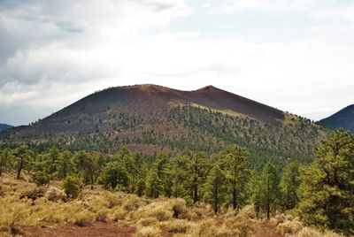
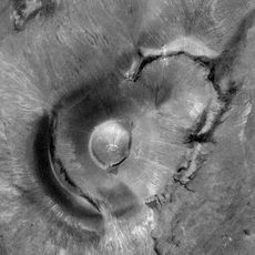
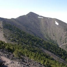
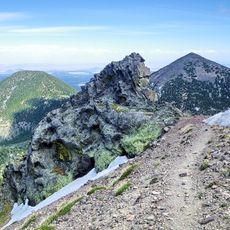
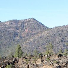
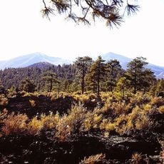
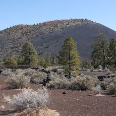
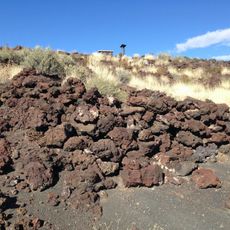
Sunset Crater Volcano National Monument preserves a volcanic cone rising about 1000 feet (300 meters) above the surrounding desert, ringed by expansive fields of dark lava and cinder. The blackened terrain stretches across miles of landscape, creating a stark contrast against the reddish desert soil beyond the eruption zone.

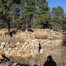
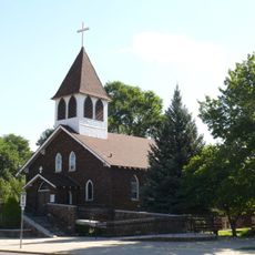
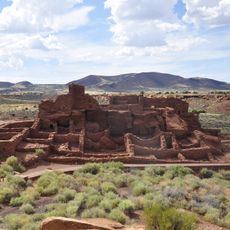
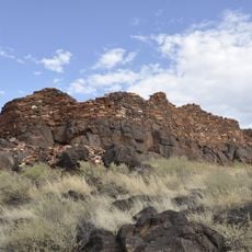
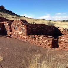
A volcanic eruption in 1085 reshaped the landscape and forced the people living here to adapt how they farmed and lived. The monument was established in 1930 to protect this geological site and the traces of early settlement it contains.

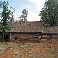
The Sinagua people living in this area adapted their farming after the eruption by using the cinder layer to help their crops retain water. This practical response to landscape change shaped how they continued to live on this land.

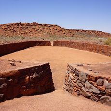
A scenic loop road about 34 miles (55 kilometers) long connects this area to the nearby Wupatki National Monument, allowing you to explore both sites in one visit. The visitor center at the entrance provides maps and educational materials to help orient yourself on the grounds.

The dark cinders contain oxidized iron and sulfur that shimmer in red, orange, and purple tones when sunlight hits them at the right angle. This optical effect is most noticeable at sunrise and sunset, which is how the crater earned its name.

Location: Coconino County

Inception: May 26, 1930

Part of: Flagstaff Area National Monuments

Website: https://nps.gov/sucr

GPS coordinates: 35.36556,-111.50064

Latest update: December 6, 2025 17:46

National parks and monuments in Southwestern US

The southwestern United States encompasses desert landscapes, sandstone formations and archaeological sites from several pre-Columbian cultures. The region spans Utah, Arizona, New Mexico and Colorado, featuring geological structures shaped over millions of years by wind and water erosion. National parks such as Canyonlands and Capitol Reef display canyons, mesas and rock spires in shades of red, orange and ochre. The area preserves evidence of the Ancestral Puebloans, who built cliff dwellings and communal structures between the 12th and 14th centuries. Sites like Bandelier National Monument and Gila Cliff Dwellings provide access to these habitations. Chaco Culture National Historical Park documents a pre-Hispanic trading center with multistory stone complexes. Petroglyphs at locations such as Three Rivers and the petrified trees of Petrified Forest National Park offer additional historical records. The Navajo Nation administers Monument Valley and the Navajo Zoo, while Hubbell Trading Post operates as a functioning 19th-century trading post. Volcanic features mark Sunset Crater and El Malpais, while White Sands covers more than 275 square miles (700 square kilometers) of gypsum dunes. Glen Canyon and the man-made Lake Cochiti provide water access in this largely arid region. Elevation differences range from the Organ Pipe Cactus Desert to Great Basin National Park with its ridges above 13,000 feet (3,900 meters).

Natural areas and historic sites in Arizona

Arizona contains geological formations spanning millions of years alongside evidence of Spanish colonial settlement and prehistoric cultures. The landscape includes sandstone canyons such as Antelope Canyon X and Canyon de Chelly National Monument, extensive desert areas with saguaro and organ pipe cacti, and volcanic remnants at Sunset Crater. Historical sites include Spanish missions like Tumacácori, pueblo ruins at Montezuma Castle, and mining towns such as Bisbee and Jerome. The state holds significant paleontological sites at Petrified Forest National Park, where fossilized tree trunks from the Triassic period lie exposed, and cave systems like Kartchner Caverns with active speleothem formations. The Vermilion Cliffs region displays layered sandstone formations including The Wave, while the Chiricahua Mountains show volcanic rock pinnacles formed from welded ash. Waterfalls such as Havasu Falls and Grand Falls result from geological faulting and seasonal water flow. Archaeological sites document occupation by the Hohokam, Sinagua, and Ancestral Puebloans between 300 and 1400 CE. Tonto Natural Bridge forms one of the largest travertine bridges in North America, while Besh-Ba-Gowah shows Salado culture construction methods from the 13th century. The territory spans from the Sonoran Desert in the south to the Colorado Plateau in the north, creating distinct climate zones and ecosystems within a compact area.

Around this place
Show the full map
Humphreys Peak
United States of America

Humphreys Peak

16.2 km
San Francisco Peaks
United States of America

San Francisco Peaks

14.2 km
Roden Crater
United States of America

Roden Crater

22.9 km
Museum of Northern Arizona
United States of America

Museum of Northern Arizona

20.9 km
Agassiz Peak
United States of America

Agassiz Peak

16.7 km
Kachina Peaks Wilderness
United States of America

Kachina Peaks Wilderness

14.9 km
Elden Pueblo
United States of America

Elden Pueblo

14.9 km
Fremont Peak
United States of America

Fremont Peak

15.3 km
Weatherford Hotel
United States of America

Weatherford Hotel

22.9 km
Doyle Peak
United States of America

Doyle Peak

13.8 km
Railroad Addition Historic District
United States of America

Railroad Addition Historic District

22.9 km
O'Leary Peak
United States of America

O'Leary Peak

4.6 km
Lenox Crater
United States of America

Lenox Crater

2.7 km
Our Lady of Guadaloupe Church
United States of America

Our Lady of Guadaloupe Church

23.4 km
Presbyterian Church Parsonage
United States of America

Presbyterian Church Parsonage

22.7 km
Brannen-Devine House
United States of America

Brannen-Devine House

23.2 km
Cliffs Ranger Station
United States of America

Cliffs Ranger Station

21.3 km
Wupatki Pueblo
United States of America

Wupatki Pueblo

20.8 km
Flagstaff Area National Monuments
United States of America

Flagstaff Area National Monuments

22.6 km
Pioneer Museum--Arizona Historical Society
United States of America

Pioneer Museum--Arizona Historical Society

21.1 km
Flagstaff Southside Historic District
United States of America

Flagstaff Southside Historic District

23.4 km
Citadel Pueblo
United States of America

Citadel Pueblo

22.5 km
Nalakihu Pueblo
United States of America

Nalakihu Pueblo

22.5 km
Walnut Canyon Visitor Center
United States of America

Walnut Canyon Visitor Center

21.6 km
Flagstaff Federated Community Church
United States of America

Flagstaff Federated Community Church

23 km
Little Doney Crater Ruins
United States of America

Little Doney Crater Ruins

20.4 km
Wupatki Pueblo Ball Court
United States of America

Wupatki Pueblo Ball Court

21 km
O'Leary Peak Lookout Tower
United States of America

O'Leary Peak Lookout Tower

4.6 km
Show the full map

Reviews

Visited this place? Tap the stars to rate it and share your experience / photos with the community! Try now! You can cancel it anytime.

« Sunset Crater Volcano National Monument - National Monument in Coconino County, Arizona » is provided by Around Us (aroundus.com). Images and texts are derived from Wikimedia project under a Creative Commons license. You are allowed to copy, distribute, and modify copies of this page, under the conditions set by the license, as long as this note is clearly visible.

Discover hidden gems everywhere you go!

From secret cafés to breathtaking viewpoints, skip the crowded tourist spots and find places that match your style. Our app makes it easy with voice search, smart filtering, route optimization, and insider tips from travelers worldwide. Download now for the complete mobile experience.

Around Us App Screenshot

A unique approach to discovering new places

Le Figaro

All the places worth exploring

France Info

A tailor-made excursion in just a few clicks

20 Minutes