Elden Pueblo

Log in to your account

AroundUs is a community-driven map of interesting places, built by curious explorers like you. It grows with every review, story, and photo you share.
Connect to save your favorite spots, contribute locations, and create personalized routes.
Continue with Google
Continue with Apple
Continue with X
Continue with Facebook
Continue with email
By continuing, you accept our Terms and Conditions and our Privacy Policy
Create an account
Add to collection
Map
Suggest a change
Share

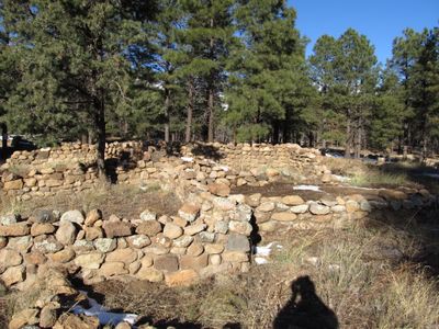
Elden Pueblo, Archaeological site in Coconino National Forest, Arizona, United States.

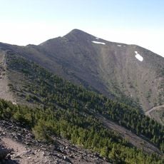
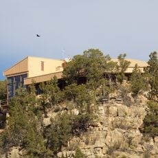
Elden Pueblo is an archaeological site in Coconino National Forest preserving the remains of stone walls, circular ceremonial structures, and dwelling areas positioned at the base of Mount Elden. The location contains foundations and walls of around 60 to 70 rooms that once formed part of a larger settlement.

The Sinagua people established a settlement here from around 1070 to 1275, creating one of the region's notable communities during that era. The site was eventually abandoned, but left behind archaeological layers that reveal clues about daily life across those centuries.

The settlement demonstrates far-reaching trade connections through objects discovered during excavations, including tropical bird remains and shells from distant coasts. These finds show how residents maintained active exchange networks with communities well beyond their immediate region.

The site features marked trails and interpretive signs that guide visitors through the ruins. Year-round exploration is possible, though conditions vary seasonally, particularly during the hot summer months when shade and water become important considerations.

The site played a surprising role in modern history when its scientific study led to the creation of protective laws for archaeological sites in the region. This connection between a local discovery and broader legislation shows how academic work influenced the treatment of archaeological heritage.

Location: Arizona

GPS coordinates: 35.24340,-111.56800

Latest update: December 11, 2025 18:03

Photos
Around this place
Humphreys Peak
United States of America

Humphreys Peak

15.2 km
San Francisco Peaks
United States of America

San Francisco Peaks

13.5 km
Lowell Observatory
United States of America

Lowell Observatory

9.9 km
Riordan Mansion State Historic Park
United States of America

Riordan Mansion State Historic Park

10.2 km
Museum of Northern Arizona
United States of America

Museum of Northern Arizona

8.9 km
Agassiz Peak
United States of America

Agassiz Peak

13.6 km
Kachina Peaks Wilderness
United States of America

Kachina Peaks Wilderness

13.7 km
Fremont Peak
United States of America

Fremont Peak

12.2 km
Weatherford Hotel
United States of America

Weatherford Hotel

8.9 km
The Arboretum at Flagstaff
United States of America

The Arboretum at Flagstaff

17.5 km
Doyle Peak
United States of America

Doyle Peak

12 km
Railroad Addition Historic District
United States of America

Railroad Addition Historic District

8.8 km
O'Leary Peak
United States of America

O'Leary Peak

18 km
Lenox Crater
United States of America

Lenox Crater

13.5 km
Our Lady of Guadaloupe Church
United States of America

Our Lady of Guadaloupe Church

9.4 km
Presbyterian Church Parsonage
United States of America

Presbyterian Church Parsonage

8.6 km
Brannen-Devine House
United States of America

Brannen-Devine House

9 km
Cliffs Ranger Station
United States of America

Cliffs Ranger Station

8.8 km
Riordan Mansion
United States of America

Riordan Mansion

10.4 km
Flagstaff Armory
United States of America

Flagstaff Armory

9.7 km
Pioneer Museum--Arizona Historical Society
United States of America

Pioneer Museum--Arizona Historical Society

8.2 km
Flagstaff Southside Historic District
United States of America

Flagstaff Southside Historic District

9.2 km
Woody Mountain Lookout Tower
United States of America

Woody Mountain Lookout Tower

20.1 km
Walnut Canyon Visitor Center
United States of America

Walnut Canyon Visitor Center

9.6 km
Flagstaff Federated Community Church
United States of America

Flagstaff Federated Community Church

9.1 km
O'Leary Peak Lookout Tower
United States of America

O'Leary Peak Lookout Tower

18 km
Northern Arizona Normal School Historic District
United States of America

Northern Arizona Normal School Historic District

9.7 km
Flagstaff City-coconino County Public Library
United States of America

Flagstaff City-coconino County Public Library

9.1 km
Show the full map
Reviews

Visited this place? Tap the stars to rate it and share your experience / photos with the community! Try now! You can cancel it anytime.

« Elden Pueblo - Archaeological site in Coconino National Forest, Arizona, United States » is provided by Around Us (aroundus.com). Images and texts are derived from Wikimedia project under a Creative Commons license. You are allowed to copy, distribute, and modify copies of this page, under the conditions set by the license, as long as this note is clearly visible.

Discover hidden gems everywhere you go!

From secret cafés to breathtaking viewpoints, skip the crowded tourist spots and find places that match your style. Our app makes it easy with voice search, smart filtering, route optimization, and insider tips from travelers worldwide. Download now for the complete mobile experience.

Around Us App Screenshot

A unique approach to discovering new places

Le Figaro

All the places worth exploring

France Info

A tailor-made excursion in just a few clicks

20 Minutes