Chiricahua National Monument

Log in to your account

AroundUs is a community-driven map of interesting places, built by curious explorers like you. It grows with every review, story, and photo you share.
Connect to save your favorite spots, contribute locations, and create personalized routes.
Continue with Google
Continue with Apple
Continue with X
Continue with Facebook
Continue with email
By continuing, you accept our Terms and Conditions and our Privacy Policy
Create an account
Add to collection
Map
Suggest a change
Share

Chiricahua National Monument, Nature reserve and International Dark Sky Park in Cochise County, Arizona.

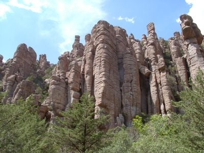
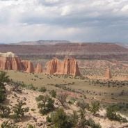
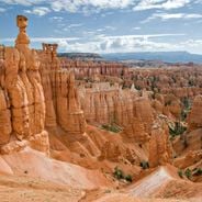
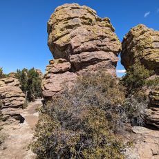
Chiricahua National Monument is a nature reserve in southeastern Arizona featuring hundreds of volcanic rock formations scattered across its terrain. The landscape displays stone pinnacles, balanced boulders, and deep canyons that create a dramatic natural wonderland.

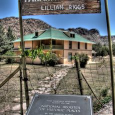
The Chiricahua Apache inhabited this region from around 1400 and shaped its history for centuries. Swedish settlers arrived in the early 1900s, bringing a new chapter to the land's human story.

The Faraway Ranch Historic District tells the story of Swedish pioneers who settled here and built their homes in the early 1900s. Walking through the site, you see how outsiders adapted to life in this remote and challenging environment.

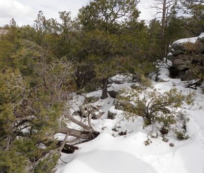
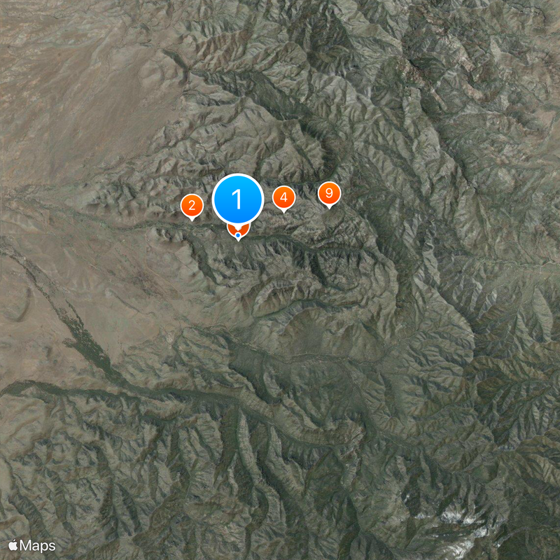
The monument offers over 17 miles of hiking trails suited to different abilities, from gentle walks to challenging climbs. Plan enough time since the paths cross varied terrain and there are options for every skill level.

The rock formations originated from volcanic ash deposits roughly 27 million years ago and were sculpted into natural art by erosion. These stones have remained stable enough over millions of years to keep their remarkable shapes intact.

Location: Cochise County

Inception: 1924

Operator: United States National Park Service

Part of: Southeast Arizona

Website: https://nps.gov/chir

GPS coordinates: 32.00570,-109.35700

Latest update: December 20, 2025 12:48

Photos
National parks and monuments in Southwestern US

The southwestern United States encompasses desert landscapes, sandstone formations and archaeological sites from several pre-Columbian cultures. The region spans Utah, Arizona, New Mexico and Colorado, featuring geological structures shaped over millions of years by wind and water erosion. National...

Natural areas and historic sites in Arizona

Arizona contains geological formations spanning millions of years alongside evidence of Spanish colonial settlement and prehistoric cultures. The landscape includes sandstone canyons such as Antelope Canyon X and Canyon de Chelly National Monument, extensive desert areas with saguaro and organ pipe...

Rock formations and hoodoos for Instagram photos

Rock pillars and spires shaped by erosion stand as natural monuments across various locations worldwide. These geological structures, known as hoodoos, display different colors and shapes based on their mineral composition and environmental conditions. From the red rocks of Utah to the limestone...

Around this place
Faraway Ranch Historic District
United States of America

Faraway Ranch Historic District

1.6 km
United States of America

Bonita Canyon

304 m
United States of America

Chiricahua National Forest

1.7 km
Chiricahua National Monument Historic Designed Landscape
United States of America

Chiricahua National Monument Historic Designed Landscape

3.2 km
United States of America

Chiricahua National Monument Visitor Center

59 m
United States of America

Bonita Canyon Campground Ranger Residence

630 m
United States of America

Chiricahua National Monument Residence #2

127 m
Sugarloaf Mountain Lookout
United States of America

Sugarloaf Mountain Lookout

3.2 km
United States of America

Chiricahua National Monument Residence #1

136 m
United States of America

Chiricahua National Monument Power House and Laundry

98 m
United States of America

Chiricahua National Monument Equipment Shed

119 m
United States of America

Chiricahua National Monument Residence #3

120 m
United States of America

Massai Point Orientation Station

4.3 km
United States of America

Inspiration Point

4.3 km
United States of America

Bonita Canyon Campground Comfort Station

651 m
United States of America

Chiricahua National Monument Warehouse

87 m
Bonita Canyon Campground
United States of America

Bonita Canyon Campground

625 m
Heart of Rocks Loop Trail
United States of America

Heart of Rocks Loop Trail

3.5 km
United States of America

Natural Bridge

1.7 km
United States of America

Faraway ranch (guided tour)

1.5 km
United States of America

Scenic viewpoint

4.2 km
United States of America

Chiricahau Mountains Wilderness

3.8 km
United States of America

Scenic viewpoint

3.5 km
United States of America

Stream Beds

4.7 km
United States of America

Scenic viewpoint

3.1 km
United States of America

Sea Captain

2.8 km
United States of America

Waterfall

9.2 km
United States of America

Wood Canyon Waterfall

7.4 km
Show the full map
Reviews

Visited this place? Tap the stars to rate it and share your experience / photos with the community! Try now! You can cancel it anytime.

« Chiricahua National Monument - Nature reserve and International Dark Sky Park in Cochise County, Arizona » is provided by Around Us (aroundus.com). Images and texts are derived from Wikimedia project under a Creative Commons license. You are allowed to copy, distribute, and modify copies of this page, under the conditions set by the license, as long as this note is clearly visible.

Discover hidden gems everywhere you go!

From secret cafés to breathtaking viewpoints, skip the crowded tourist spots and find places that match your style. Our app makes it easy with voice search, smart filtering, route optimization, and insider tips from travelers worldwide. Download now for the complete mobile experience.

Around Us App Screenshot

A unique approach to discovering new places

Le Figaro

All the places worth exploring

France Info

A tailor-made excursion in just a few clicks

20 Minutes