Log in to your account

AroundUs is a community-driven map of interesting places, built by curious explorers like you. It grows with every review, story, and photo you share.
Connect to save your favorite spots, contribute locations, and create personalized routes.
Continue with Google
Continue with Apple
Continue with X
Continue with Facebook
Continue with email
By continuing, you accept our Terms and Conditions and our Privacy Policy
Create an account
Add to collection
Map
Suggest a change
Share

Bonita Canyon, Canyon in Chiricahua National Monument, Arizona, United States

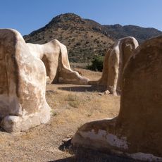
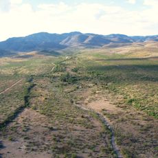
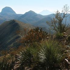
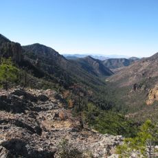
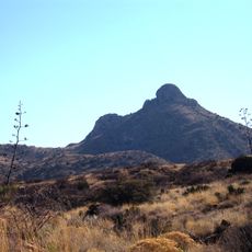
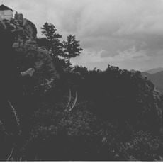
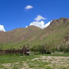
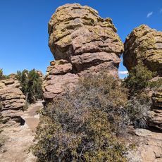
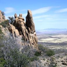
Bonita Canyon is a narrow gorge with volcanic rock walls in the Chiricahua Mountains at about 5,400 feet elevation. The canyon cuts through the western side of the range and holds a creek that flows year-round.

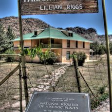
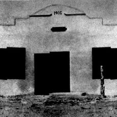
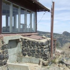
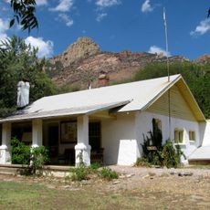
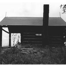
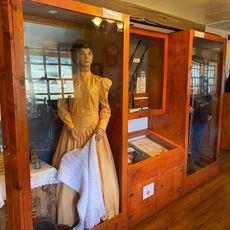
European settlers arrived in the 1880s and built a historic ranch in the canyon that you can still visit today. This property shows what early life was like for people trying to make a living in this remote mountain area.

Apache people lived in these mountains for generations and shaped the land through their presence and knowledge of its resources. The canyon remains a place where their historical connection to the landscape is still felt.

There is a campground here with sites for different vehicle sizes, and you can stay in a tent or RV. It helps to arrive early in the day and check local conditions since weather and road access can change.

A permanent creek runs through the narrow gorge, creating a green refuge in the dry mountains. This water draws large animals that are rarely seen, making the canyon special among its surrounding peaks.

Location: Arizona

GPS coordinates: 32.00830,-109.35600

Latest update: December 9, 2025 12:24

Photos
Around this place
The Thing?
United States of America

The Thing?

66 km
Fort Bowie
United States of America

Fort Bowie

17.1 km
Skeleton Canyon
United States of America

Skeleton Canyon

55.5 km
Willcox Playa
United States of America

Willcox Playa

48.7 km
Chiricahua Peak
United States of America

Chiricahua Peak

19.1 km
Faraway Ranch Historic District
United States of America

Faraway Ranch Historic District

1.6 km
Leslie Canyon National Wildlife Refuge
United States of America

Leslie Canyon National Wildlife Refuge

49 km
Gleeson Jail
United States of America

Gleeson Jail

54.3 km
Rex Allen Arizona Cowboy Museum and Willcox Cowboy Hall of Fame
United States of America

Rex Allen Arizona Cowboy Museum and Willcox Cowboy Hall of Fame

52.4 km
Rucker Canyon
United States of America

Rucker Canyon

29.3 km
Chiricahua National Monument Historic Designed Landscape
United States of America

Chiricahua National Monument Historic Designed Landscape

3 km
Portal Ranger Station
United States of America

Portal Ranger Station

22.1 km
United States of America

Our Lady of Victory Catholic Church

45.5 km
Pearce General Store
United States of America

Pearce General Store

45.4 km
Johnson-Tillotson House
United States of America

Johnson-Tillotson House

52.7 km
John Gung'l House
United States of America

John Gung'l House

52.9 km
Benjamin E. Briscoe House
United States of America

Benjamin E. Briscoe House

53.3 km
Fort Bowie National Historic Site
United States of America

Fort Bowie National Historic Site

18.1 km
Bowie School District No. 14
United States of America

Bowie School District No. 14

37.5 km
Chiricahua Desert Museum
United States of America

Chiricahua Desert Museum

34 km
Silver Peak Lookout Complex
United States of America

Silver Peak Lookout Complex

18.7 km
Monte Vista Lookout Cabin
United States of America

Monte Vista Lookout Cabin

20.8 km
Fort Bowie Ranger Station & Visitor Center
United States of America

Fort Bowie Ranger Station & Visitor Center

17.1 km
Sugarloaf Mountain Lookout
United States of America

Sugarloaf Mountain Lookout

3 km
Horseshoe Canyon
United States of America

Horseshoe Canyon

34.3 km
Bonita Canyon Campground
United States of America

Bonita Canyon Campground

322 m
Heart of Rocks Loop Trail
United States of America

Heart of Rocks Loop Trail

3.5 km
Cochise Trail
United States of America

Cochise Trail

60.1 km
Show the full map
Reviews

Visited this place? Tap the stars to rate it and share your experience / photos with the community! Try now! You can cancel it anytime.

« Bonita Canyon - Canyon in Chiricahua National Monument, Arizona, United States » is provided by Around Us (aroundus.com). Images and texts are derived from Wikimedia project under a Creative Commons license. You are allowed to copy, distribute, and modify copies of this page, under the conditions set by the license, as long as this note is clearly visible.

Discover hidden gems everywhere you go!

From secret cafés to breathtaking viewpoints, skip the crowded tourist spots and find places that match your style. Our app makes it easy with voice search, smart filtering, route optimization, and insider tips from travelers worldwide. Download now for the complete mobile experience.

Around Us App Screenshot

A unique approach to discovering new places

Le Figaro

All the places worth exploring

France Info

A tailor-made excursion in just a few clicks

20 Minutes