Enable Location

We need your location to show you interesting places around you

Discover nearby places

Find interesting locations and hidden gems around you

Precise directions

Get accurate directions and distances to places

Your location is never shared with other users. It's only used when you tap the location button.

Leslie Canyon National Wildlife Refuge

Log in to your account

Start exploring — it's free

Trusted by 62,144 travelers worldwide

Continue with Google
Continue with Apple
or

We will send you a code to connect

By continuing, you accept our Terms and Conditions and our Privacy Policy

Check your inbox

We've sent a pincode in your inbox. Please enter the code below.

Leslie Canyon National Wildlife Refuge

Leslie Canyon National Wildlife Refuge, National Wildlife Refuge in Cochise County, Arizona, United States.

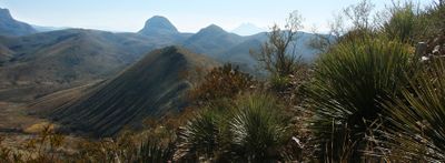
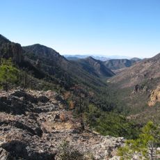
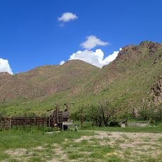
Leslie Canyon National Wildlife Refuge is a protected area spanning 2765 acres in southeastern Arizona with mountain ranges separated by flat basins. The terrain combines multiple habitats that support a variety of wildlife species throughout the region.

This refuge was established in 1988 to protect two endangered fish species found in this region. The creation reflected broader efforts to preserve ecosystems within the Rio Yaqui watershed.

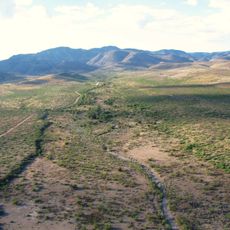
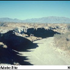
The valley was once shaped by flowing creeks and wetlands that supported both human settlement and wildlife. Today agricultural development has transformed how people and nature interact with this landscape.

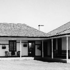
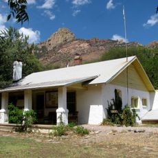
Access is available through the headquarters located roughly 12 miles north of Douglas on Highway 191 with no entrance fee required. Visitors should wear sturdy footwear and carry plenty of water, especially when exploring during warmer months.

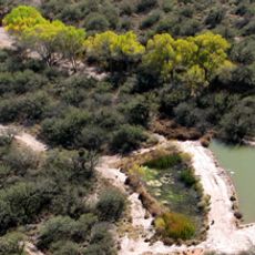
Specialized trees like velvet ash, black walnut, and cottonwood grow along Leslie Creek providing shelter for migrating birds. This riparian corridor serves as a critical stopover for bird species traveling long distances.

The community of curious travelers

AroundUs brings together thousands of curated places, local tips, and hidden gems, enriched daily by 60,000 contributors worldwide.

Start exploring
Location
Inception
1988
GPS coordinates
31.58850,-109.51200
Latest update
December 12, 2025 17:43
Around this place
Skeleton Canyon
United States of America

Skeleton Canyon

45.1 km
Chiricahua Peak
United States of America

Chiricahua Peak

35.5 km
San Bernardino Ranch
United States of America

San Bernardino Ranch

35.7 km
San Bernardino National Wildlife Refuge
United States of America

San Bernardino National Wildlife Refuge

35.9 km
Faraway Ranch Historic District
United States of America

Faraway Ranch Historic District

48.8 km
Gleeson Jail
United States of America

Gleeson Jail

34 km
Mexico

Canyon de Guadalupe

46.8 km
Bisbee Historic District
United States of America

Bisbee Historic District

41.4 km
Rucker Canyon
United States of America

Rucker Canyon

19.9 km
Grand Theatre
United States of America

Grand Theatre

27.5 km
Phelps Dodge General Office Building
United States of America

Phelps Dodge General Office Building

41.5 km
St. Patrick's Roman Catholic Church
United States of America

St. Patrick's Roman Catholic Church

42.1 km
Double Adobe Site
United States of America

Double Adobe Site

26.6 km
Plaza Azueta
Mexico

Plaza Azueta

29.2 km
Portal Ranger Station
United States of America

Portal Ranger Station

47.9 km
Douglas Historic District
United States of America

Douglas Historic District

27.4 km
El Paso and Southwestern Railroad YMCA
United States of America

El Paso and Southwestern Railroad YMCA

27.5 km
Bisbee Residential Historic District
United States of America

Bisbee Residential Historic District

42.3 km
Bisbee Woman's Club Clubhouse
United States of America

Bisbee Woman's Club Clubhouse

41.8 km
United States Post Office and Customs House–Douglas Main
United States of America

United States Post Office and Customs House–Douglas Main

27.4 km
United States of America

Our Lady of Victory Catholic Church

45.8 km
Pearce General Store
United States of America

Pearce General Store

45.8 km
Douglas Residential Historic District
United States of America

Douglas Residential Historic District

27.4 km
Silver Peak Lookout Complex
United States of America

Silver Peak Lookout Complex

46.1 km
Monte Vista Lookout Cabin
United States of America

Monte Vista Lookout Cabin

32.3 km
Horseshoe Canyon
United States of America

Horseshoe Canyon

42.5 km
Castle Rock
United States of America

Castle Rock

41.8 km
Heart of Rocks Loop Trail
United States of America

Heart of Rocks Loop Trail

48.7 km
Show the full map
« Leslie Canyon National Wildlife Refuge - National Wildlife Refuge in Cochise County, Arizona, United States » is provided by Around Us (aroundus.com). Images and texts are derived from Wikimedia project under a Creative Commons license. You are allowed to copy, distribute, and modify copies of this page, under the conditions set by the license, as long as this note is clearly visible.

Discover hidden gems everywhere you go!

From secret cafés to breathtaking viewpoints, skip the crowded tourist spots and find places that match your style. Our app makes it easy with voice search, smart filtering, route optimization, and insider tips from travelers worldwide. Download now for the complete mobile experience.

Around Us App Screenshot

A unique approach to discovering new places

Le Figaro

All the places worth exploring

France Info

A tailor-made excursion in just a few clicks

20 Minutes

Around Us
Travel Guide & Maps
Download

Send to your phone

QR Code
1

Open the camera app on your mobile.

2

Point at the QR code with your camera. A notification will appear.

3

Tap the notification to open the link.