Enable Location

We need your location to show you interesting places around you

Discover nearby places

Find interesting locations and hidden gems around you

Precise directions

Get accurate directions and distances to places

Your location is never shared with other users. It's only used when you tap the location button.

San Bernardino Ranch

Log in to your account

Start exploring — it's free

Trusted by 61,981 travelers worldwide

Continue with Google
Continue with Apple
or

We will send you a code to connect

By continuing, you accept our Terms and Conditions and our Privacy Policy

Check your inbox

We've sent a pincode in your inbox. Please enter the code below.

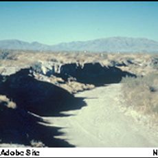
San Bernardino Ranch, Historic cattle ranch in San Bernardino Valley, Arizona, United States.

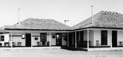
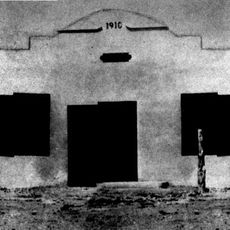
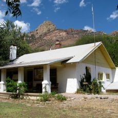
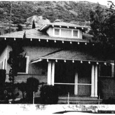
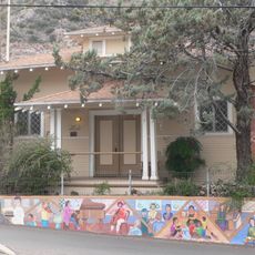
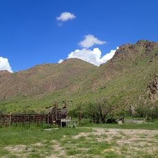
San Bernardino Ranch is a historic cattle farming area in the San Bernardino Valley east of Douglas near the Mexican border. The property still contains original buildings from its operational period, including the main residence, a washing house, an icehouse, a grain storage building, and a commissary structure.

The place began as a Spanish land grant in 1822 and was stocked with about 4,000 cattle until Apache raids forced its abandonment in the 1830s. John Horton Slaughter, a former sheriff of Cochise County, revived it as a working cattle ranch starting in 1884.

The name comes from Spanish settlers and reflects the religious heritage of the border region. Today visitors can sense how people from different backgrounds once worked and lived together on this land.

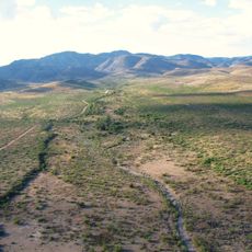
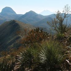
The site sits about 15 miles east of Douglas in open terrain very close to the border. Plan a visit during cooler months, as the desert heat here can be intense during summer.

Slaughter was himself a legendary gunman and lawman of the border region before he took over and transformed the property into a working operation. His personal story embodies the transitions and conflicts of the American Southwest during this turbulent era.

The community of curious travelers

AroundUs brings together thousands of curated places, local tips, and hidden gems, enriched daily by 60,000 contributors worldwide.

Start exploring
Location
GPS coordinates
31.33639,-109.27972
Latest update
December 10, 2025 20:09
Around this place
Skeleton Canyon
United States of America

Skeleton Canyon

36.5 km
Chiricahua Peak
United States of America

Chiricahua Peak

56.7 km
San Bernardino National Wildlife Refuge
United States of America

San Bernardino National Wildlife Refuge

2.3 km
Leslie Canyon National Wildlife Refuge
United States of America

Leslie Canyon National Wildlife Refuge

35.7 km
Gleeson Jail
United States of America

Gleeson Jail

68.2 km
Mexico

Canyon de Guadalupe

27.2 km
United States of America

Bonita Canyon

75.1 km
Bisbee Historic District
United States of America

Bisbee Historic District

61.4 km
Rucker Canyon
United States of America

Rucker Canyon

48.5 km
Grand Theatre
United States of America

Grand Theatre

26.6 km
Phelps Dodge General Office Building
United States of America

Phelps Dodge General Office Building

61.4 km
St. Patrick's Roman Catholic Church
United States of America

St. Patrick's Roman Catholic Church

62.2 km
Double Adobe Site
United States of America

Double Adobe Site

24.2 km
Plaza Azueta
Mexico

Plaza Azueta

26.8 km
Portal Ranger Station
United States of America

Portal Ranger Station

63.6 km
Douglas Historic District
United States of America

Douglas Historic District

26.1 km
El Paso and Southwestern Railroad YMCA
United States of America

El Paso and Southwestern Railroad YMCA

26.3 km
Bisbee Residential Historic District
United States of America

Bisbee Residential Historic District

62.4 km
Bisbee Woman's Club Clubhouse
United States of America

Bisbee Woman's Club Clubhouse

61.6 km
United States Post Office and Customs House–Douglas Main
United States of America

United States Post Office and Customs House–Douglas Main

26 km
Douglas Residential Historic District
United States of America

Douglas Residential Historic District

25.4 km
Chiricahua Desert Museum
United States of America

Chiricahua Desert Museum

63.8 km
Silver Peak Lookout Complex
United States of America

Silver Peak Lookout Complex

63.8 km
Monte Vista Lookout Cabin
United States of America

Monte Vista Lookout Cabin

54.5 km
Horseshoe Canyon
United States of America

Horseshoe Canyon

51.1 km
Castle Rock
United States of America

Castle Rock

61.8 km
Bonita Canyon Campground
United States of America

Bonita Canyon Campground

75.5 km
Heart of Rocks Loop Trail
United States of America

Heart of Rocks Loop Trail

73.4 km
Show the full map
« San Bernardino Ranch - Historic cattle ranch in San Bernardino Valley, Arizona, United States » is provided by Around Us (aroundus.com). Images and texts are derived from Wikimedia project under a Creative Commons license. You are allowed to copy, distribute, and modify copies of this page, under the conditions set by the license, as long as this note is clearly visible.

Discover hidden gems everywhere you go!

From secret cafés to breathtaking viewpoints, skip the crowded tourist spots and find places that match your style. Our app makes it easy with voice search, smart filtering, route optimization, and insider tips from travelers worldwide. Download now for the complete mobile experience.

Around Us App Screenshot

A unique approach to discovering new places

Le Figaro

All the places worth exploring

France Info

A tailor-made excursion in just a few clicks

20 Minutes

Around Us
Travel Guide & Maps
Download

Send to your phone

QR Code
1

Open the camera app on your mobile.

2

Point at the QR code with your camera. A notification will appear.

3

Tap the notification to open the link.