Heart of Rocks Loop Trail, Mountain trail in Chiricahua National Monument, Arizona, US.
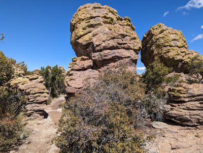
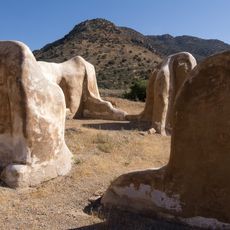
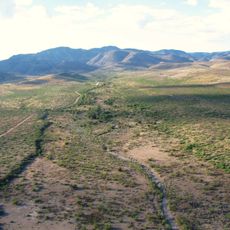
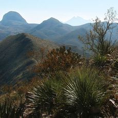
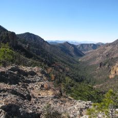
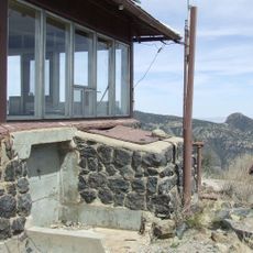
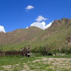
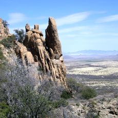
Heart of Rocks Loop Trail is a mountain pathway through Chiricahua National Monument in Arizona that winds across volcanic rock formations. The route crosses many stone steps and natural rock structures shaped by ancient geological forces.
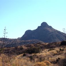
The area formed around 27 million years ago when volcanic eruptions deposited ash that transformed into rhyolite rock structures. These ancient geological events created the striking formations that hikers see along the route today.
The path crosses lands where the Chiricahua Apache people once lived, finding shelter and advantage in these mountains for their way of life. Visitors today walk through a landscape that held deep meaning for these communities.
Plan to spend 4 to 6 hours on the walk and start early in the day when conditions are coolest. Bring plenty of water since the elevation and sun exposure make dehydration a real concern.
The route passes several named rock formations such as Pinnacle Balanced Rock and Thor's Hammer that serve as natural stone monuments. These distinctive rocks are favorite photo spots and navigation landmarks for people walking the loop.
Location: Cochise County
Address: Balanced Rock Trl, Willcox, AZ 85643, USA
GPS coordinates: 31.99510,-109.32253
Latest update: December 15, 2025 13:23
Fort Bowie
19.9 km
Skeleton Canyon
52.6 km
Willcox Playa
52.2 km
Chiricahua Peak
16.9 km
Faraway Ranch Historic District
5.1 km
Leslie Canyon National Wildlife Refuge
48.7 km
Gleeson Jail
56.1 km
Canyon de Guadalupe
64.4 km
Rex Allen Arizona Cowboy Museum and Willcox Cowboy Hall of Fame
55.9 km
Bonita Canyon
3.5 km
Rucker Canyon
28.8 km
Chiricahua National Monument Historic Designed Landscape
2.1 km
Portal Ranger Station
18.6 km
Our Lady of Victory Catholic Church
48.2 km
Pearce General Store
48.2 km
Johnson-Tillotson House
56.1 km
John Gung'l House
56.3 km
Benjamin E. Briscoe House
56.8 km
Fort Bowie National Historic Site
21 km
Bowie School District No. 14
40 km
Chiricahua Desert Museum
30.5 km
Silver Peak Lookout Complex
15.3 km
Monte Vista Lookout Cabin
19 km
Fort Bowie Ranger Station & Visitor Center
19.9 km
Sugarloaf Mountain Lookout
2.1 km
Horseshoe Canyon
31.1 km
Bonita Canyon Campground
3.6 km
Cochise Trail
63 kmVisited this place? Tap the stars to rate it and share your experience / photos with the community! Try now! You can cancel it anytime.
Discover hidden gems everywhere you go!
From secret cafés to breathtaking viewpoints, skip the crowded tourist spots and find places that match your style. Our app makes it easy with voice search, smart filtering, route optimization, and insider tips from travelers worldwide. Download now for the complete mobile experience.
A unique approach to discovering new places❞
— Le Figaro
All the places worth exploring❞
— France Info
A tailor-made excursion in just a few clicks❞
— 20 Minutes