Chiricahua Peak

Log in to your account

AroundUs is a community-driven map of interesting places, built by curious explorers like you. It grows with every review, story, and photo you share.
Connect to save your favorite spots, contribute locations, and create personalized routes.
By continuing, you accept our Terms and Conditions and our Privacy Policy
Add to collection
Map
Suggest a change
Share

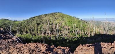
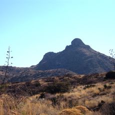
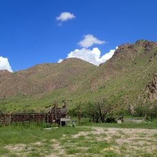
Chiricahua Peak, Mountain summit in Chiricahua Mountains, Arizona, United States.

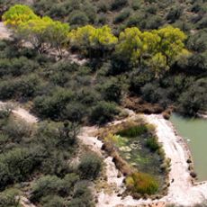
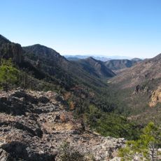
Chiricahua Peak rises in the southeastern mountains of Arizona and is surrounded by dense forests. Its northern slopes are covered with Engelmann spruce and quaking aspen trees, creating green hillsides that reach toward the summit.

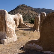
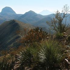
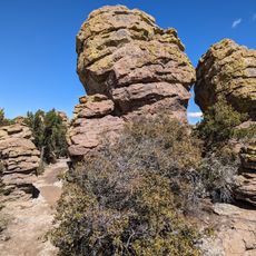
The Chiricahua Mountains formed 27 million years ago through volcanic activity that created the distinctive rock formations visible today. This ancient geological process shaped the landscape that visitors see now.

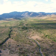
The Chiricahua Mountains were home to the Chiricahua Apache for centuries, who made these highlands their territory. Walking through the forests today, visitors can sense the deep connection this land held for indigenous peoples.

The peak is reachable via Mormon Ridge Trail or Mormon Canyon Trail, though winter weather can require special gear for the final push to the summit. Visitors should prepare for possible snow and ice on the upper sections of the route.

The peak is home to the southernmost natural stand of Engelmann spruce in North America. These trees mark the geographic limit where this species can naturally survive, making the site botanically significant.

Location: Arizona

GPS coordinates: 31.84590,-109.29133

Latest update: December 10, 2025 15:50

Photos
Around this place
Fort Bowie
United States of America

Fort Bowie

36.1 km
Skeleton Canyon
United States of America

Skeleton Canyon

37.4 km
San Bernardino Ranch
United States of America

San Bernardino Ranch

56.7 km
San Bernardino National Wildlife Refuge
United States of America

San Bernardino National Wildlife Refuge

55.5 km
Faraway Ranch Historic District
United States of America

Faraway Ranch Historic District

19.9 km
Leslie Canyon National Wildlife Refuge
United States of America

Leslie Canyon National Wildlife Refuge

35.5 km
Gleeson Jail
United States of America

Gleeson Jail

52.4 km
Canyon de Guadalupe
Mexico

Canyon de Guadalupe

48.3 km
Bonita Canyon
United States of America

Bonita Canyon

19.1 km
Rucker Canyon
United States of America

Rucker Canyon

16.7 km
Double Adobe Site
United States of America

Double Adobe Site

59.8 km
Chiricahua National Monument Historic Designed Landscape
United States of America

Chiricahua National Monument Historic Designed Landscape

19 km
Portal Ranger Station
United States of America

Portal Ranger Station

13.6 km
Douglas Historic District
United States of America

Douglas Historic District

61 km
United States Post Office and Customs House–Douglas Main
United States of America

United States Post Office and Customs House–Douglas Main

61.1 km
Our Lady of Victory Catholic Church
United States of America

Our Lady of Victory Catholic Church

50.6 km
Pearce General Store
United States of America

Pearce General Store

50.5 km
Fort Bowie National Historic Site
United States of America

Fort Bowie National Historic Site

37 km
Bowie School District No. 14
United States of America

Bowie School District No. 14

56.6 km
Douglas Residential Historic District
United States of America

Douglas Residential Historic District

60.9 km
Chiricahua Desert Museum
United States of America

Chiricahua Desert Museum

24.4 km
Silver Peak Lookout Complex
United States of America

Silver Peak Lookout Complex

11 km
Monte Vista Lookout Cabin
United States of America

Monte Vista Lookout Cabin

3.2 km
Fort Bowie Ranger Station & Visitor Center
United States of America

Fort Bowie Ranger Station & Visitor Center

36.1 km
Sugarloaf Mountain Lookout
United States of America

Sugarloaf Mountain Lookout

19 km
Horseshoe Canyon
United States of America

Horseshoe Canyon

18 km
Bonita Canyon Campground
United States of America

Bonita Canyon Campground

19.4 km
Heart of Rocks Loop Trail
United States of America

Heart of Rocks Loop Trail

16.9 km
Show the full map
Reviews

Visited this place? Tap the stars to rate it and share your experience / photos with the community! Try now! You can cancel it anytime.

« Chiricahua Peak - Mountain summit in Chiricahua Mountains, Arizona, United States » is provided by Around Us (aroundus.com). Images and texts are derived from Wikimedia project under a Creative Commons license. You are allowed to copy, distribute, and modify copies of this page, under the conditions set by the license, as long as this note is clearly visible.

Discover hidden gems everywhere you go!

From secret cafés to breathtaking viewpoints, skip the crowded tourist spots and find places that match your style. Our app makes it easy with voice search, smart filtering, route optimization, and insider tips from travelers worldwide. Download now for the complete mobile experience.

Around Us App Screenshot

A unique approach to discovering new places

Le Figaro

All the places worth exploring

France Info

A tailor-made excursion in just a few clicks

20 Minutes