San Bernardino National Wildlife Refuge, Wildlife refuge in Cochise County, Arizona.
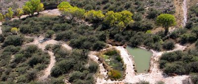
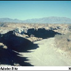
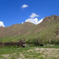
San Bernardino National Wildlife Refuge is a protected area featuring wetlands along the Mexican border where water winds through flat terrain. The area provides habitat for hundreds of bird species and various fish that live in and around these water systems.
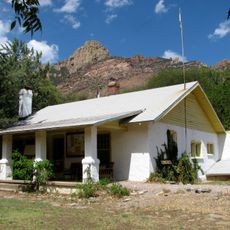
The refuge was established in the 1980s to protect a threatened wetland area that was once the largest of its kind in the region. Since then it has served to preserve this unique landscape and the wildlife that depends on it.
The refuge demonstrates how wetland habitats support the birds and fish that pass through or settle here. Visitors can observe how animals interact with the natural water and vegetation, and understand why this place matters for their survival.
The refuge is located in a dry region and is best visited during cooler months when wildlife is more active and weather is more comfortable. Start early and bring plenty of water since there is little shade on the trails and no facilities available.
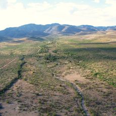
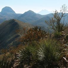
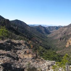
The refuge sits on an important migration route for animals moving between Mexican mountain ranges and the mountain regions of the American Southwest. This passage makes the location a bridge between two distinct mountain areas.
Location: Arizona
Inception: 1982
Website: https://fws.gov/refuge/san_bernardino
GPS coordinates: 31.34790,-109.26000
Latest update: December 12, 2025 07:55
Skeleton Canyon
34.3 km
Chiricahua Peak
55.5 km
San Bernardino Ranch
2.3 km
Leslie Canyon National Wildlife Refuge
35.9 km
Gleeson Jail
68.9 kmCanyon de Guadalupe
24.9 kmBonita Canyon
74.1 km
Bisbee Historic District
63 km
Rucker Canyon
47.9 km
Grand Theatre
28.5 km
Phelps Dodge General Office Building
63.1 km
St. Patrick's Roman Catholic Church
63.8 km
Double Adobe Site
26 km
Plaza Azueta
28.7 km
Portal Ranger Station
62 km
Douglas Historic District
27.9 km
El Paso and Southwestern Railroad YMCA
28.2 km
Bisbee Residential Historic District
64 km
Bisbee Woman's Club Clubhouse
63.2 km
United States Post Office and Customs House–Douglas Main
27.8 km
Douglas Residential Historic District
27.3 km
Chiricahua Desert Museum
61.9 km
Silver Peak Lookout Complex
62.4 km
Monte Vista Lookout Cabin
53.4 km
Horseshoe Canyon
49.3 km
Castle Rock
63.4 km
Bonita Canyon Campground
74.4 km
Heart of Rocks Loop Trail
72.3 kmVisited this place? Tap the stars to rate it and share your experience / photos with the community! Try now! You can cancel it anytime.
Discover hidden gems everywhere you go!
From secret cafés to breathtaking viewpoints, skip the crowded tourist spots and find places that match your style. Our app makes it easy with voice search, smart filtering, route optimization, and insider tips from travelers worldwide. Download now for the complete mobile experience.
A unique approach to discovering new places❞
— Le Figaro
All the places worth exploring❞
— France Info
A tailor-made excursion in just a few clicks❞
— 20 Minutes