Organ Pipe Cactus National Monument

Log in to your account

AroundUs is a community-driven map of interesting places, built by curious explorers like you. It grows with every review, story, and photo you share.
Connect to save your favorite spots, contribute locations, and create personalized routes.
By continuing, you accept our Terms and Conditions and our Privacy Policy
Add to collection
Map
Suggest a change
Share

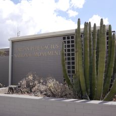
Organ Pipe Cactus National Monument, Biosphere reserve and national monument in Western Arizona, United States

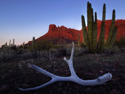
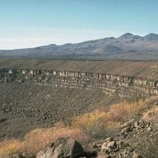
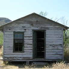
Organ Pipe Cactus National Monument protects over 520 square miles of Sonoran Desert in southwestern Arizona, home to many cactus species and wildlife. The area features a network of hiking trails and campgrounds that allow visitors to explore the desert landscape firsthand.

Arizona's legislature donated the land to the federal government during Prohibition, and it became a national monument in 1937. This designation protected this unique desert area from commercial development and preserved it for future generations.

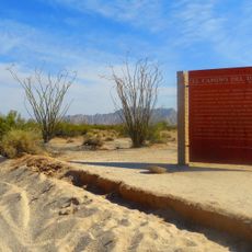
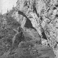
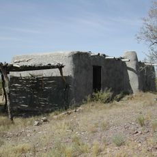
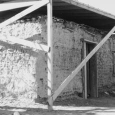
The land borders the Tohono O'odham Reservation and reflects centuries of indigenous presence through archaeological remains and traditional routes. Visitors walking these paths can sense the deep connection between the landscape and its original inhabitants.

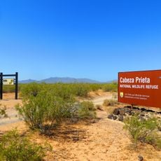
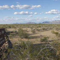
Access is via Puerto Blanco Drive from State Route 85, with clearly marked trails for different fitness levels. Visitors should bring plenty of water and sun protection, as desert sun is intense.

It is the only place in the United States where senita and organ pipe cacti grow together in their natural desert setting. This rare combination makes the area botanically significant and especially interesting for cactus researchers.

Location: Pima County

Inception: April 13, 1937

Operator: National Park Service

Part of: Western Arizona

Shares border with: Ajo

Website: https://nps.gov/orpi

GPS coordinates: 31.95400,-112.80095

Latest update: December 6, 2025 16:01

National parks and monuments in Southwestern US

The southwestern United States encompasses desert landscapes, sandstone formations and archaeological sites from several pre-Columbian cultures. The region spans Utah, Arizona, New Mexico and Colorado, featuring geological structures shaped over millions of years by wind and water erosion. National parks such as Canyonlands and Capitol Reef display canyons, mesas and rock spires in shades of red, orange and ochre. The area preserves evidence of the Ancestral Puebloans, who built cliff dwellings and communal structures between the 12th and 14th centuries. Sites like Bandelier National Monument and Gila Cliff Dwellings provide access to these habitations. Chaco Culture National Historical Park documents a pre-Hispanic trading center with multistory stone complexes. Petroglyphs at locations such as Three Rivers and the petrified trees of Petrified Forest National Park offer additional historical records. The Navajo Nation administers Monument Valley and the Navajo Zoo, while Hubbell Trading Post operates as a functioning 19th-century trading post. Volcanic features mark Sunset Crater and El Malpais, while White Sands covers more than 275 square miles (700 square kilometers) of gypsum dunes. Glen Canyon and the man-made Lake Cochiti provide water access in this largely arid region. Elevation differences range from the Organ Pipe Cactus Desert to Great Basin National Park with its ridges above 13,000 feet (3,900 meters).

Natural areas and historic sites in Arizona

Arizona contains geological formations spanning millions of years alongside evidence of Spanish colonial settlement and prehistoric cultures. The landscape includes sandstone canyons such as Antelope Canyon X and Canyon de Chelly National Monument, extensive desert areas with saguaro and organ pipe cacti, and volcanic remnants at Sunset Crater. Historical sites include Spanish missions like Tumacácori, pueblo ruins at Montezuma Castle, and mining towns such as Bisbee and Jerome. The state holds significant paleontological sites at Petrified Forest National Park, where fossilized tree trunks from the Triassic period lie exposed, and cave systems like Kartchner Caverns with active speleothem formations. The Vermilion Cliffs region displays layered sandstone formations including The Wave, while the Chiricahua Mountains show volcanic rock pinnacles formed from welded ash. Waterfalls such as Havasu Falls and Grand Falls result from geological faulting and seasonal water flow. Archaeological sites document occupation by the Hohokam, Sinagua, and Ancestral Puebloans between 300 and 1400 CE. Tonto Natural Bridge forms one of the largest travertine bridges in North America, while Besh-Ba-Gowah shows Salado culture construction methods from the 13th century. The territory spans from the Sonoran Desert in the south to the Colorado Plateau in the north, creating distinct climate zones and ecosystems within a compact area.

Around this place
Show the full map
Kitt Peak National Observatory
United States of America

Kitt Peak National Observatory

113.7 km
El Pinacate y Gran Desierto de Altar Biosphere Reserve
Mexico

El Pinacate y Gran Desierto de Altar Biosphere Reserve

105.5 km
Sonoran Desert National Monument
United States of America

Sonoran Desert National Monument

110.7 km
Dark Energy Spectroscopic Instrument
United States of America

Dark Energy Spectroscopic Instrument

113.7 km
Cabeza Prieta National Wildlife Refuge
United States of America

Cabeza Prieta National Wildlife Refuge

68 km
Kitt Peak
United States of America

Kitt Peak

113.5 km
McMath–Pierce Solar Telescope
United States of America

McMath–Pierce Solar Telescope

113.9 km
Nicholas U. Mayall Telescope
United States of America

Nicholas U. Mayall Telescope

113.4 km
Ventana Cave
United States of America

Ventana Cave

69.3 km
El Elegante Crater
Mexico

El Elegante Crater

57.1 km
Cabeza Prieta Wilderness
United States of America

Cabeza Prieta Wilderness

68 km
WIYN Telescope
United States of America

WIYN Telescope

113.3 km
ARO 12m Radio Telescope
United States of America

ARO 12m Radio Telescope

112 km
Michigan-Dartmouth-MIT Observatory
United States of America

Michigan-Dartmouth-MIT Observatory

111.9 km
Isanaklesh Peaks
United States of America

Isanaklesh Peaks

104.2 km
Bates Well Ranch
United States of America

Bates Well Ranch

27.7 km
Bok Telescope
United States of America

Bok Telescope

113.4 km
Ajo Peak
United States of America

Ajo Peak

43.6 km
Dos Lomitas Ranch
United States of America

Dos Lomitas Ranch

12.1 km
Gu Achi Peak
United States of America

Gu Achi Peak

97.5 km
Gachado Well and Line Camp
United States of America

Gachado Well and Line Camp

9.3 km
McGraw-Hill Telescope
United States of America

McGraw-Hill Telescope

111.9 km
Aquariam Mar De Cortez
Mexico

Aquariam Mar De Cortez

100.8 km
Hiltner 2.4m Telescope
United States of America

Hiltner 2.4m Telescope

112 km
Gila Bend Visitor Center and Museum
United States of America

Gila Bend Visitor Center and Museum

110.5 km
Stout's Hotel
United States of America

Stout's Hotel

110.9 km
SARA-KP
United States of America

SARA-KP

113.5 km
Kris Eggle Visitor Center
United States of America

Kris Eggle Visitor Center

94 m
Show the full map

Reviews

Visited this place? Tap the stars to rate it and share your experience / photos with the community! Try now! You can cancel it anytime.

« Organ Pipe Cactus National Monument - Biosphere reserve and national monument in Western Arizona, United States » is provided by Around Us (aroundus.com). Images and texts are derived from Wikimedia project under a Creative Commons license. You are allowed to copy, distribute, and modify copies of this page, under the conditions set by the license, as long as this note is clearly visible.

Discover hidden gems everywhere you go!

From secret cafés to breathtaking viewpoints, skip the crowded tourist spots and find places that match your style. Our app makes it easy with voice search, smart filtering, route optimization, and insider tips from travelers worldwide. Download now for the complete mobile experience.

Around Us App Screenshot

A unique approach to discovering new places

Le Figaro

All the places worth exploring

France Info

A tailor-made excursion in just a few clicks

20 Minutes