Enable Location

We need your location to show you interesting places around you

Discover nearby places

Find interesting locations and hidden gems around you

Precise directions

Get accurate directions and distances to places

Your location is never shared with other users. It's only used when you tap the location button.

Cabeza Prieta Wilderness

Log in to your account

Start exploring — it's free

Trusted by 65,805 travelers worldwide

Continue with Google
Continue with Apple
or

We will send you a code to connect

By continuing, you accept our Terms and Conditions and our Privacy Policy

Check your inbox

We've sent a pincode in your inbox. Please enter the code below.

Cabeza Prieta Wilderness
Discussion Reviews 1 Photos
3.1k Popularity

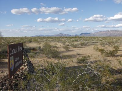
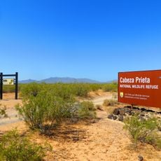
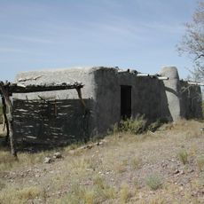
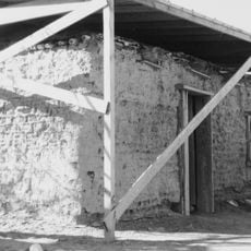
Cabeza Prieta Wilderness, Protected wilderness area in southwestern Arizona, United States

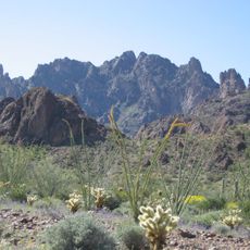
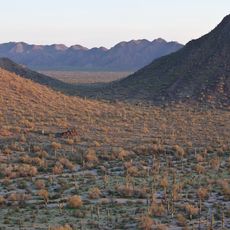
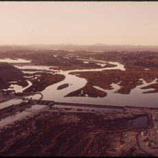
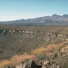
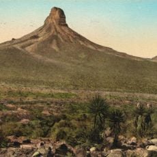
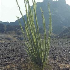
Cabeza Prieta Wilderness is a protected desert land in the far southwestern corner of Arizona, near the Mexican border, made up almost entirely of Sonoran Desert terrain. The landscape is shaped by bare mountain ranges, flat valleys, and open ground covered with cacti and low desert shrubs.

The area was first set aside as a national wildlife refuge in 1939, then used for decades by the US Air Force as a bombing and gunnery range. The Wilderness Act of 1990 gave it formal wilderness status and permanently restricted motorized activity within its borders.

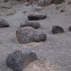
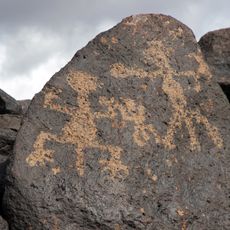
The name "Cabeza Prieta" comes from Spanish and means "dark head," a reference to the black desert-varnished rocks found throughout the terrain. Visitors who look closely at the hillsides will notice these darkened stones, which give the area its name.

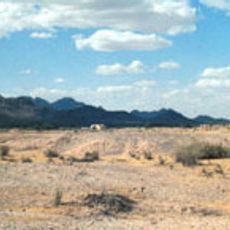
A free visitor permit is required before entering and must be obtained in advance. The area is very remote with no water sources, so carrying enough water and being prepared for extreme heat are essential for any trip here.

A trail called El Camino del Diablo, meaning "The Devil's Road," runs through the southern part of the area and was once used by travelers heading to California during the Gold Rush. Many of them died of thirst along the way, and old graves can still be found beside the route today.

The community of curious travelers

AroundUs brings together thousands of curated places, local tips, and hidden gems, enriched daily by 60,000 contributors worldwide.

Start exploring
Location
GPS coordinates
32.26806,-113.41972
Latest update
March 3, 2026 13:54
Around this place
El Pinacate y Gran Desierto de Altar Biosphere Reserve
Mexico

El Pinacate y Gran Desierto de Altar Biosphere Reserve

55.5 km
All-American Canal
United States of America

All-American Canal

119.7 km
Kofa National Wildlife Refuge
United States of America

Kofa National Wildlife Refuge

121.6 km
Sonoran Desert National Monument
United States of America

Sonoran Desert National Monument

108 km
Painted Rock Petroglyph Site
United States of America

Painted Rock Petroglyph Site

91 km
Cabeza Prieta National Wildlife Refuge
United States of America

Cabeza Prieta National Wildlife Refuge

4.5 km
Desert Sun Stadium
United States of America

Desert Sun Stadium

122.4 km
Upper Gulf of California and Colorado River Delta biosphere reserve
Mexico

Upper Gulf of California and Colorado River Delta biosphere reserve

121.4 km
McPhaul Suspension Bridge
United States of America

McPhaul Suspension Bridge

108.8 km
Yuma Project
United States of America

Yuma Project

119 km
Gillespie Dam Highway Bridge
United States of America

Gillespie Dam Highway Bridge

122.9 km
Ventana Cave
United States of America

Ventana Cave

112 km
Imperial Reservoir
United States of America

Imperial Reservoir

119.8 km
El Elegante Crater
Mexico

El Elegante Crater

47 km
Isanaklesh Peaks
United States of America

Isanaklesh Peaks

109.6 km
Bates Well Ranch
United States of America

Bates Well Ranch

45.6 km
United States of America

Ajo Peak

48.9 km
Gatlin Site
United States of America

Gatlin Site

104.5 km
Dos Lomitas Ranch
United States of America

Dos Lomitas Ranch

78.7 km
Muggins Mountain Wilderness
United States of America

Muggins Mountain Wilderness

94.4 km
United States Post Office–Yuma Main
United States of America

United States Post Office–Yuma Main

123.2 km
Gachado Well and Line Camp
United States of America

Gachado Well and Line Camp

74.3 km
Westwind Golf Course
United States of America

Westwind Golf Course

107.6 km
Aquariam Mar De Cortez
Mexico

Aquariam Mar De Cortez

108.3 km
Gila Bend Visitor Center and Museum
United States of America

Gila Bend Visitor Center and Museum

99.3 km
Stout's Hotel
United States of America

Stout's Hotel

100.4 km
Kris Eggle Visitor Center
United States of America

Kris Eggle Visitor Center

68 km
Rocky Point
United States of America

Rocky Point

89.1 km
Show the full map
Reviews
Share your experience

No review yet

Discussions
Start a discussion...

No discussion yet

« Cabeza Prieta Wilderness - Protected wilderness area in southwestern Arizona, United States » is provided by Around Us (aroundus.com). Images and texts are derived from Wikimedia project under a Creative Commons license. You are allowed to copy, distribute, and modify copies of this page, under the conditions set by the license, as long as this note is clearly visible.

Discover hidden gems everywhere you go!

From secret cafés to breathtaking viewpoints, skip the crowded tourist spots and find places that match your style. Our app makes it easy with voice search, smart filtering, route optimization, and insider tips from travelers worldwide. Download now for the complete mobile experience.

Around Us App Screenshot

A unique approach to discovering new places

Le Figaro

All the places worth exploring

France Info

A tailor-made excursion in just a few clicks

20 Minutes

Around Us
Travel Guide & Maps
Download

Send to your phone

QR Code
1

Open the camera app on your mobile.

2

Point at the QR code with your camera. A notification will appear.

3

Tap the notification to open the link.