El Pinacate y Gran Desierto de Altar Biosphere Reserve
El Pinacate y Gran Desierto de Altar Biosphere Reserve, Biosphere reserve in Sonora, Mexico
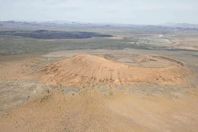
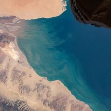
El Pinacate y Gran Desierto de Altar is a large protected area in Sonora combining volcanic peaks, dark lava fields, and vast sand dunes where the Sonoran Desert meets the Gulf of California. The terrain features numerous craters and an extensive active dune field that create a stark and varied landscape.
Beginning in 1965, NASA astronauts trained here because the volcanic terrain resembled the lunar surface. This use continued into the early 1970s and brought international attention to the area's geological features.
The Tohono O'odham people hold this land sacred, viewing Pinacate Peak as central to their creation story. This spiritual connection shapes how they understand and relate to the region.
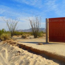
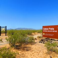
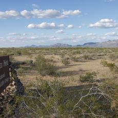
Visitors enter through the Biological Station at kilometer 51 on Highway 8 between Sonoyta and Puerto Peñasco, where registration is required before exploring. The cooler months offer the most comfortable visiting conditions, and bring plenty of water and sun protection.
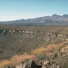
The area contains North America's largest active dune field with star-shaped formations that constantly shift in the wind. It also holds the world's highest concentration of maar-type craters, formed by underground explosions.
Location: Sonora
Inception: June 28, 2006
Operator: Comisión Nacional de Áreas Naturales Protegidas
Website: https://elpinacate.com.mx
GPS coordinates: 32.00000,-113.91667
Latest update: December 13, 2025 13:39
El Camino Del Diablo
50.7 km
Cabeza Prieta National Wildlife Refuge
51.6 km
Upper Gulf of California and Colorado River Delta biosphere reserve
66 km
El Elegante Crater
52.5 km
Cabeza Prieta Wilderness
55.5 km
Playa Bonita Resort
83.3 km
Bates Well Ranch
93.1 km
Volcán El Elegante
52.6 km
Volcán Los Vidrios
44.3 km
Aquariam Mar De Cortez
85.8 km
Volcán La Jarapeña
13.8 km
Cabeza Prieta Game Range
52 km
Playa Hermosa (lapyahan sa Mehiko, Estado de Sonora)
82.6 km
Cerro Colorado
59 km
Puerto Penasco Lighthouse
85.8 km
Cerro Blanco
79.6 km
Cerro La Pastoria
23.1 km
Playa Arenosa (lapyahan sa Mehiko)
58.9 km
NEAR HERE
59.3 km
NEAR HERE IS CAMPO SALINAS
60.5 km
The Links at Las Palomas beach and golf resort
82.3 km
Wayside Shrine
79 km
Sandy Beach
81.9 km
Monumento El Camaronero
85.1 km
Statue, Work of art
84.5 km
Scenic viewpoint
57.9 km
Scenic viewpoint
79.6 km
Waterfall
70 kmVisited this place? Tap the stars to rate it and share your experience / photos with the community! Try now! You can cancel it anytime.
Discover hidden gems everywhere you go!
From secret cafés to breathtaking viewpoints, skip the crowded tourist spots and find places that match your style. Our app makes it easy with voice search, smart filtering, route optimization, and insider tips from travelers worldwide. Download now for the complete mobile experience.
A unique approach to discovering new places❞
— Le Figaro
All the places worth exploring❞
— France Info
A tailor-made excursion in just a few clicks❞
— 20 Minutes