El Camino Del Diablo

Log in to your account

AroundUs is a community-driven map of interesting places, built by curious explorers like you. It grows with every review, story, and photo you share.
Connect to save your favorite spots, contribute locations, and create personalized routes.
Continue with Google
Continue with Apple
Continue with X
Continue with Facebook
Continue with email
By continuing, you accept our Terms and Conditions and our Privacy Policy
Create an account
Add to collection
Map
Suggest a change
Share

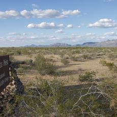
El Camino Del Diablo, historic road in Pima and Yuma counties in Arizona, United States

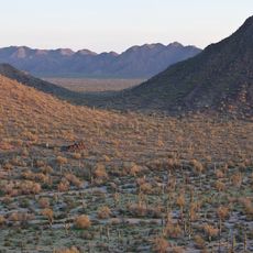
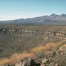
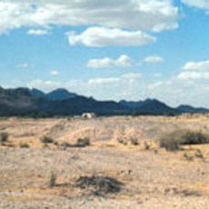
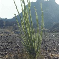
El Camino Del Diablo is a long-distance trail stretching roughly 140 kilometers across the Yuma Desert, connecting several historic routes. The path winds through extreme terrain with sand, rock, and sparse vegetation, where some sections are barely marked and cross flat ground with few landmarks.

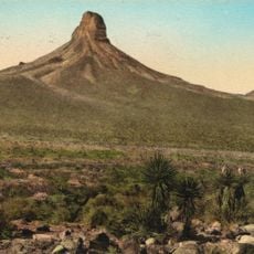
The trail served as a trade route between Spanish California and Arizona from the 17th century and was used by soldiers, settlers, and gold seekers during the 18th and 19th centuries. The name reflects the dangers travelers faced from extreme heat, scarce water, and harsh desert conditions.

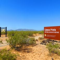
The trail is accessible only with experienced navigation and thorough preparation, as there is minimal infrastructure and limited water sources. Visitors should expect extreme temperatures, require full equipment, carry adequate water, and need detailed terrain knowledge depending on the season.

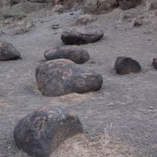
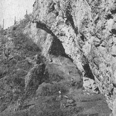
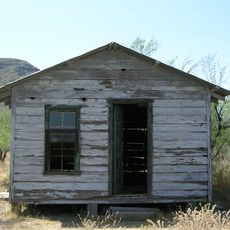
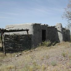
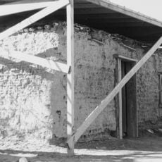
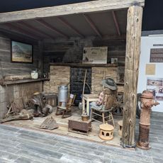
The route was once considered one of the most dangerous paths in North America and also served as an escape route for settlers during early European expansion. Attentive hikers can still find traces of old rest stops, abandoned water sources, and other remnants from this turbulent past.

Location: Pima County

Location: Yuma County

GPS coordinates: 32.07222,-113.38667

Latest update: December 15, 2025 13:27

Photos
Around this place
Colorado River Delta
Mexico

Colorado River Delta

125.9 km
El Pinacate y Gran Desierto de Altar Biosphere Reserve
Mexico

El Pinacate y Gran Desierto de Altar Biosphere Reserve

50.7 km
All-American Canal
United States of America

All-American Canal

135.6 km
Sonoran Desert National Monument
United States of America

Sonoran Desert National Monument

122 km
Painted Rock Petroglyph Site
United States of America

Painted Rock Petroglyph Site

110.5 km
Cabeza Prieta National Wildlife Refuge
United States of America

Cabeza Prieta National Wildlife Refuge

18.6 km
Desert Sun Stadium
United States of America

Desert Sun Stadium

134.7 km
Upper Gulf of California and Colorado River Delta biosphere reserve
Mexico

Upper Gulf of California and Colorado River Delta biosphere reserve

115.4 km
McPhaul Suspension Bridge
United States of America

McPhaul Suspension Bridge

123.7 km
Painted Rock Dam
United States of America

Painted Rock Dam

116.7 km
Ventana Cave
United States of America

Ventana Cave

112.9 km
Imperial Reservoir
United States of America

Imperial Reservoir

135.9 km
El Elegante Crater
Mexico

El Elegante Crater

25.1 km
Cabeza Prieta Wilderness
United States of America

Cabeza Prieta Wilderness

22 km
Playa Bonita Resort
Mexico

Playa Bonita Resort

85.5 km
Isanaklesh Peaks
United States of America

Isanaklesh Peaks

121.6 km
Bates Well Ranch
United States of America

Bates Well Ranch

42.5 km
United States of America

Ajo Peak

53.9 km
Gatlin Site
United States of America

Gatlin Site

120.4 km
Dos Lomitas Ranch
United States of America

Dos Lomitas Ranch

65.5 km
Z Fun Factory and Waylon's Water World
United States of America

Z Fun Factory and Waylon's Water World

129.4 km
Muggins Mountain Wilderness
United States of America

Muggins Mountain Wilderness

110.5 km
Gachado Well and Line Camp
United States of America

Gachado Well and Line Camp

61 km
Westwind Golf Course
United States of America

Westwind Golf Course

121 km
Aquariam Mar De Cortez
Mexico

Aquariam Mar De Cortez

87.1 km
Gila Bend Visitor Center and Museum
United States of America

Gila Bend Visitor Center and Museum

115.1 km
Stout's Hotel
United States of America

Stout's Hotel

116 km
Kris Eggle Visitor Center
United States of America

Kris Eggle Visitor Center

56.8 km
Show the full map
Reviews

Visited this place? Tap the stars to rate it and share your experience / photos with the community! Try now! You can cancel it anytime.

« El Camino Del Diablo - historic road in Pima and Yuma counties in Arizona, United States » is provided by Around Us (aroundus.com). Images and texts are derived from Wikimedia project under a Creative Commons license. You are allowed to copy, distribute, and modify copies of this page, under the conditions set by the license, as long as this note is clearly visible.

Discover hidden gems everywhere you go!

From secret cafés to breathtaking viewpoints, skip the crowded tourist spots and find places that match your style. Our app makes it easy with voice search, smart filtering, route optimization, and insider tips from travelers worldwide. Download now for the complete mobile experience.

Around Us App Screenshot

A unique approach to discovering new places

Le Figaro

All the places worth exploring

France Info

A tailor-made excursion in just a few clicks

20 Minutes