Enable Location

We need your location to show you interesting places around you

Discover nearby places

Find interesting locations and hidden gems around you

Precise directions

Get accurate directions and distances to places

Your location is never shared with other users. It's only used when you tap the location button.

Log in to your account

Start exploring — it's free

Trusted by 61,686 travelers worldwide

Continue with Google
Continue with Apple
or

We will send you a code to connect

By continuing, you accept our Terms and Conditions and our Privacy Policy

Check your inbox

We've sent a pincode in your inbox. Please enter the code below.

Ajo Peak

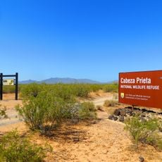
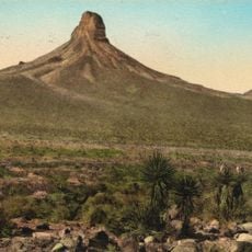
Ajo Peak, Mountain summit in Arizona, United States

Description

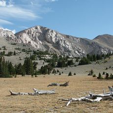
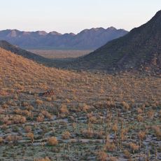
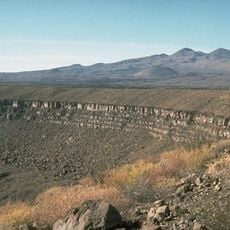
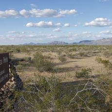
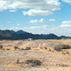
Ajo Peak is a mountain summit in the Sonoran Desert of Arizona with views across the surrounding desert landscape from its top. The peak has rocky slopes and sparse desert vegetation that extends toward the ridgeline.

History

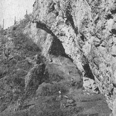
The peak has served as a landmark for people crossing the desert region over many centuries. Its raised position made it a recognizable feature in the surrounding terrain.

Culture

Local tribes maintain connections to Ajo Peak through ceremonial practices and oral traditions that span multiple generations of desert inhabitants.

Practical

Visitors should bring several liters of water and wear sturdy boots since the route covers rocky terrain. Starting early in the day helps avoid the intense afternoon heat.

Did you know?

The summit hosts plant species that have adapted to survive extreme dryness and temperature swings. These species display interesting survival strategies that allow them to thrive in such harsh conditions.

Location
GPS coordinates
32.33561,-112.90655
Latest update
December 14, 2025 14:25

AroundUs brings together thousands of curated places, local tips, and hidden gems, enriched daily by 60,000 contributors worldwide. Discover all places nearby (Arizona).

Around this place
Basin and Range Province
United States of America

Basin and Range Province

112.6 km
El Pinacate y Gran Desierto de Altar Biosphere Reserve
Mexico

El Pinacate y Gran Desierto de Altar Biosphere Reserve

102.3 km
Sonoran Desert National Monument
United States of America

Sonoran Desert National Monument

73 km
El Camino Del Diablo
United States of America

El Camino Del Diablo

53.9 km
Painted Rock Petroglyph Site
United States of America

Painted Rock Petroglyph Site

77.7 km
Cabeza Prieta National Wildlife Refuge
United States of America

Cabeza Prieta National Wildlife Refuge

51.8 km
Painted Rock Dam
United States of America

Painted Rock Dam

82.7 km
Corona Satellite Calibration Targets
United States of America

Corona Satellite Calibration Targets

120 km
Gillespie Dam Highway Bridge
United States of America

Gillespie Dam Highway Bridge

100.1 km
Ventana Cave
United States of America

Ventana Cave

63.3 km
El Elegante Crater
Mexico

El Elegante Crater

71.1 km
Cabeza Prieta Wilderness
United States of America

Cabeza Prieta Wilderness

48.9 km
Isanaklesh Peaks
United States of America

Isanaklesh Peaks

69.9 km
Bates Well Ranch
United States of America

Bates Well Ranch

19.1 km
Gatlin Site
United States of America

Gatlin Site

74.9 km
Dos Lomitas Ranch
United States of America

Dos Lomitas Ranch

55.4 km
United States of America

Gu Achi Peak

96.9 km
Hassayampa Bridge
United States of America

Hassayampa Bridge

114.1 km
Casa Grande Woman's Club Building
United States of America

Casa Grande Woman's Club Building

123.8 km
Gachado Well and Line Camp
United States of America

Gachado Well and Line Camp

52.9 km
Saint Anthony's Church
United States of America

Saint Anthony's Church

123.8 km
Valley National Bank
United States of America

Valley National Bank

123.5 km
Cruz Trading Post
United States of America

Cruz Trading Post

123.6 km
Henry and Anna Kochsmeier House
United States of America

Henry and Anna Kochsmeier House

123.2 km
The Domes of Casa Grande
United States of America

The Domes of Casa Grande

118.9 km
Gila Bend Visitor Center and Museum
United States of America

Gila Bend Visitor Center and Museum

69.8 km
Stout's Hotel
United States of America

Stout's Hotel

70.4 km
Kris Eggle Visitor Center
United States of America

Kris Eggle Visitor Center

43.5 km
Show the full map
« Ajo Peak - Mountain summit in Arizona, United States » is provided by Around Us (aroundus.com). Images and texts are derived from Wikimedia project under a Creative Commons license. You are allowed to copy, distribute, and modify copies of this page, under the conditions set by the license, as long as this note is clearly visible.

Discover hidden gems everywhere you go!

From secret cafés to breathtaking viewpoints, skip the crowded tourist spots and find places that match your style. Our app makes it easy with voice search, smart filtering, route optimization, and insider tips from travelers worldwide. Download now for the complete mobile experience.

Around Us App Screenshot

A unique approach to discovering new places

Le Figaro

All the places worth exploring

France Info

A tailor-made excursion in just a few clicks

20 Minutes

Around Us
Travel Guide & Maps
Download

Send to your phone

QR Code
1

Open the camera app on your mobile.

2

Point at the QR code with your camera. A notification will appear.

3

Tap the notification to open the link.