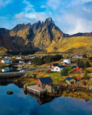
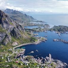
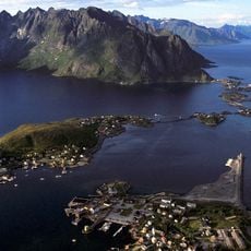
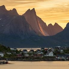
Hamnøya, Fishing islet in Moskenes, Norway
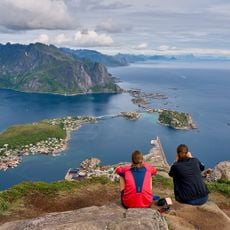
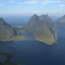
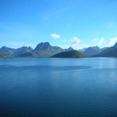
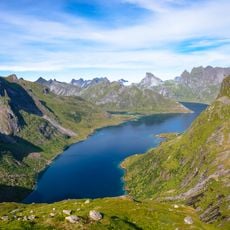
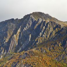
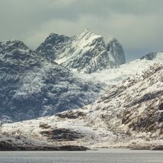
Hamnøya is a fishing settlement on the eastern side of Moskenesøya island, connected to neighboring communities by a series of bridges forming part of the E10 highway. The islet sits beneath towering mountain peaks that rise directly from the sea.
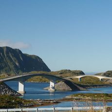
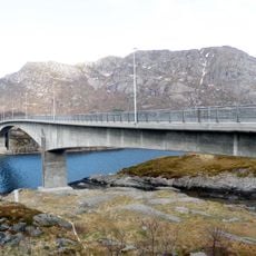
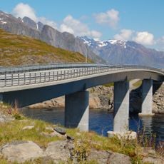
The settlement depended on ferries for centuries before the Lofoten Mainland Connection project transformed it with bridge infrastructure. This shift opened new possibilities for the community and changed how people and goods moved through the region.
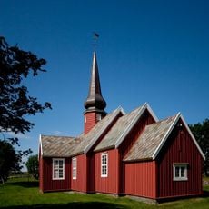
Fishing traditions shape daily life on the islet, with residents practicing methods passed down through generations. The sight of wooden drying racks dotting the landscape remains central to how locals connect with their maritime heritage.
You reach the islet by driving the E10 highway through the Lofoten region, which connects directly to the settlement. The nearest airport is in Leknes to the north, making it accessible for travelers arriving by air.
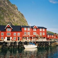
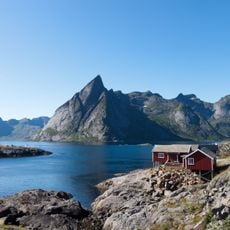
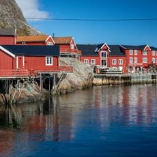
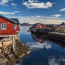
Red wooden cabins built on stilts above the water mark the landscape here, representing traditional Norwegian coastal building methods. These structures serve the practical purpose of protecting homes from rising tides while creating an unforgettable visual appearance against the mountain backdrop.
Location: Moskenes
Address: Hamnøy, Norway
GPS coordinates: 67.94631,13.13387
Latest update: December 6, 2025 19:10
The Lofoten Islands feature white sandy beaches, coastal villages with red and orange houses, museums on Viking history and fishing, as well as elevated viewpoints over the fjords. The archipelago includes active fishing ports, hiking trails leading to peaks, wooden churches, and islands accessible by ferry. The region offers opportunities to observe the midnight sun and sea eagles in their natural habitat.
Fredvang Bridges
15.2 km
Lofoten Stockfish Museum
9.5 km
Norwegian Fishing Village Museum
9.6 km
Flakstad Church
19 km
Reinebringen
3.2 km
Kjerkfjorden
7.7 km
Kåkern Bridge
8.3 km
Djupfjord Bridge
4.3 km
On south island
10.2 km
Reinefjorden
1.3 km
Walbucht
14.6 km
Bunesfjorden
6 km
Glåpen Lighthouse
7.7 km
Reinebruggen
718 m
Selfjorden
10.7 km
Djupfjorden
4.6 km
Forsfjorden
5.7 km
Lofoten Tørrfiskmuseum
9.5 km
Reine fyr
1.5 km
Lofotodden National Park
9.1 km
Lilandstinden
2.3 km
Bunes Beach
8 km
Breiflogtinden
9.4 km
Glåpen Lighthouse
7.7 km
Narvtinden
8.2 km
Kråkhammartinden
7.7 km
Viewpoint Rock
15.7 km
Å FISKEVÆR
9.7 kmReviews
Visited this place? Tap the stars to rate it and share your experience / photos with the community! Try now! You can cancel it anytime.
Discover hidden gems everywhere you go!
From secret cafés to breathtaking viewpoints, skip the crowded tourist spots and find places that match your style. Our app makes it easy with voice search, smart filtering, route optimization, and insider tips from travelers worldwide. Download now for the complete mobile experience.
A unique approach to discovering new places❞
— Le Figaro
All the places worth exploring❞
— France Info
A tailor-made excursion in just a few clicks❞
— 20 Minutes