See the monuments around you in AROpen chests in the app
Around Us is built for your phone — point your camera at the streets and discover the monuments and places around you in augmented reality.Around Us is built for your phone — chests unlock when you walk, explore and capture nearby places.
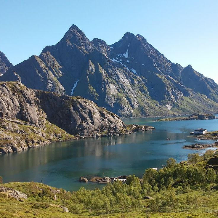
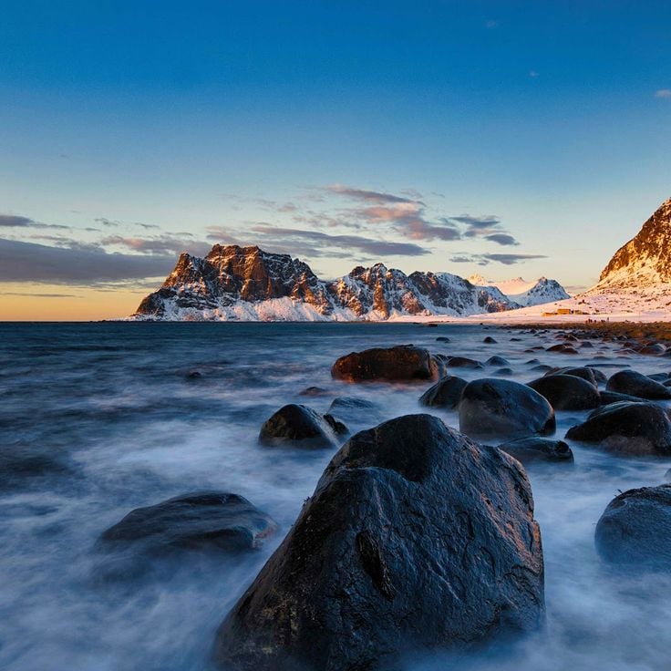
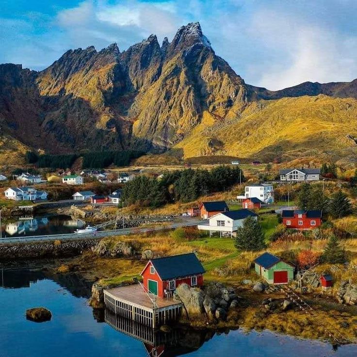
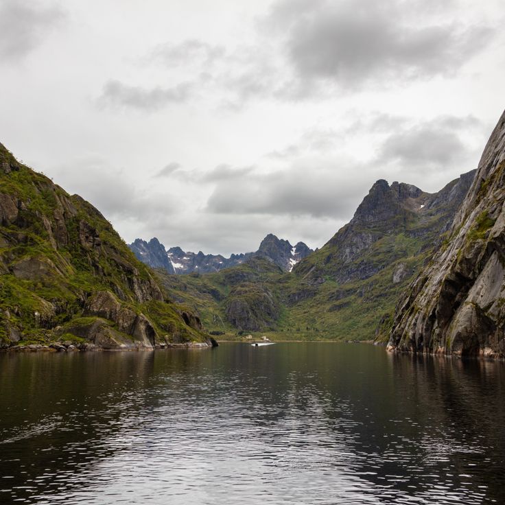
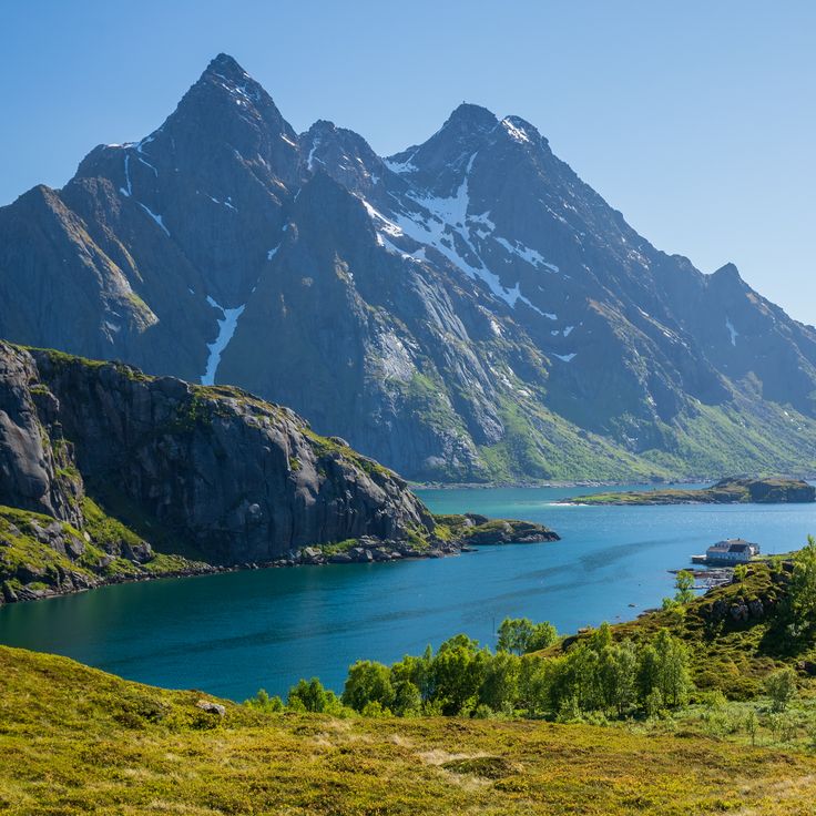
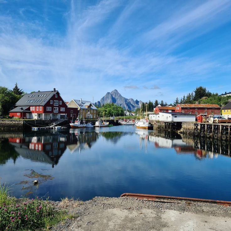
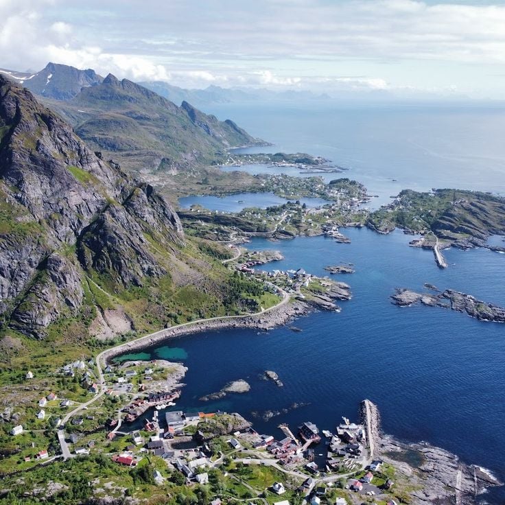
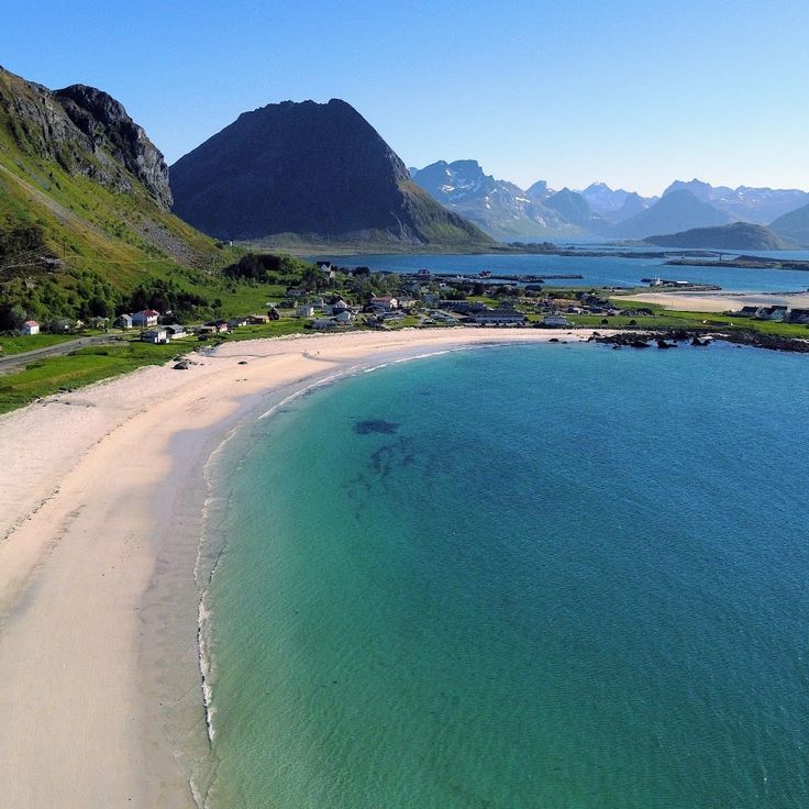
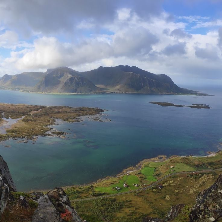
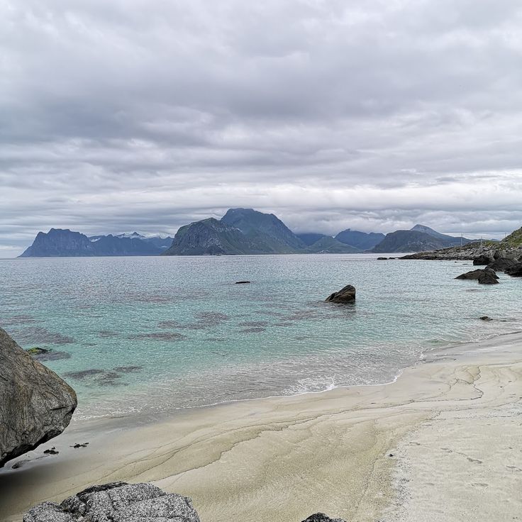
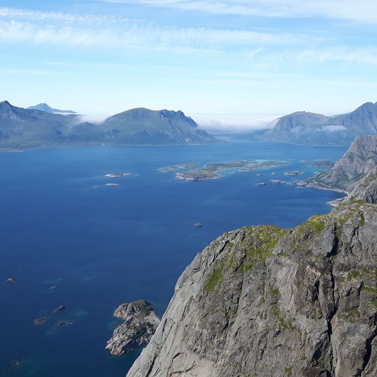
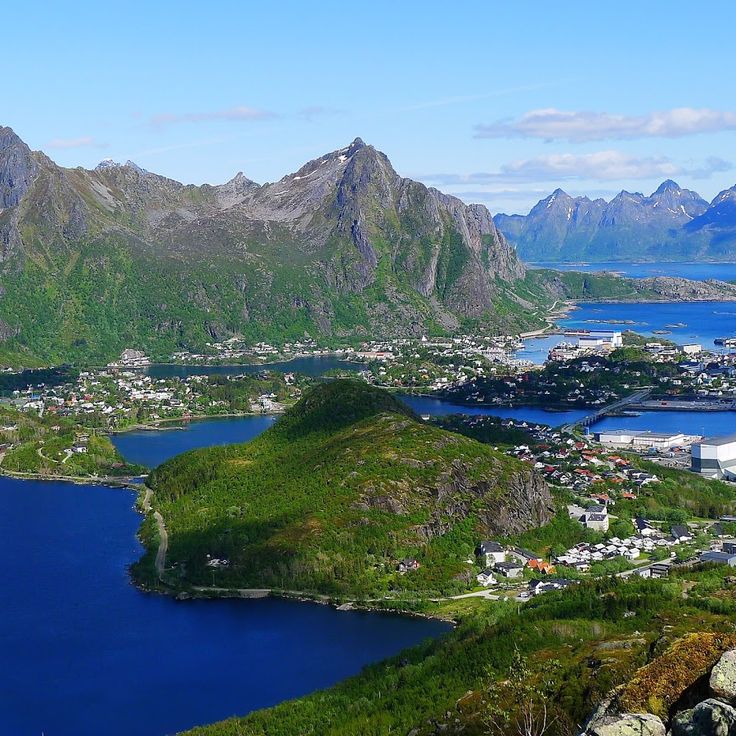
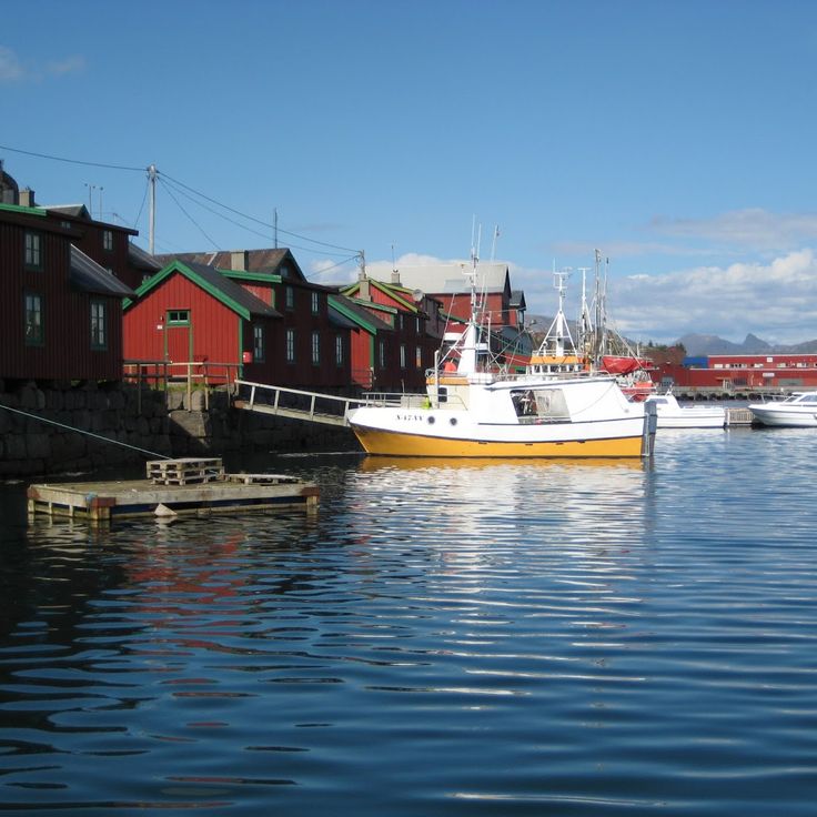
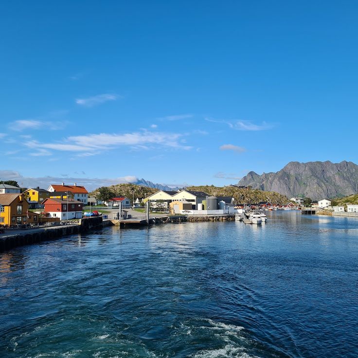
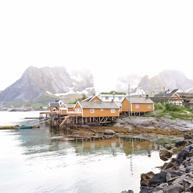
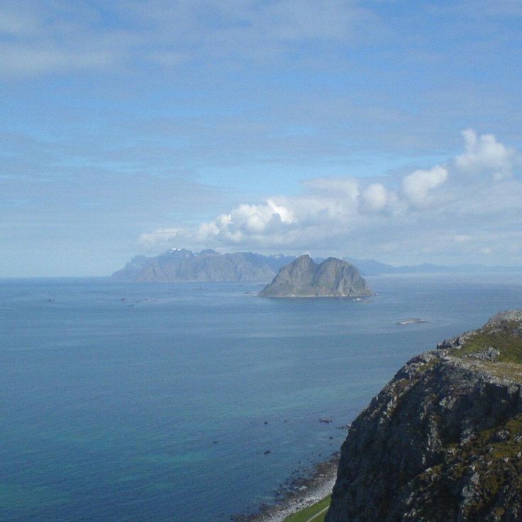
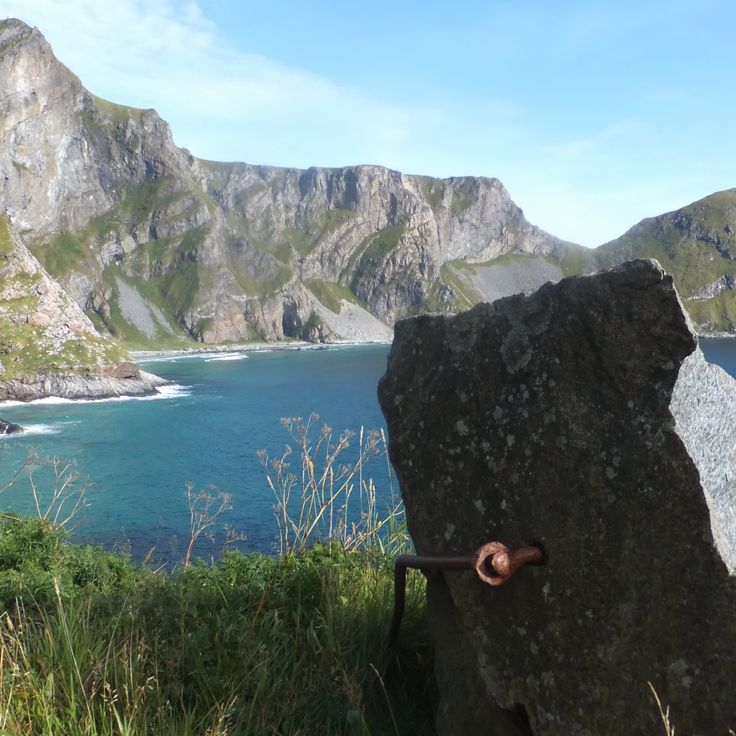
The Lofoten Islands are an archipelago in northern Norway where steep mountain peaks rise directly from the sea. The islands are connected by bridges and ferries, making them accessible for exploration. White sandy beaches stretch along the coastline, while small fishing villages preserve red and orange wooden houses and the traditions of the sea.
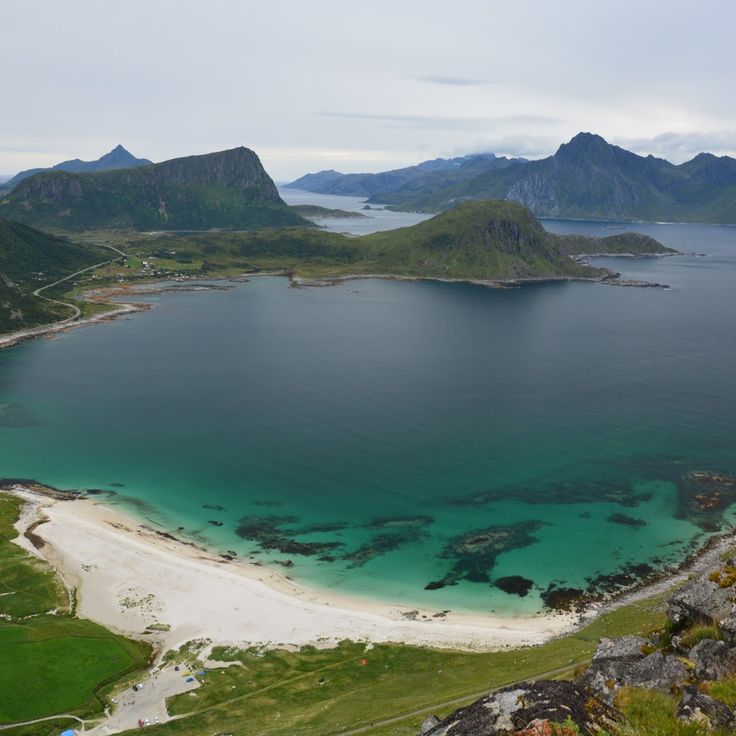
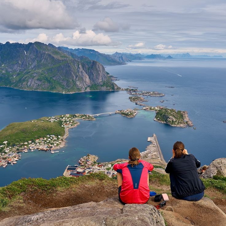
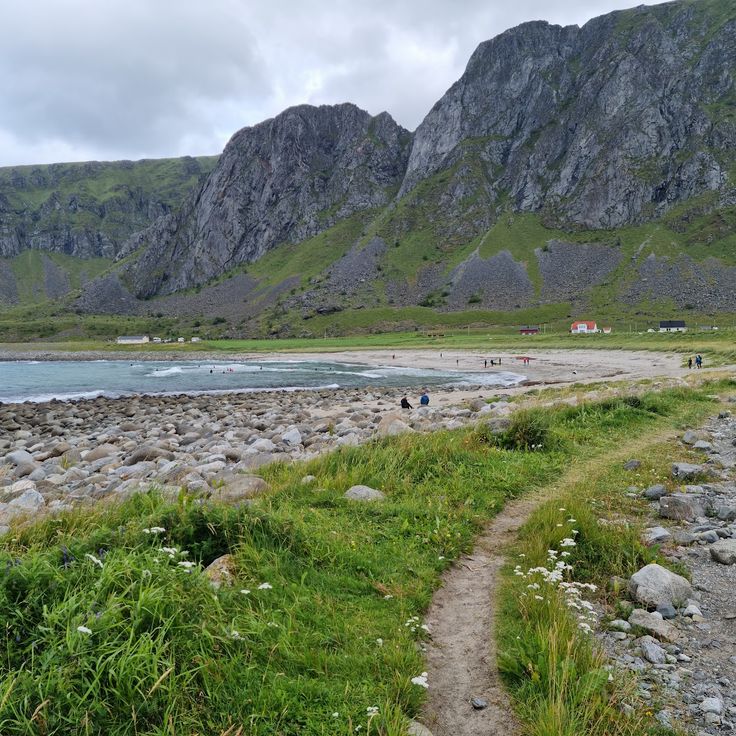
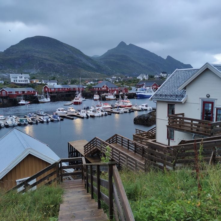
The region offers plenty to experience whether you enjoy hiking, photography, or learning about local history. Beaches like Uttakleiv, Haukland, and Kvalvika provide space to walk and take in views of the fjords. Mountain summits such as Reinebringen, Ryten, and Himmeltinden reward hikers with panoramic views. Villages like Reine, Hamnøy, and Å maintain their character through traditional architecture and working fishing ports where you can still see the daily rhythms of the community.
Museums throughout the islands share stories of Viking heritage and the fishing culture that shaped the region. The Lofotr Viking Museum and the Lofoten War Museum provide historical context, while aquariums showcase local marine life. During summer months, visitors can witness the midnight sun, and year-round there are opportunities to spot white-tailed sea eagles in their natural habitat. Ferries connect the main islands to smaller ones like Værøy, Skrova, and Mosken.
The Lofoten Islands are an archipelago in northern Norway where steep mountain peaks rise directly from the sea. The islands are connected by bridges and ferries, making them accessible for exploration. White sandy beaches stretch along the coastline, while small fishing villages preserve red and orange wooden houses and the traditions of the sea.
The region offers plenty to experience whether you enjoy hiking, photography, or learning about local history. Beaches like Uttakleiv, Haukland, and Kvalvika provide space to walk and take in views of the fjords. Mountain summits such as Reinebringen, Ryten, and Himmeltinden reward hikers with panoramic views. Villages like Reine, Hamnøy, and Å maintain their character through traditional architecture and working fishing ports where you can still see the daily rhythms of the community.
Museums throughout the islands share stories of Viking heritage and the fishing culture that shaped the region. The Lofotr Viking Museum and the Lofoten War Museum provide historical context, while aquariums showcase local marine life. During summer months, visitors can witness the midnight sun, and year-round there are opportunities to spot white-tailed sea eagles in their natural habitat. Ferries connect the main islands to smaller ones like Værøy, Skrova, and Mosken.
Uttakleiv Beach is a sandy shore in the Lofoten region where waves crash against surrounding rocks and cliffs. The mountains that frame this beach are part of the natural landscape characteristic of the Lofoten Islands, where you can also find red and orange fishing villages, hiking trails, and viewpoints overlooking the fjords.
This long white sandy beach on the Lofoten Islands stretches between Arctic mountain peaks and provides a clear view of the seabed in good weather. As part of the archipelago's coastal experience, the beach complements the region's hiking trails, fishing villages with their colorful wooden houses, and viewpoints overlooking the fjords.
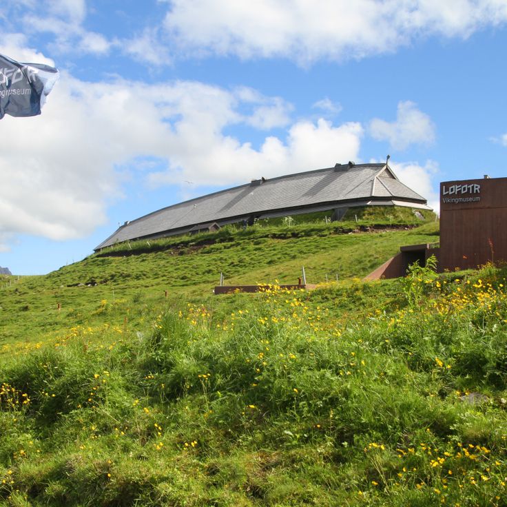
The Lofotr Viking Museum features a reconstructed Viking longhouse approximately 83 meters in length from the 8th century. As you explore the Lofoten Islands, this site lets you see archaeological artifacts and watch craftspeople demonstrate traditional techniques. The museum helps you understand how Vikings lived in this harsh northern region.
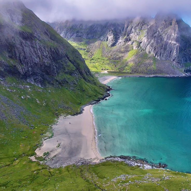
Kvalvika Beach is one of the isolated beaches discovered in the Lofoten Islands and is reached after a 2-kilometer walk from the parking area. The trail crosses rocky slopes with views of the ocean. This beach shows the wild coastal landscape that defines the Lofoten region.
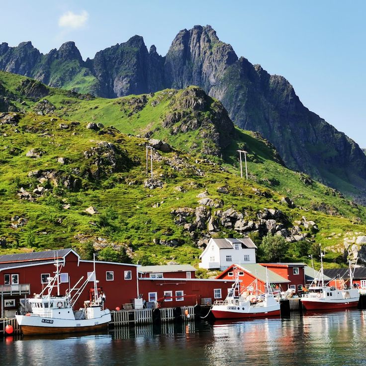
The Village of Henningsvaer is an active fishing port within the Lofoten Islands. Red cabins built on stilts rise directly from the water, creating the heart of this working harbor. Along the wooden quays, cod hangs on drying racks, a sight that shows how fishing shapes daily life here. This village fits perfectly into your exploration of the Lofoten, where fishing communities remain unchanged and integral to the region.
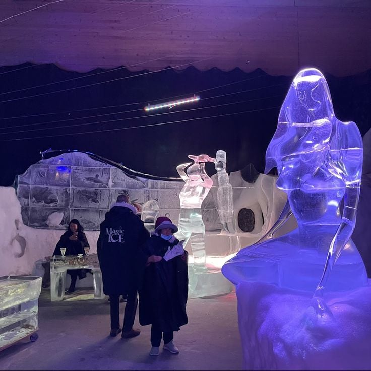
Magic Ice Lofoten is an art gallery housed in an old vaulted cellar kept at -5 degrees Celsius, where ice sculptures and frozen furniture tell the story of the Lofoten Islands. It complements your exploration of this archipelago with its fishing villages, Viking heritage sites, and dramatic coastal landscape.
Nusfjord is a fishing village in the Lofoten Islands that shows how people lived from the sea. Red wooden rorbus buildings line the waterfront, and fish drying racks hang above the harbor. The natural bay provided shelter for boats for many generations. Walking through the village, you see how fishing shaped everyday life here. The 19th-century structures remain much as they were, offering a window into the traditional practices of Norwegian coastal fishing communities.
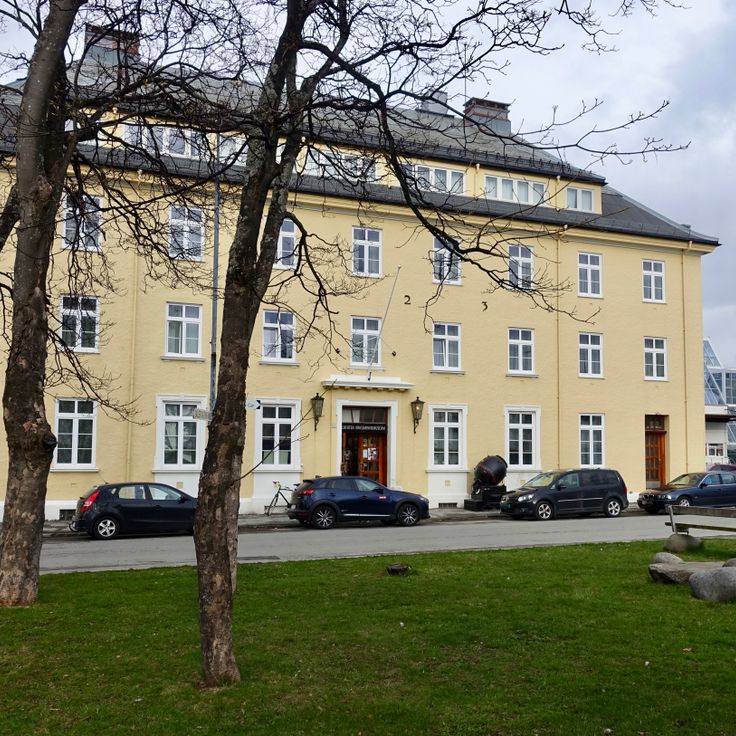
The Lofoten War Museum documents the German occupation of the Lofoten Islands during World War II from 1940 to 1945. Its collection includes objects, photographs, and documents that tell the story of this period in the islands' history. Visitors can learn how the archipelago and its people were affected during the war years.
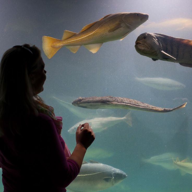
The Lofoten Aquarium displays fish and invertebrates from the Norwegian Sea in 23 different tanks. Seal feedings happen regularly here. This marine center complements your exploration of the Lofoten Islands, where you will find fishing villages with red and orange houses, hiking trails to peaks, and chances to see sea eagles in their natural surroundings.
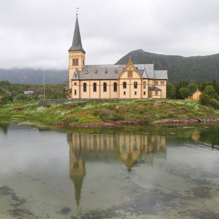
Kabelvag Church is a neogothic wooden structure built in 1898 that you can visit while exploring the Lofoten Islands. This building once served as the largest wooden church in northern Norway and could hold about 1200 people. It sits at the heart of the religious heritage of this archipelago, where you can also find red and orange houses in coastal villages, museums dedicated to Viking and fishing history, and elevated viewpoints over the fjords.
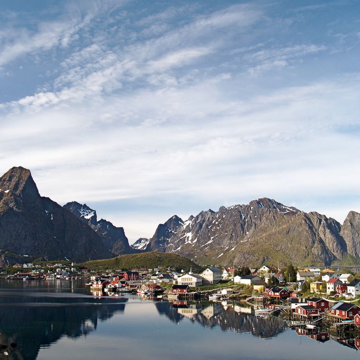
Reine is a fishing port on the island of Moskenesøya in the Lofoten Islands. Traditional wooden houses on stilts line a bay surrounded by mountain peaks. The village displays the history of fishing in Norway and offers views of the dramatic landscape that defines this archipelago. Visitors here can experience how the sea and fjords shape daily life in these islands.
This fishing community sits on a rocky island and shows how people in the Lofoten Islands have lived from the sea. The distinctive red wooden houses on stilts, called rorbus, were originally built as shelter for fishermen during the fishing season. Today these houses give visitors a sense of the hard work that defined life here. The village fits into the larger story of the Lofoten Islands, where coastal settlements with their red and orange houses are central to the region's character.
Trollfjord is a narrow fjord passage in Lofoten where you can watch white-tailed sea eagles in their natural environment. This fjord fits perfectly into exploring the Lofoten Islands with their fishing villages, hiking trails, and views over the fjords. Here you experience nature up close.
Reinebringen Summit is a mountain reached by a hiking trail that climbs to 460 meters in elevation. From the top, you can see across the Reine fjord and the villages nestled along its shores. This viewpoint fits perfectly with exploring the Lofoten Islands, where hiking trails to peaks and elevated views over fjords are central to the region's appeal.
Unstad Beach shows why the Lofoten Islands attract visitors with their white sandy beaches and coastal villages. This beach sits in a bay open to the Atlantic Ocean and draws surfers year-round despite the cold water. It offers a sense of the active water sports culture found across this archipelago.
Himmeltinden Summit is the highest point on Vestvågøy Island in the Lofoten archipelago, reached by a 6-kilometer hike that opens onto views of the islands. This viewpoint fits naturally into exploring the region, where red and orange houses dot coastal villages, museums tell stories of Vikings and fishing heritage, and elevated lookouts reveal the shape of the fjords.
The village of Ballstad is a key place to experience the living fishing tradition of the Lofoten Islands. It features an active maritime port with traditional fishing sheds and offers boat rentals for water activities throughout the year. The village shows how people here have made their living from fishing for generations, and lets visitors watch the daily work of the harbor.
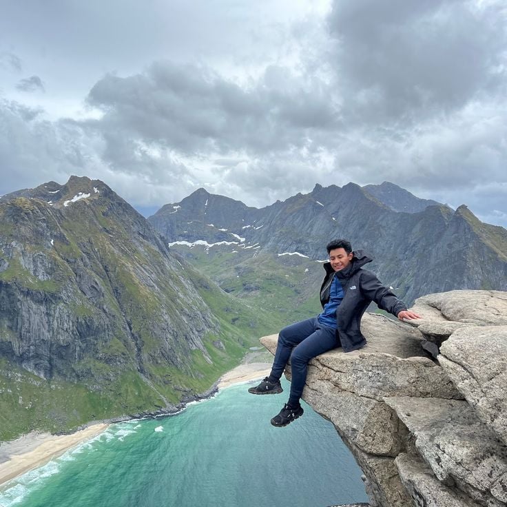
The Ryten Summit is a mountain within the Lofoten Islands, a Norwegian archipelago known for white sandy beaches, colorful fishing villages, and coastal views. This peak rises to 550 meters and offers views of Kvalvika Beach and the Atlantic Ocean. A marked hiking path connects the parking lot to the summit.
Kabelvåg is the first fishing port of the Lofoten Islands, founded in the 12th century. This village fits perfectly into discovering the Lofoten, where fishing has shaped the culture for centuries. The village houses a museum dedicated to fishing techniques and local maritime history. Visitors can learn how people made their living from the sea and how this tradition continues today.
Geitgallien Summit sits within the Lofoten Islands and rewards hikers with a demanding climb from fjord level. The steep path gains 900 meters of elevation to reach this 1100 meter peak. From the top, you see across the archipelago's distinctive landscape of red and orange coastal villages, white sandy beaches, and deep fjords below.
Ramberg Beach is a white sandy beach in the Lofoten Islands that stretches along the coast with steep mountains rising behind it. Visitors come here to walk on the sand, swim in summer months, and enjoy views out toward the sea and surrounding islands. On clear days, the backdrop of mountains makes the beach feel remote and dramatic. The beach sits near fishing villages with the characteristic red and orange wooden houses typical of the region.
The village of Å sits at the southern end of the Lofoten Islands and shows how traditional life shaped this island chain. Red stilt cabins line the waterfront, and a museum tells the story of cod fishing that once supported the entire region. Here you can see how fishing shaped the daily rhythm and culture of island living.
Hoven Summit offers a vantage point for those discovering the Lofoten Islands, standing at 368 meters above sea level. From the peak, you can see in all directions across the archipelago, with views of surrounding islands, the sea, and distant fjords. During summer, the mountain provides an excellent location to witness the midnight sun hanging low on the horizon. The trail takes you through natural terrain to reach the top, where the landscape unfolds beneath your feet.
Myrland Beach sits in a cove between mountains on the north of the island and is part of the Lofoten Islands, known for white sandy beaches, coastal villages with red and orange houses, and hiking trails leading to peaks. The beach is accessible via a 2-kilometer hiking trail.
Festvågtind Summit is a 541-meter-high peak located in the Lofoten Islands. From its top, you can see the fishing port of Henningsvær and the surrounding islands spread below you. This viewpoint helps you understand the landscape of the Lofoten Islands, with their red and orange houses, active fishing ports, and fjords.
Tjeldbergtind Summit is a 367-meter-high mountain in the Lofoten region. After a 2-kilometer walk to the top, you get a clear view of the town of Svolvær, Vestfjord, and the surrounding mountains. This viewpoint fits perfectly into your exploration of the Lofoten Islands, where you can find hiking trails leading to peaks and elevated viewpoints over fjords and open landscapes.
The village of Stamsund is a traditional fishing port in the Lofoten Islands. Here you will find facilities for sailing, fishing, and kayaking. The village has a shopping center and restaurants serving local specialties. Stamsund fits well into a journey through this archipelago of red and orange houses, hiking trails to peaks, and working fishing ports.
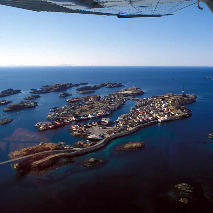
The Island of Skrova is a small fishing village in the Lofoten archipelago where about 200 residents make their living from the sea. Red and orange houses cluster along the waterfront, and fishing boats and equipment are part of everyday life here. A year-round ferry service from Svolvær connects the island to the mainland, making it accessible to visitors. On Skrova, you can experience how people work with the ocean and observe traditional fishing practices that have shaped this community for generations. The island offers a glimpse into authentic coastal life in northern Norway.
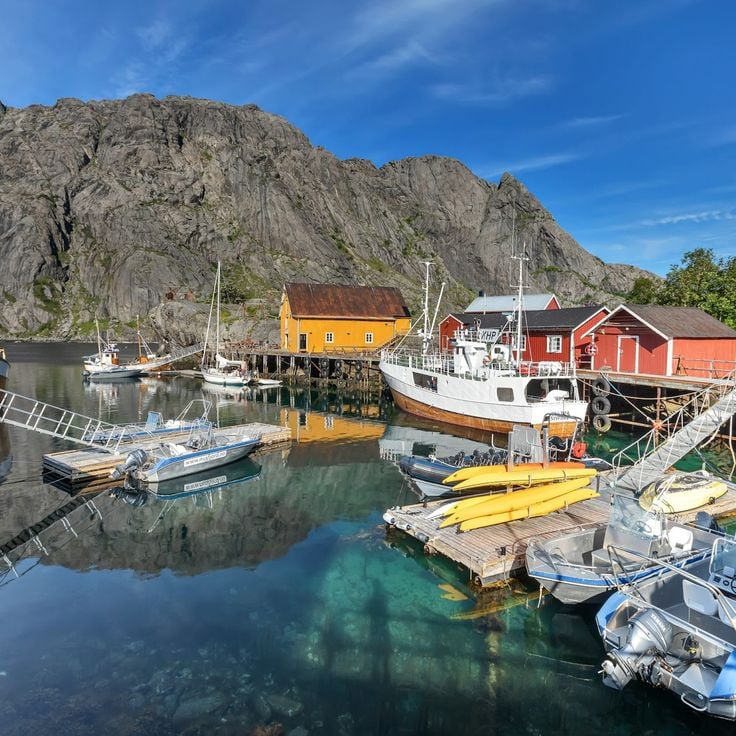
Sakrisøy is a historic village in the Lofoten Islands where traditional orange houses and old cod warehouses shape the character of the settlement. Wooden pedestrian bridges connect the dwellings to each other, forming pathways through the village. Located near an active fishing port, this settlement reflects the everyday life of island residents and their connection to the sea and fishing traditions.
The Island of Mosken is an uninhabited rocky islet in the southern part of the Lofoten archipelago, situated between Værøy and Moskenes. Strong marine currents make this location challenging to reach. As part of discovering the Lofoten Islands, Mosken reveals the rugged, less accessible side of the archipelago, where natural forces dominate and only experienced sailors venture.
The village of Sørvågen is an active fishing port in the Lofoten Islands where you can observe traditional fishing practices and the daily life of local fishermen. The village displays fish drying racks and houses a small museum dedicated to maritime history, telling the story of the region's connection to the sea. Sørvågen fits perfectly into your exploration of the Lofoten with its fishing villages, red and orange houses, and living fishing culture.
Værøy Island is a mountainous island in the Lofoten archipelago with steep walls rising 450 meters high. Coastal trails lead to viewpoints overlooking the Norwegian Sea. This island fits perfectly into a visit to the Lofoten, with its fishing villages, museums dedicated to Viking and fishing history, and opportunities to observe the midnight sun and sea eagles in their natural habitat.
The village of Måstad sits on the western coast of Værøy Island and shows how people lived in the Lofoten Islands. Residents hunted puffins and raised sheep until the middle of the 20th century. The village is part of the Lofoten region, allowing visitors to understand life in this island area with its red and orange houses, fishing ports, and hiking trails.
Uttakleiv Beach is a sandy shore in the Lofoten region where waves crash against surrounding rocks and cliffs. The mountains that frame this beach are part of the natural landscape characteristic of the Lofoten Islands, where you can also find red and orange fishing villages, hiking trails, and viewpoints overlooking the fjords.
This long white sandy beach on the Lofoten Islands stretches between Arctic mountain peaks and provides a clear view of the seabed in good weather. As part of the archipelago's coastal experience, the beach complements the region's hiking trails, fishing villages with their colorful wooden houses, and viewpoints overlooking the fjords.
The Lofotr Viking Museum features a reconstructed Viking longhouse approximately 83 meters in length from the 8th century. As you explore the Lofoten Islands, this site lets you see archaeological artifacts and watch craftspeople demonstrate traditional techniques. The museum helps you understand how Vikings lived in this harsh northern region.
Kvalvika Beach is one of the isolated beaches discovered in the Lofoten Islands and is reached after a 2-kilometer walk from the parking area. The trail crosses rocky slopes with views of the ocean. This beach shows the wild coastal landscape that defines the Lofoten region.
The Village of Henningsvaer is an active fishing port within the Lofoten Islands. Red cabins built on stilts rise directly from the water, creating the heart of this working harbor. Along the wooden quays, cod hangs on drying racks, a sight that shows how fishing shapes daily life here. This village fits perfectly into your exploration of the Lofoten, where fishing communities remain unchanged and integral to the region.
Magic Ice Lofoten is an art gallery housed in an old vaulted cellar kept at -5 degrees Celsius, where ice sculptures and frozen furniture tell the story of the Lofoten Islands. It complements your exploration of this archipelago with its fishing villages, Viking heritage sites, and dramatic coastal landscape.
Nusfjord is a fishing village in the Lofoten Islands that shows how people lived from the sea. Red wooden rorbus buildings line the waterfront, and fish drying racks hang above the harbor. The natural bay provided shelter for boats for many generations. Walking through the village, you see how fishing shaped everyday life here. The 19th-century structures remain much as they were, offering a window into the traditional practices of Norwegian coastal fishing communities.
The Lofoten War Museum documents the German occupation of the Lofoten Islands during World War II from 1940 to 1945. Its collection includes objects, photographs, and documents that tell the story of this period in the islands' history. Visitors can learn how the archipelago and its people were affected during the war years.
The Lofoten Aquarium displays fish and invertebrates from the Norwegian Sea in 23 different tanks. Seal feedings happen regularly here. This marine center complements your exploration of the Lofoten Islands, where you will find fishing villages with red and orange houses, hiking trails to peaks, and chances to see sea eagles in their natural surroundings.
Kabelvag Church is a neogothic wooden structure built in 1898 that you can visit while exploring the Lofoten Islands. This building once served as the largest wooden church in northern Norway and could hold about 1200 people. It sits at the heart of the religious heritage of this archipelago, where you can also find red and orange houses in coastal villages, museums dedicated to Viking and fishing history, and elevated viewpoints over the fjords.
Reine is a fishing port on the island of Moskenesøya in the Lofoten Islands. Traditional wooden houses on stilts line a bay surrounded by mountain peaks. The village displays the history of fishing in Norway and offers views of the dramatic landscape that defines this archipelago. Visitors here can experience how the sea and fjords shape daily life in these islands.
This fishing community sits on a rocky island and shows how people in the Lofoten Islands have lived from the sea. The distinctive red wooden houses on stilts, called rorbus, were originally built as shelter for fishermen during the fishing season. Today these houses give visitors a sense of the hard work that defined life here. The village fits into the larger story of the Lofoten Islands, where coastal settlements with their red and orange houses are central to the region's character.
Trollfjord is a narrow fjord passage in Lofoten where you can watch white-tailed sea eagles in their natural environment. This fjord fits perfectly into exploring the Lofoten Islands with their fishing villages, hiking trails, and views over the fjords. Here you experience nature up close.
Reinebringen Summit is a mountain reached by a hiking trail that climbs to 460 meters in elevation. From the top, you can see across the Reine fjord and the villages nestled along its shores. This viewpoint fits perfectly with exploring the Lofoten Islands, where hiking trails to peaks and elevated views over fjords are central to the region's appeal.
Unstad Beach shows why the Lofoten Islands attract visitors with their white sandy beaches and coastal villages. This beach sits in a bay open to the Atlantic Ocean and draws surfers year-round despite the cold water. It offers a sense of the active water sports culture found across this archipelago.
Himmeltinden Summit is the highest point on Vestvågøy Island in the Lofoten archipelago, reached by a 6-kilometer hike that opens onto views of the islands. This viewpoint fits naturally into exploring the region, where red and orange houses dot coastal villages, museums tell stories of Vikings and fishing heritage, and elevated lookouts reveal the shape of the fjords.
The village of Ballstad is a key place to experience the living fishing tradition of the Lofoten Islands. It features an active maritime port with traditional fishing sheds and offers boat rentals for water activities throughout the year. The village shows how people here have made their living from fishing for generations, and lets visitors watch the daily work of the harbor.
The Ryten Summit is a mountain within the Lofoten Islands, a Norwegian archipelago known for white sandy beaches, colorful fishing villages, and coastal views. This peak rises to 550 meters and offers views of Kvalvika Beach and the Atlantic Ocean. A marked hiking path connects the parking lot to the summit.
Kabelvåg is the first fishing port of the Lofoten Islands, founded in the 12th century. This village fits perfectly into discovering the Lofoten, where fishing has shaped the culture for centuries. The village houses a museum dedicated to fishing techniques and local maritime history. Visitors can learn how people made their living from the sea and how this tradition continues today.
Geitgallien Summit sits within the Lofoten Islands and rewards hikers with a demanding climb from fjord level. The steep path gains 900 meters of elevation to reach this 1100 meter peak. From the top, you see across the archipelago's distinctive landscape of red and orange coastal villages, white sandy beaches, and deep fjords below.
Ramberg Beach is a white sandy beach in the Lofoten Islands that stretches along the coast with steep mountains rising behind it. Visitors come here to walk on the sand, swim in summer months, and enjoy views out toward the sea and surrounding islands. On clear days, the backdrop of mountains makes the beach feel remote and dramatic. The beach sits near fishing villages with the characteristic red and orange wooden houses typical of the region.
The village of Å sits at the southern end of the Lofoten Islands and shows how traditional life shaped this island chain. Red stilt cabins line the waterfront, and a museum tells the story of cod fishing that once supported the entire region. Here you can see how fishing shaped the daily rhythm and culture of island living.
Hoven Summit offers a vantage point for those discovering the Lofoten Islands, standing at 368 meters above sea level. From the peak, you can see in all directions across the archipelago, with views of surrounding islands, the sea, and distant fjords. During summer, the mountain provides an excellent location to witness the midnight sun hanging low on the horizon. The trail takes you through natural terrain to reach the top, where the landscape unfolds beneath your feet.
Myrland Beach sits in a cove between mountains on the north of the island and is part of the Lofoten Islands, known for white sandy beaches, coastal villages with red and orange houses, and hiking trails leading to peaks. The beach is accessible via a 2-kilometer hiking trail.
Festvågtind Summit is a 541-meter-high peak located in the Lofoten Islands. From its top, you can see the fishing port of Henningsvær and the surrounding islands spread below you. This viewpoint helps you understand the landscape of the Lofoten Islands, with their red and orange houses, active fishing ports, and fjords.
Tjeldbergtind Summit is a 367-meter-high mountain in the Lofoten region. After a 2-kilometer walk to the top, you get a clear view of the town of Svolvær, Vestfjord, and the surrounding mountains. This viewpoint fits perfectly into your exploration of the Lofoten Islands, where you can find hiking trails leading to peaks and elevated viewpoints over fjords and open landscapes.
The village of Stamsund is a traditional fishing port in the Lofoten Islands. Here you will find facilities for sailing, fishing, and kayaking. The village has a shopping center and restaurants serving local specialties. Stamsund fits well into a journey through this archipelago of red and orange houses, hiking trails to peaks, and working fishing ports.
The Island of Skrova is a small fishing village in the Lofoten archipelago where about 200 residents make their living from the sea. Red and orange houses cluster along the waterfront, and fishing boats and equipment are part of everyday life here. A year-round ferry service from Svolvær connects the island to the mainland, making it accessible to visitors. On Skrova, you can experience how people work with the ocean and observe traditional fishing practices that have shaped this community for generations. The island offers a glimpse into authentic coastal life in northern Norway.
Sakrisøy is a historic village in the Lofoten Islands where traditional orange houses and old cod warehouses shape the character of the settlement. Wooden pedestrian bridges connect the dwellings to each other, forming pathways through the village. Located near an active fishing port, this settlement reflects the everyday life of island residents and their connection to the sea and fishing traditions.
The Island of Mosken is an uninhabited rocky islet in the southern part of the Lofoten archipelago, situated between Værøy and Moskenes. Strong marine currents make this location challenging to reach. As part of discovering the Lofoten Islands, Mosken reveals the rugged, less accessible side of the archipelago, where natural forces dominate and only experienced sailors venture.
The village of Sørvågen is an active fishing port in the Lofoten Islands where you can observe traditional fishing practices and the daily life of local fishermen. The village displays fish drying racks and houses a small museum dedicated to maritime history, telling the story of the region's connection to the sea. Sørvågen fits perfectly into your exploration of the Lofoten with its fishing villages, red and orange houses, and living fishing culture.
Værøy Island is a mountainous island in the Lofoten archipelago with steep walls rising 450 meters high. Coastal trails lead to viewpoints overlooking the Norwegian Sea. This island fits perfectly into a visit to the Lofoten, with its fishing villages, museums dedicated to Viking and fishing history, and opportunities to observe the midnight sun and sea eagles in their natural habitat.
The village of Måstad sits on the western coast of Værøy Island and shows how people lived in the Lofoten Islands. Residents hunted puffins and raised sheep until the middle of the 20th century. The village is part of the Lofoten region, allowing visitors to understand life in this island area with its red and orange houses, fishing ports, and hiking trails.