Enable Location

We need your location to show you interesting places around you

Discover nearby places

Find interesting locations and hidden gems around you

Precise directions

Get accurate directions and distances to places

Your location is never shared with other users. It's only used when you tap the location button.

Marina State Beach

Log in to your account

Start exploring — it's free

Trusted by 62,043 travelers worldwide

Continue with Google
Continue with Apple
or

We will send you a code to connect

By continuing, you accept our Terms and Conditions and our Privacy Policy

Check your inbox

We've sent a pincode in your inbox. Please enter the code below.

Marina State Beach

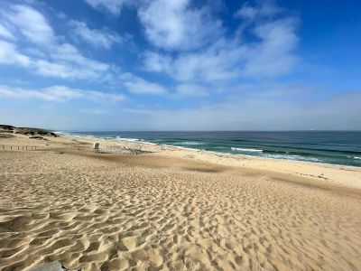
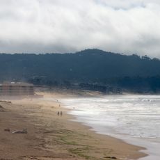
Marina State Beach, Public beach in Marina, United States

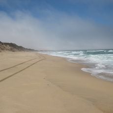
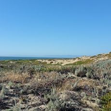
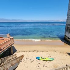
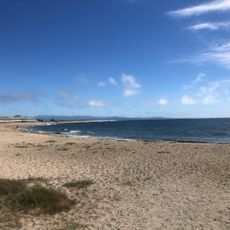
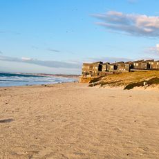
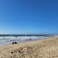
Marina State Beach is a public beach on the Pacific Coast featuring wide sandy areas and tall dunes that line the Monterey Bay shore. The site includes parking areas, restroom facilities, and observation platforms accessible from Highway 1 at Reservation Road.

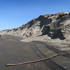
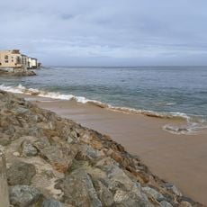
The site was originally part of the Fort Ord military installation before becoming a California State Park in the 1970s. This transformation opened the coastal landscape to public use and preservation.

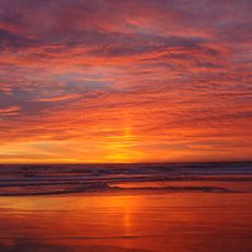
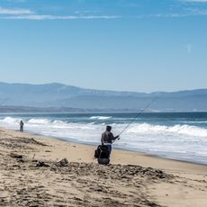
The beach serves as a gathering place where visitors connect with coastal nature and observe how wind and sand shape the daily experience. People come here to experience the open landscape and the natural rhythms of the Pacific.

Strong winds are a constant feature of this beach, and conditions can change throughout the day. Visitors should bring appropriate clothing and protection from the elements.

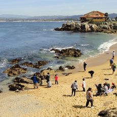
The beach is renowned for its consistent wind patterns that create excellent conditions for hang gliding, with designated launch sites on the southern side. This feature draws adventure seekers from across the region.

The community of curious travelers

AroundUs brings together thousands of curated places, local tips, and hidden gems, enriched daily by 60,000 contributors worldwide.

Start exploring
Location
Address
200 Reservation Rd, Marina, CA 93933, USA
Phone
GPS coordinates
36.69873,-121.80917
Latest update
December 12, 2025 12:01
Around this place
Monterey Bay Aquarium
United States of America

Monterey Bay Aquarium

12.2 km
Fort Ord Dunes State Park
United States of America

Fort Ord Dunes State Park

5.1 km
Pacific Biological Laboratories
United States of America

Pacific Biological Laboratories

12.2 km
Monterey State Beach
United States of America

Monterey State Beach

12.8 km
Marina State Beach
United States of America

Marina State Beach

1.7 km
Moss Landing State Beach
United States of America

Moss Landing State Beach

12.9 km
Salinas River State Beach
United States of America

Salinas River State Beach

9.5 km
Salinas River National Wildlife Refuge
United States of America

Salinas River National Wildlife Refuge

4.8 km
Edward F. Ricketts State Marine Conservation Area
United States of America

Edward F. Ricketts State Marine Conservation Area

12.4 km
Pacific Grove Museum of Natural History
United States of America

Pacific Grove Museum of Natural History

12.9 km
Wharf Theater
United States of America

Wharf Theater

12.8 km
Jose Eusebio Boronda Adobe
United States of America

Jose Eusebio Boronda Adobe

11.7 km
Monterey State Beach
United States of America

Monterey State Beach

11.3 km
Fort Ord Station Veterinary Hospital
United States of America

Fort Ord Station Veterinary Hospital

4.1 km
Castroville Japanese Language School
United States of America

Castroville Japanese Language School

9.1 km
Trimmer Hill
United States of America

Trimmer Hill

12.7 km
Giant artichoke
United States of America

Giant artichoke

8.7 km
Peter J. Bontadelli House
United States of America

Peter J. Bontadelli House

4.3 km
Monterey Lanes
United States of America

Monterey Lanes

12.2 km
Monterey Bay Aquarium
United States of America

Monterey Bay Aquarium

12.2 km
Cannery Row Monument
United States of America

Cannery Row Monument

12.3 km
Aeneas Beach
United States of America

Aeneas Beach

12.5 km
Jetty Beach
United States of America

Jetty Beach

12.5 km
Macabee Beach
United States of America

Macabee Beach

12.3 km
Del Monte Beach
United States of America

Del Monte Beach

11.9 km
Island Beach
United States of America

Island Beach

11.9 km
San Carlos Beach
United States of America

San Carlos Beach

12.6 km
McAbee Beach
United States of America

McAbee Beach

12.3 km
Show the full map
« Marina State Beach - Public beach in Marina, United States » is provided by Around Us (aroundus.com). Images and texts are derived from Wikimedia project under a Creative Commons license. You are allowed to copy, distribute, and modify copies of this page, under the conditions set by the license, as long as this note is clearly visible.

Discover hidden gems everywhere you go!

From secret cafés to breathtaking viewpoints, skip the crowded tourist spots and find places that match your style. Our app makes it easy with voice search, smart filtering, route optimization, and insider tips from travelers worldwide. Download now for the complete mobile experience.

Around Us App Screenshot

A unique approach to discovering new places

Le Figaro

All the places worth exploring

France Info

A tailor-made excursion in just a few clicks

20 Minutes

Around Us
Travel Guide & Maps
Download

Send to your phone

QR Code
1

Open the camera app on your mobile.

2

Point at the QR code with your camera. A notification will appear.

3

Tap the notification to open the link.