Mullaley Park
Location: Mullaley
Location: Gunnedah Shire Council
GPS coordinates: -31.09733,149.90980
Latest update: November 21, 2025 05:35
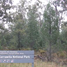
Garrawilla National Park
26.7 km
Gunnedah Rural Museum
33.7 km
Wondoba State Conservation Area
21.7 km
Mullaley Park
1.9 km
Avards Lookout
34.5 km
Scenic viewpoint
35.4 km
Boggabri Golf Course
43.8 km
Sandstone Caves
48 km
Ag-Quip Field Days
30.9 km
Smithurst Theatre
35.3 km
Porcupine Lookout
35.4 km
Yaminba Lookout
47.9 km
Baileys Lookout
29.3 km
Scenic viewpoint
34.6 km
Gunnedah Golf Club
33.8 km
Spring Ridge Golf Course
46.3 km
Scenic viewpoint
35.6 km
Ruvigne Lookout
35.2 km
Scenic viewpoint
35.2 km
Scenic viewpoint
34.1 km
Cave 1
48 km
John Oxley historic marker
4.3 km
Memorial
45.5 km
Gunnedah Cenotaph
35.5 km
Miners Memorial
35.2 km
Monument
35.2 km
Drinking fountain, fountain, memorial
46.1 km
Memorial
40.5 kmReviews
Visited this place? Tap the stars to rate it and share your experience / photos with the community! Try now! You can cancel it anytime.
Discover hidden gems everywhere you go!
From secret cafés to breathtaking viewpoints, skip the crowded tourist spots and find places that match your style. Our app makes it easy with voice search, smart filtering, route optimization, and insider tips from travelers worldwide. Download now for the complete mobile experience.

A unique approach to discovering new places❞
— Le Figaro
All the places worth exploring❞
— France Info
A tailor-made excursion in just a few clicks❞
— 20 Minutes