Picture Frame
Location: Werribee South
Location: Melbourne
GPS coordinates: -37.92968,144.66766
Latest update: October 25, 2025 19:17
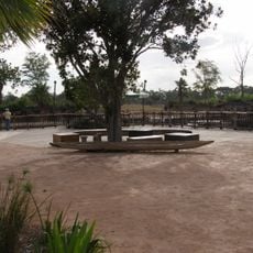
Werribee Open Range Zoo
757 m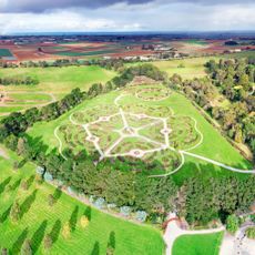
Werribee Park
259 m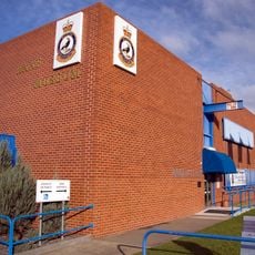
RAAF Museum
7.2 km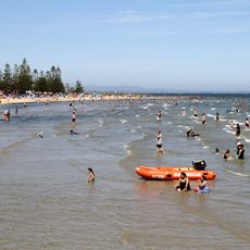
Altona Beach
14.9 km
Chirnside Park
3.1 km
Truganina Explosives Reserve
13.5 km
Scenic viewpoint
12.5 km
Dead end street, scenic viewpoint
3.1 km
Wyndham Art Gallery
3 km
Time Beacon sculpture
12.5 km
Reunion
11.7 km
GROW Art Project Flower
11.7 km
Fire Within Two
14.3 km
Seeds of Change
7 km
Point Cook Homestead
11 km
Scenic viewpoint
9.7 km
Bungies Hole Landing
3.1 km
Werribee Mansion
308 m
Scenic viewpoint
9.6 km
Scenic viewpoint
6 km
Scenic viewpoint
6.8 km
Scenic viewpoint
4 m
Scenic viewpoint
6.4 km
Scenic viewpoint
6.4 km
Scenic viewpoint
5.3 km
Scenic viewpoint
5.4 km
Scenic viewpoint
5.5 km
Scenic viewpoint
6.1 kmReviews
Visited this place? Tap the stars to rate it and share your experience / photos with the community! Try now! You can cancel it anytime.
Discover hidden gems everywhere you go!
From secret cafés to breathtaking viewpoints, skip the crowded tourist spots and find places that match your style. Our app makes it easy with voice search, smart filtering, route optimization, and insider tips from travelers worldwide. Download now for the complete mobile experience.

A unique approach to discovering new places❞
— Le Figaro
All the places worth exploring❞
— France Info
A tailor-made excursion in just a few clicks❞
— 20 Minutes