Max Karten
Location: Homberg/Ruhrort/Baerl
Location: Duisburg
Inception: November 20, 2006
Creator: Gunter Demnig
Made from material: brass
Creator: Gunter Demnig
GPS coordinates: 51.45373,6.71554
Latest update: November 19, 2025 15:11
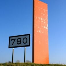
Rhine Orange
675 m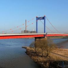
Friedrich-Ebert-Brücke
918 m
Rheinpreußenhafen
511 m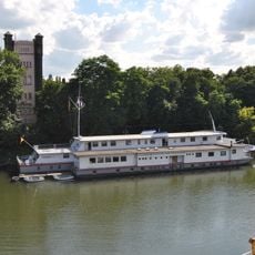
Schulschiff Rhein
235 m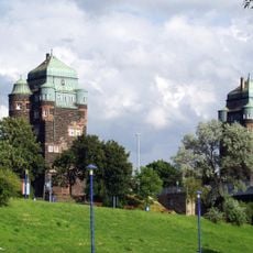
Brückentürme der Friedrich-Ebert-Brücke
971 m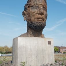
Echo des Poseidon
737 m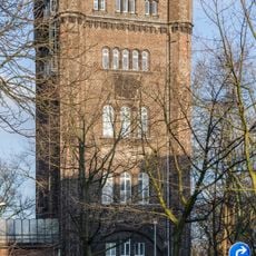
Hebeturm Homberg
211 m
LSG-Ehrenfriedhof, Lutherpark, Hakenfeld, Eisenbahnhafen in Homberg
573 m
Otto Gutmann
0 m
Die Sinnende
512 m
Betty Gutmann
0 m
Julius Coppel
0 m
Gundula Coppel
0 m
Israel Karten
0 m
Flaggenmast Mühlenweide
914 m
Paul Gutmann
0 m
Binnen-Hafen-Tor
874 m
Sankt Nikolaus
953 m
Johanna Gerson
839 m
Karl Gerson
839 m
Paul Coppel
0 m
Der Angler
966 m
Scenic viewpoint
731 m
Mühlenweide
949 m
Pfeilerrest der Admiral Scheer Brücke
457 m
Memorial
619 m
Erinnerung an die Admiral-Scheer-Brücke
380 m
Erinnerung an die Admiral-Scheer-Brücke
193 mReviews
Visited this place? Tap the stars to rate it and share your experience / photos with the community! Try now! You can cancel it anytime.
Discover hidden gems everywhere you go!
From secret cafés to breathtaking viewpoints, skip the crowded tourist spots and find places that match your style. Our app makes it easy with voice search, smart filtering, route optimization, and insider tips from travelers worldwide. Download now for the complete mobile experience.

A unique approach to discovering new places❞
— Le Figaro
All the places worth exploring❞
— France Info
A tailor-made excursion in just a few clicks❞
— 20 Minutes