Enable Location

We need your location to show you interesting places around you

Discover nearby places

Find interesting locations and hidden gems around you

Precise directions

Get accurate directions and distances to places

Your location is never shared with other users. It's only used when you tap the location button.

Captain James Cook

Log in to your account

Start exploring — it's free

Trusted by 68,253 travelers worldwide

Continue with Google
Continue with Apple
or

We will send you a code to connect

By continuing, you accept our Terms and Conditions and our Privacy Policy

Check your inbox

We've sent a pincode in your inbox. Please enter the code below.

Captain James Cook
Discussion Reviews 1 Photos
3 Popularity

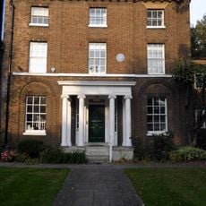
Captain James Cook, Memorial and commemorative plaque in Tower Hamlets borough, United Kingdom.

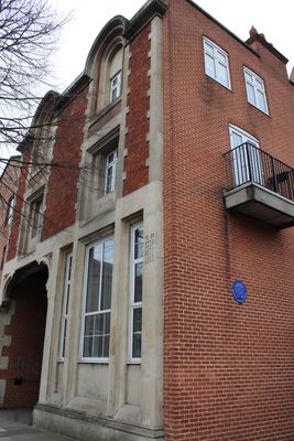
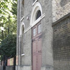
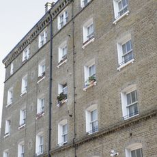
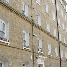
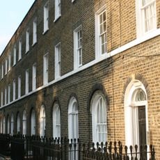
This slate plaque mounted on a brick wall marks the former site of 88 Mile End Road where the renowned British navigator James Cook resided from 1764 until the building's demolition in 1959.

Erected in 1970 by the Greater London Council to commemorate the bicentenary of Cook's landing at Botany Bay, it replaced the original plaque installed in 1907 by the London County Council.

The memorial reflects Cook's enduring impact on European understanding of the Pacific region and his role in expanding global geographical knowledge through his detailed charting work during the 18th century.

Located at coordinates 51.5097658 latitude and -0.0469422 longitude, the site is easily accessible from central London via public transportation and can be visited year-round by those interested in maritime history.

The inscription specifically details his survey of the Saint Lawrence River in 1759 and his navigation along the coasts of New Zealand, Australia, and North America during his three Pacific voyages.

The community of curious travelers

AroundUs brings together thousands of curated places, local tips, and hidden gems, enriched daily by 60,000 contributors worldwide.

Start exploring
Address
Lion Court, 435 The Hwy, London E1W 3HT, UK
GPS coordinates
51.50977,-0.04694
Latest update
September 8, 2025 12:36
Around this place
Prospect of Whitby
United Kingdom

Prospect of Whitby

416 m
Troxy
United Kingdom

Troxy

391 m
Royal Foundation of St Katharine
United Kingdom

Royal Foundation of St Katharine

397 m
St Paul's Church, Shadwell
United Kingdom

St Paul's Church, Shadwell

387 m
King Edward Memorial Park
United Kingdom

King Edward Memorial Park

166 m
Church of St Mary
United Kingdom

Church of St Mary

309 m
Iron Railings, Wall And Iron Gates Of St Paul's Church
United Kingdom

Iron Railings, Wall And Iron Gates Of St Paul's Church

373 m
St Paul's Church Church House
United Kingdom

St Paul's Church Church House

400 m
Shadwell Portal To The Rotherhithe Tunnel
United Kingdom

Shadwell Portal To The Rotherhithe Tunnel

367 m
5-22 Havering Street and area railings
United Kingdom

5-22 Havering Street and area railings

307 m
Limehouse War Memorial
United Kingdom

Limehouse War Memorial

397 m
East Block With Attached Railings And Gatepiers Peabody Estate
United Kingdom

East Block With Attached Railings And Gatepiers Peabody Estate

121 m
17-28, Albert Gardens and area railings
United Kingdom

17-28, Albert Gardens and area railings

279 m
South Block With Attached Railings And Gatepiers Peabody Estate
United Kingdom

South Block With Attached Railings And Gatepiers Peabody Estate

142 m
1-16, Albert Gardens and area railings
United Kingdom

1-16, Albert Gardens and area railings

295 m
West Block With Attached Railings And Gatepiers Peabody Estate
United Kingdom

West Block With Attached Railings And Gatepiers Peabody Estate

180 m
Drinking Fountain, Arbour Square
United Kingdom

Drinking Fountain, Arbour Square

374 m
440-450, Commercial Road E1
United Kingdom

440-450, Commercial Road E1

368 m
Air Shaft To The Rotherhithe Tunnel
United Kingdom

Air Shaft To The Rotherhithe Tunnel

172 m
Ratcliffe Cross Stairs
United Kingdom

Ratcliffe Cross Stairs

375 m
North Block With Attached Railings And Gatepiers Peabody Estate
United Kingdom

North Block With Attached Railings And Gatepiers Peabody Estate

156 m
Free Trade Wharf
United Kingdom

Free Trade Wharf

149 m
Flagged Passage (Approaching Stone Stairs From The Highway)
United Kingdom

Flagged Passage (Approaching Stone Stairs From The Highway)

206 m
Stone Stairs
United Kingdom

Stone Stairs

208 m
Glamis Road Bridge
United Kingdom

Glamis Road Bridge

320 m
2 Butcher Row
United Kingdom

2 Butcher Row

398 m
29-39, Albert Gardens and area railings
United Kingdom

29-39, Albert Gardens and area railings

320 m
27-45, Havering Street and area railings
United Kingdom

27-45, Havering Street and area railings

336 m
Show the full map
Reviews
Share your experience

No review yet

Discussions
Start a discussion...

No discussion yet

« Captain James Cook - Memorial and commemorative plaque in Tower Hamlets borough, United Kingdom » is provided by Around Us (aroundus.com). Images and texts are derived from Wikimedia project under a Creative Commons license. You are allowed to copy, distribute, and modify copies of this page, under the conditions set by the license, as long as this note is clearly visible.

Discover hidden gems everywhere you go!

From secret cafés to breathtaking viewpoints, skip the crowded tourist spots and find places that match your style. Our app makes it easy with voice search, smart filtering, route optimization, and insider tips from travelers worldwide. Download now for the complete mobile experience.

Around Us App Screenshot

A unique approach to discovering new places

Le Figaro

All the places worth exploring

France Info

A tailor-made excursion in just a few clicks

20 Minutes

Around Us
Travel Guide & Maps
Download

Send to your phone

QR Code
1

Open the camera app on your mobile.

2

Point at the QR code with your camera. A notification will appear.

3

Tap the notification to open the link.