Enable Location

We need your location to show you interesting places around you

Discover nearby places

Find interesting locations and hidden gems around you

Precise directions

Get accurate directions and distances to places

Your location is never shared with other users. It's only used when you tap the location button.

Fort-Royer

Log in to your account

Start exploring — it's free

Trusted by 62,530 travelers worldwide

Continue with Google
Continue with Apple
or

We will send you a code to connect

By continuing, you accept our Terms and Conditions and our Privacy Policy

Check your inbox

We've sent a pincode in your inbox. Please enter the code below.

Fort-Royer

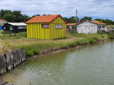
Fort-Royer, Oyster farming site in Saint-Pierre-d'Oléron, France.

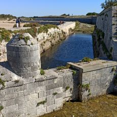
Fort-Royer is an oyster farming site on Oléron Island where cultivation channels and ponds were dug into mudflats starting in the 1920s. The location is sheltered by a natural dune barrier that helps protect the shallow basins used for raising oysters.

Oyster farmers first developed this site systematically in the 1920s by hand-digging basins in the mudflats. This growth reflected a broader shift toward organized oyster production along the French Atlantic coast.

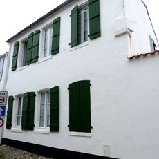
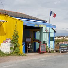
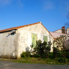
The colorful oyster huts here come from a time when farmers used leftover boat paint to decorate them. This practice shows the creativity and resourcefulness of local oyster growers who made their workspaces their own.

The site offers tours and walks that show how oyster farming works in practice. Visitors should wear sturdy shoes since the ground can be muddy and uneven.

A rare 1907 film documents the oyster farming methods used here in the early days of the site. This footage shows how the work looked before modern equipment was introduced.

The community of curious travelers

AroundUs brings together thousands of curated places, local tips, and hidden gems, enriched daily by 60,000 contributors worldwide.

Start exploring
Address
17310 Saint-Pierre-d'Oléron, France
Opening Hours
Monday-Friday 09:00-19:00
Phone
GPS coordinates
45.95945,-1.24333
Latest update
December 6, 2025 19:00
What to see on Oléron Island: tourist sites, historical monuments, and beaches to visit

Oléron Island, the largest island in mainland France after Corsica, features a military, maritime, and natural heritage reflecting its strategic position facing the Atlantic Ocean. This Charente island, connected to the mainland since 1966 by a nearly three-kilometer-long bridge, houses...

« Fort-Royer - Oyster farming site in Saint-Pierre-d'Oléron, France » is provided by Around Us (aroundus.com). Images and texts are derived from Wikimedia project under a Creative Commons license. You are allowed to copy, distribute, and modify copies of this page, under the conditions set by the license, as long as this note is clearly visible.

Discover hidden gems everywhere you go!

From secret cafés to breathtaking viewpoints, skip the crowded tourist spots and find places that match your style. Our app makes it easy with voice search, smart filtering, route optimization, and insider tips from travelers worldwide. Download now for the complete mobile experience.

Around Us App Screenshot

A unique approach to discovering new places

Le Figaro

All the places worth exploring

France Info

A tailor-made excursion in just a few clicks

20 Minutes

Around Us
Travel Guide & Maps
Download

Send to your phone

QR Code
1

Open the camera app on your mobile.

2

Point at the QR code with your camera. A notification will appear.

3

Tap the notification to open the link.