
Tara bridge
Location: Opština Pljevlja
Website: https://photos.app.goo.gl/AwAjW4ZEKXwbxwZTA
Website: https://photos.app.goo.gl/AwAjW4ZEKXwbxwZTA
GPS coordinates: 43.14965,19.29401
Latest update: November 16, 2025 22:59
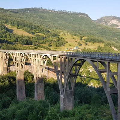
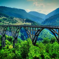
Đurđevića Tara Bridge
132 m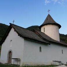
Dovolja Monastery
7.1 km
Pirlitor
5.1 km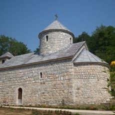
Đurđevića Tara Monastery
1 km
Grčko groblje
13.3 km
Bare Žugića
11.7 km
Radonjica (langub)
3 km
Vidakova Lastva
12.8 km
Shelter, scenic viewpoint, picnic shelter
2.1 km
Sky Line
225 m
Tara Zipline
660 m
Раткова пещера
12.6 km
Trail to Ratkovo cave
12.7 km
Scenic viewpoint
173 m
Longest zip line on Tara bridge
1 km
Red rock zipline
224 m
Tara bridge
136 m
Extreme Zipline Tara
447 m
Scenic viewpoint
1.5 km
Pirlitor
5.2 km
Panorama on the bridge and the canyon
641 m
Scenic viewpoint
2.7 km
Scenic viewpoint
11 km
Premćanski Most
6.8 km
Scenic viewpoint
3.6 km
Scenic viewpoint
1.8 km
Scenic viewpoint
1 km
Scenic viewpoint
2.1 kmReviews
Visited this place? Tap the stars to rate it and share your experience / photos with the community! Try now! You can cancel it anytime.
Discover hidden gems everywhere you go!
From secret cafés to breathtaking viewpoints, skip the crowded tourist spots and find places that match your style. Our app makes it easy with voice search, smart filtering, route optimization, and insider tips from travelers worldwide. Download now for the complete mobile experience.

A unique approach to discovering new places❞
— Le Figaro
All the places worth exploring❞
— France Info
A tailor-made excursion in just a few clicks❞
— 20 Minutes