
Five Ponds Wilderness Area
3.2 km
Stillwater Reservoir
17.8 km
William C. Whitney Wilderness Area
22.3 km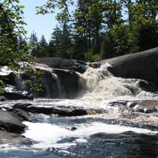
High Falls on the Oswegatchie River
33 m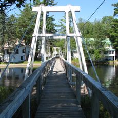
Wanakena Footbridge
7.2 km
Pepperbox Wilderness Area
18.8 km
Blatchley House
18.5 km
Round Lake Wilderness Area
26 km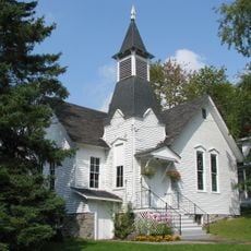
Wanakena Presbyterian Church
7.5 km
Moshier Reservoir
24.3 km
Taylorville Reservoir
15.4 km
Brown's Falls Reservoir
10.3 km
Newton Falls Reservoir
26.9 km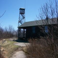
Horseshoe Lake Wild Forest
26.5 km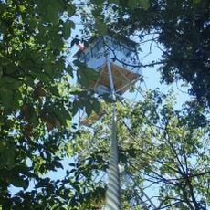
Stillwater Mountain Fire Observation Station
25.1 km
Brumagin Rapids
24.5 km
Long Rapids
24 km
Deerlick Rapids
24.2 km
Cranberry Lake Day Use Area on eastern Fred Island
10.9 km
Cranberry Lake Campground
15.5 km
Cathedral Rock Fire Tower
9.5 km
Scenic viewpoint
9.4 km
Bear Mountain Lookout
15.5 km
Scenic viewpoint
12.7 km
Scenic viewpoint
9.9 km
Copper Rock Falls
24.8 km
Copper Rock Falls
24.7 km
Waterfall
9.5 kmReviews
Visited this place? Tap the stars to rate it and share your experience / photos with the community! Try now! You can cancel it anytime.
Discover hidden gems everywhere you go!
From secret cafés to breathtaking viewpoints, skip the crowded tourist spots and find places that match your style. Our app makes it easy with voice search, smart filtering, route optimization, and insider tips from travelers worldwide. Download now for the complete mobile experience.

A unique approach to discovering new places❞
— Le Figaro
All the places worth exploring❞
— France Info
A tailor-made excursion in just a few clicks❞
— 20 Minutes