Log in to your account

AroundUs is a community-driven map of interesting places, built by curious explorers like you. It grows with every review, story, and photo you share.
Connect to save your favorite spots, contribute locations, and create personalized routes.
Continue with Google
Continue with Apple
Continue with X
Continue with Facebook
Continue with email
By continuing, you accept our Terms and Conditions and our Privacy Policy
Create an account

William C. Whitney Wilderness Area

Add to collection
Map
Suggest a change
Share

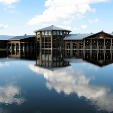
William C. Whitney Wilderness Area, Protected forest area in Long Lake, New York.

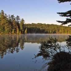
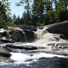
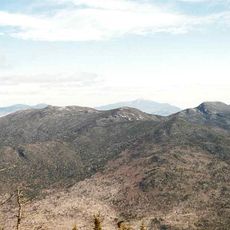
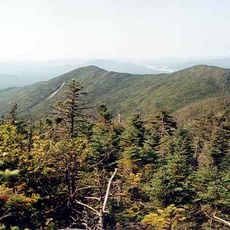
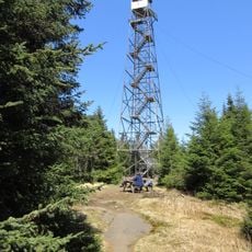
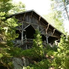
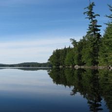
The William C. Whitney Wilderness Area is a protected forest in the Adirondacks containing four major lakes, including Lake Lila and Little Tupper Lake, connected by streams. Primitive camping sites and hiking trails weave through the landscape, offering visitors multiple ways to explore the terrain.

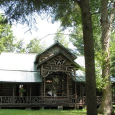
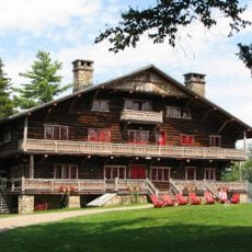
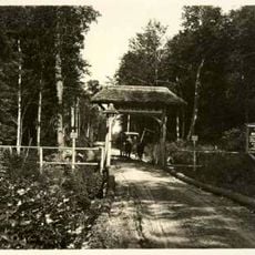
William Collins Whitney established a private park spanning 68,000 acres in 1897, creating an exclusive retreat in the Adirondack region. New York State acquired a significant portion of this land in 1997 and designated it as public wilderness to preserve its natural condition.

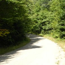
The area is named after William Collins Whitney, who shaped the landscape as a private retreat, and visitors can experience the natural character through sandy beaches and dense forests. Walking or paddling through these undeveloped shores reveals how the Adirondack forest has been allowed to remain largely untouched by development.

The area provides 60 primitive camping sites and 13.5 miles of trails suitable for different experience levels. Visitors must bring their own non-motorized boats or enter the water at designated launch points, as the wilderness is intentionally underdeveloped.

Lake Lila is the largest publicly owned lake in the entire Adirondack region, spanning 1,400 acres within this wilderness. Its size makes it unusual since many Adirondack waters have long remained private or restricted to certain users.

Location: New York

GPS coordinates: 44.00130,-74.64790

Latest update: December 12, 2025 14:25

Photos
Around this place
Adirondack Park
United States of America

Adirondack Park

25.2 km
Camp Pine Knot
United States of America

Camp Pine Knot

20.1 km
Five Ponds Wilderness Area
United States of America

Five Ponds Wilderness Area

23.3 km
Great Camp Sagamore
United States of America

Great Camp Sagamore

26.3 km
Camp Uncas
United States of America

Camp Uncas

28.7 km
Wild Center
United States of America

Wild Center

29.5 km
Moose River Plains Wild Forest
United States of America

Moose River Plains Wild Forest

30.6 km
Adirondack Museum
United States of America

Adirondack Museum

22.6 km
Echo Camp
United States of America

Echo Camp

19.8 km
Covewood Lodge
United States of America

Covewood Lodge

26.3 km
High Falls on the Oswegatchie River
United States of America

High Falls on the Oswegatchie River

22.3 km
Mount Emmons
United States of America

Mount Emmons

38.1 km
Adirondack Park Agency visitor interpretive centers
United States of America

Adirondack Park Agency visitor interpretive centers

38.5 km
Beth Joseph Synagogue
United States of America

Beth Joseph Synagogue

28.8 km
Donaldson Mountain
United States of America

Donaldson Mountain

38.8 km
New York Central Railroad Adirondack Division Historic District
United States of America

New York Central Railroad Adirondack Division Historic District

20.4 km
Blue Mountain Fire Observation Station
United States of America

Blue Mountain Fire Observation Station

24.4 km
The Hedges
United States of America

The Hedges

22.8 km
Arab Mountain Fire Observation Station
United States of America

Arab Mountain Fire Observation Station

23.1 km
Wanakena Footbridge
United States of America

Wanakena Footbridge

26.4 km
George and John R. Hunt Memorial Building
United States of America

George and John R. Hunt Memorial Building

25 km
Wakely Mountain Fire Observation Station
United States of America

Wakely Mountain Fire Observation Station

31.4 km
Camp Eagle Island
United States of America

Camp Eagle Island

39.5 km
Church of the Transfiguration
United States of America

Church of the Transfiguration

23.4 km
Round Lake Wilderness Area
United States of America

Round Lake Wilderness Area

9.2 km
Wanakena Presbyterian Church
United States of America

Wanakena Presbyterian Church

26.5 km
Blue Mountain Wild Forest
United States of America

Blue Mountain Wild Forest

31.3 km
Owls Head Mountain Forest Fire Observation Station
United States of America

Owls Head Mountain Forest Fire Observation Station

13.5 km
Show the full map
Reviews

Visited this place? Tap the stars to rate it and share your experience / photos with the community! Try now! You can cancel it anytime.

« William C. Whitney Wilderness Area - Protected forest area in Long Lake, New York » is provided by Around Us (aroundus.com). Images and texts are derived from Wikimedia project under a Creative Commons license. You are allowed to copy, distribute, and modify copies of this page, under the conditions set by the license, as long as this note is clearly visible.

Discover hidden gems everywhere you go!

From secret cafés to breathtaking viewpoints, skip the crowded tourist spots and find places that match your style. Our app makes it easy with voice search, smart filtering, route optimization, and insider tips from travelers worldwide. Download now for the complete mobile experience.

Around Us App Screenshot

A unique approach to discovering new places

Le Figaro

All the places worth exploring

France Info

A tailor-made excursion in just a few clicks

20 Minutes