Ditchling Beacon
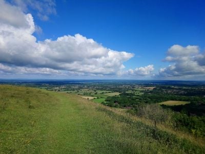
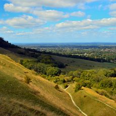
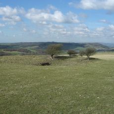
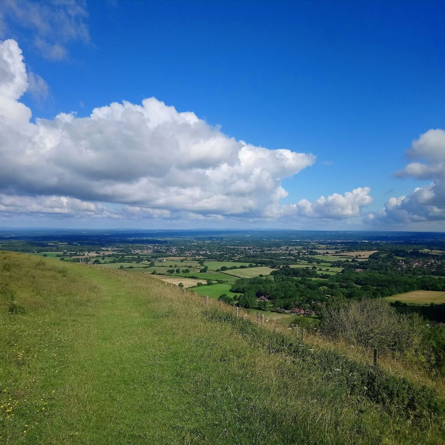
Ditchling Beacon is the highest point in East Sussex and a scenic viewpoint on the South Downs. It offers wide views over the landscape with fields, rolling hills, and distant villages, while chalk grassland and open terrain form the surrounding area.
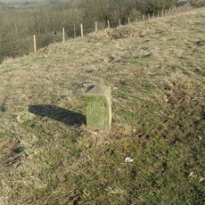
The site once served as a beacon station where fire signals were used to send warnings across long distances. Remains of an Iron Age hillfort lie nearby, showing that people have used this elevated spot for defense and observation for thousands of years.
The name comes from warning fires that once burned here to alert distant communities in times of danger. Today, visitors gather at this spot to connect with the open landscape and experience the quiet that the place offers to those seeking a break from everyday life.
The location is easily reached by car and has a simple car park that can fill quickly on busy days. Visitors should wear comfortable walking shoes and prepare for exposed weather, as the summit is open and wind is often present.
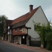
Nearby stand two 19th-century windmills, Jill and Jack, that recall the region's grain-milling past. Jack is the only surviving male mill in England and is now used as a private home for occasional events and filming.
Location: Lewes
Address: Ditchling Beacon, Brighton BN6 8RJ, UK
GPS coordinates: 50.90120,-0.10528
Latest update: January 8, 2026 15:52
Sussex extends along the south coast of England, between London and the Channel. This area has different types of scenery: white chalk cliffs that rise above the sea, gentle hills of the South Downs, old forests, and valleys with quiet rivers. There are seaside towns such as Brighton and Eastbourne,...
Clayton to Offham Escarpment
1.9 km
The Parish Church of St Martin
839 m
Hillfort, a beacon and dewpond on Ditchling Beacon
184 mEarthwork near Horseshoe Plantation, Stamer
2 km
Round barrows W of Ditchling Beacon
2 kmMiddleton Manor
1.6 kmEast End House
2.2 kmMiddle Brow earthwork
854 mThree bowl barrows 820m south east of Westmeston Farm, forming part of Western Brow round barrow cemetery
1.2 kmBowl barrow on Streat Hill 430m NNW of Streathill Farm, forming part of Western Brow round barrow cemetery
1.5 kmAnglo-Saxon barrow field 650m south west of Wick Farm
988 mBowl barrow 780m south east of Westmeston Farm, forming part of Western Brow round barrow cemetery
1 kmFaulkner's Bottom entrenchment
2 kmTwo bowl barrows north-east of Streathill Farm
2.1 kmHlaew 430m ENE of Keymer Post
1.4 kmRound barrow S of Ditchling Beacon
622 mBowl barrow 750m south east of Westmeston Farm, forming part of Western Brow round barrow cemetery
962 mPart of Western Brow round barrow cemetery and an Anglo-Saxon barrow field 700m south of Westmeston Farm
644 mPair of bowl barrows 720m SSE of Westmeston Farm forming part of Western Brow round barrow cemetery
712 mThree bowl barrows 750m south east of Westmeston Farm, forming part of Western Brow round barrow cemetery
925 mBowl barrow on Streat Hill 400m NNW of Streathill Farm, forming part of Western Brow round barrow cemetery
1.6 kmThree bowl barrows 770m south east of Westmeston Farm, forming part of Western Brow round barrow cemetery
1 kmApril Cottage Culpepper
911 mThe Old Rectory
943 mWestmeston Place
1.1 kmBarn To The South West Of Westmeston Place
1.1 kmThe Gote
1.5 kmHillway Cottage Including Walls, Steps And Terraces Hillway House Including Walls, Steps And Terraces
2 kmVisited this place? Tap the stars to rate it and share your experience / photos with the community! Try now! You can cancel it anytime.
Discover hidden gems everywhere you go!
From secret cafés to breathtaking viewpoints, skip the crowded tourist spots and find places that match your style. Our app makes it easy with voice search, smart filtering, route optimization, and insider tips from travelers worldwide. Download now for the complete mobile experience.
A unique approach to discovering new places❞
— Le Figaro
All the places worth exploring❞
— France Info
A tailor-made excursion in just a few clicks❞
— 20 Minutes