Hole of Horcum

Log in to your account

AroundUs is a community-driven map of interesting places, built by curious explorers like you. It grows with every review, story, and photo you share.
Connect to save your favorite spots, contribute locations, and create personalized routes.
Continue with Google
Continue with Apple
Continue with X
Continue with Facebook
Continue with email
By continuing, you accept our Terms and Conditions and our Privacy Policy
Create an account

Hole of Horcum

Add to collection
Map
Suggest a change
Share

Hole of Horcum

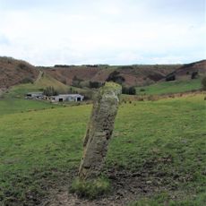
The Hole of Horcum is a large, bowl-shaped hollow carved into the North York Moors landscape. The formation stretches about 1.2 kilometers across and drops roughly 120 meters deep, with steep sides surrounding a wide, flat floor.

The hollow formed thousands of years ago when water from underground springs slowly wore away the soft rock underneath. The land collapsed over time, creating the depression you see today through natural erosion.

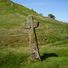
The name comes from old English words: 'horh' meaning filth and 'cumb' meaning bowl-shaped valley. The area has been home to people for thousands of years, as shown by archaeological finds of burial sites and earthworks.

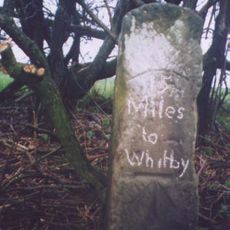
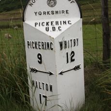
Park at the Saltergate car park at the North York Moors National Park and follow a paved trail downhill into the hollow. The well-maintained path guides you through the area, and a full walk of the site covers roughly 8 kilometers.

Local folklore tells of a giant named Wade who created the hollow during a fight with his wife Bell, flinging a handful of earth at her in anger. According to the legend, the nearby hill Blakey Topping was formed from the earth he threw.

Address: Hole of Horcum, Pickering YO18 7NW, UK

GPS coordinates: 54.32896,-0.70493

Latest update: January 9, 2026 09:54

Photos
Yorkshire and the Humber : historic towns, national parks and northern coasts of England

Yorkshire and the Humber brings together different sides of northern England. York shows its medieval walls, narrow streets with timber houses, and a gothic cathedral. Leeds and Sheffield show their past as centers of industry, with old factories turned into museums and new neighborhoods. Hull,...

Around this place
Blakey Topping standing stones
United Kingdom

Blakey Topping standing stones

2.9 km
North York Moors National Park
United Kingdom

North York Moors National Park

3 km
United Kingdom

Head Road round cairn

2.3 km
United Kingdom

Three medieval pillow mounds 900m north of Grove House

2.7 km
United Kingdom

Cross ridge dyke known as Gallows Dike and three round barrows 330m south west of Glebe Farm

903 m
United Kingdom

Round barrow 660m south west of Glebe Farm

723 m
United Kingdom

Cross dyke on Saltergate Brow, 750m south east of Barr Farm

1.8 km
Malo Cross
United Kingdom

Malo Cross

2.8 km
United Kingdom

Manor Farmhouse

2.9 km
Milestone, ½ mile N of Lockton  at SE84999060
United Kingdom

Milestone, ½ mile N of Lockton at SE84999060

2.9 km
United Kingdom

Round barrow 780m north of Grove House

2.8 km
United Kingdom

Cairnfield and field systems on Saltergate Moor, immediately north of Nab Farm

3 km
Milestone, carved stone post, near entrance to Barr Farm
United Kingdom

Milestone, carved stone post, near entrance to Barr Farm

2 km
Milestone, ½ mile N of Lockton  at SE84499060
United Kingdom

Milestone, ½ mile N of Lockton at SE84499060

2.8 km
Milestone, cast iron post, near entrance to Barr Farm
United Kingdom

Milestone, cast iron post, near entrance to Barr Farm

2 km
United Kingdom

Three round barrows 130m north west of Seavy Pond

1.1 km
United Kingdom

Prehistoric dyke known as Horcum Dike

649 m
United Kingdom

Kidsty

1.8 km
United Kingdom

Skelton's Tower

2.4 km
United Kingdom

East Toft Dike: a cross dyke 720m south and 680m south west of Little Marfit Head

1.4 km
United Kingdom

Field system and cairnfield on Lockton High Moor, 1km NNE of Needle Point

2.9 km
United Kingdom

Extensive prehistoric and medieval remains on Levisham Moor

1.6 km
United Kingdom

Round barrow 400m north of Levisham Hall

2.8 km
United Kingdom

Needle Point

2 km
United Kingdom

Scenic viewpoint

2.6 km
United Kingdom

Waterfall

1.5 km
United Kingdom

Waterfall

1.4 km
United Kingdom

Lime Kiln

2.7 km
Show the full map
Reviews

Visited this place? Tap the stars to rate it and share your experience / photos with the community! Try now! You can cancel it anytime.

« Hole of Horcum » is provided by Around Us (aroundus.com). Images and texts are derived from Wikimedia project under a Creative Commons license. You are allowed to copy, distribute, and modify copies of this page, under the conditions set by the license, as long as this note is clearly visible.

Discover hidden gems everywhere you go!

From secret cafés to breathtaking viewpoints, skip the crowded tourist spots and find places that match your style. Our app makes it easy with voice search, smart filtering, route optimization, and insider tips from travelers worldwide. Download now for the complete mobile experience.

Around Us App Screenshot

A unique approach to discovering new places

Le Figaro

All the places worth exploring

France Info

A tailor-made excursion in just a few clicks

20 Minutes