Blakey Topping standing stones
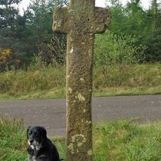
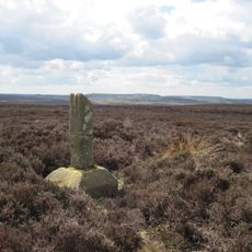
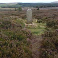
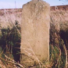
Blakey Topping standing stones, Stone row at Blakey Topping, North Yorkshire, England.
Description
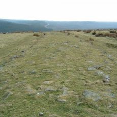
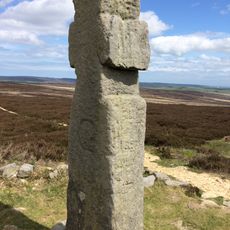
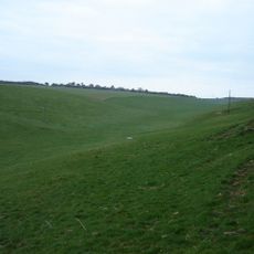
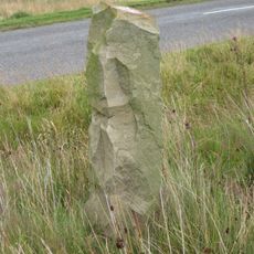
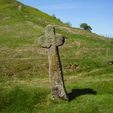
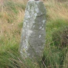
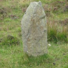
Blakey Topping standing stones is an arrangement of four surviving stones positioned on elevated moorland in North Yorkshire. The stones form a linear pattern across the open landscape, with the western group containing the taller examples.
History
The stones were raised during prehistoric times and belong to a family of monuments scattered across Britain. The site received protected monument status in 1968, recognizing its archaeological significance.
Culture
The stones sit on elevated ground and mark a location that held meaning for early people. They may have served as a gathering point where communities came together for shared purposes.
Practical
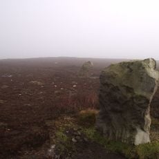
The site is reached across moorland paths and requires sturdy footwear and readiness for changeable weather. The open landscape offers little shelter, so checking conditions before visiting and allowing daylight hours are important considerations.
Did you know?
One of the original stones was moved roughly 85 meters from its intended location, likely through farming activity over the centuries. Another stone has been incorporated into a field boundary, making it difficult to distinguish from the surrounding landscape.
AroundUs brings together thousands of curated places, local tips, and hidden gems, enriched daily by 60,000 contributors worldwide. Discover all places nearby (Allerston).
RAF Fylingdales
3.7 km
Wade's Causeway
7.9 km
Lilla Cross
5.6 km
Simon Howe
6.3 km
Church of St Mary
5.2 km
St. Peter's Church
7.2 km
Church of Saint Giles
4.4 km
Milestone, carved stone post, S of Lockton nearly opp blue sign 'Severe Gradients'
5.1 km
North York Moors National Park
5.8 km
Milestone, cast iron post, S of Lockton nearly opp blue sign 'Severe Gradients'
5.1 km
Scamridge Dikes: prehistoric linear boundaries and associated features
8.1 km
Stones
7.8 km
Mauley Cross in Cropton Forest 580m north of Hill Top Farm
7.6 km
Black Howe round barrow
7 km
K6 Telephone Kiosk
7.1 km
Ann's Cross
6.8 km
Malo Cross
1.6 km
Waymarker
8.1 km
Station House
5.9 km
Stones
7.5 km
Bridge Farmhouse And Attached Barn
7.4 km
The Moorcock Inn And Attached Outbuildings
7 km
York Cross wayside cross, 700m north east of Foster Howes on Sneaton High Moor
8.2 km
Milestone, just S of entrance to Fylingdales Early Warning Station
3.7 km
Milestone, ½ mile N of Lockton at SE84999060
3.5 km
Milestone, ½ mile N of Lockton at SE84499060
3.9 km
Milestone, carved stone post, near entrance to Barr Farm
2.5 km
Milestone, cast iron post, near entrance to Barr Farm
2.5 kmDiscover hidden gems everywhere you go!
From secret cafés to breathtaking viewpoints, skip the crowded tourist spots and find places that match your style. Our app makes it easy with voice search, smart filtering, route optimization, and insider tips from travelers worldwide. Download now for the complete mobile experience.
A unique approach to discovering new places❞
— Le Figaro
All the places worth exploring❞
— France Info
A tailor-made excursion in just a few clicks❞
— 20 Minutes