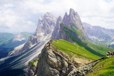
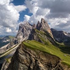
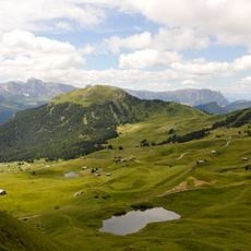
Seceda Ridgeline

Log in to your account

AroundUs is a community-driven map of interesting places, built by curious explorers like you. It grows with every review, story, and photo you share.
Connect to save your favorite spots, contribute locations, and create personalized routes.
Continue with Google
Continue with Apple
Continue with X
Continue with Facebook
Continue with email
By continuing, you accept our Terms and Conditions and our Privacy Policy
Create an account

Seceda Ridgeline

Add to collection
Map
Suggest a change
Share

Seceda Ridgeline

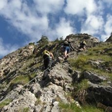
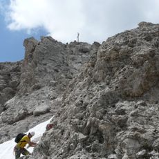
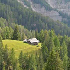
Seceda Ridgeline is a mountain ridge in the Geisler group within Puez-Odle Natural Park in northern Val Gardena, South Tyrol, marked by sharp peaks and green meadows. The ridge extends along marked trails of varying difficulty and features mountain huts distributed along the path that serve as rest points and dining stops.

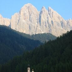
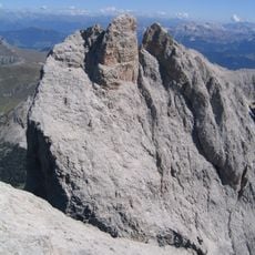
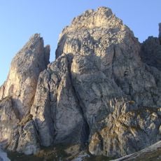
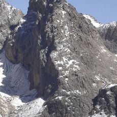
The Church of St. Jakob near Seceda was first documented in 1283 and has stood for nearly a thousand years. The rocks themselves are millions of years old and have been shaped by wind and rain erosion over time, resulting in the distinctive sharp peaks and layered formations visible today.

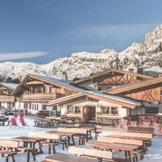
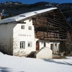
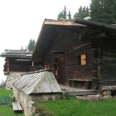
The area around Seceda maintains traditional mountain culture through its huts and village structures, where visitors can taste local cheeses, bread, and Tyrolean dishes. Craft traditions appear in wood carvings and art installations like the WOOOW sculpture made from spruce trunks, reflecting how people connect with this mountain.

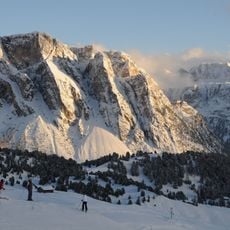
The easiest way is by taking the gondola and cable car from Ortisei, which takes about 15 to 20 minutes. Alternatively, you can use the chairlift from Col Raiser near Selva village or hike from Santa Cristina. It is recommended to arrive around 9 in the morning to avoid crowds and enjoy better light for photography.

The rocks contain fossils and coral remnants that hint at a distant ocean past. These remains tell the story of an ancient sea that once covered the area before mountain-building reshaped the landscape into the peaks you see today.

Address: 39040 Villnöß, Autonomous Province of Bolzano – South Tyrol, Italy

GPS coordinates: 46.60158,11.73418

Latest update: January 13, 2026 16:28

Photos
Trentino-Alto Adige, tourism in Italy: historic towns, mountain lakes and Dolomites

South Tyrol and Trentino stretch between the Alps and the Dolomites, in a place where Italy meets Central Europe. There are towns like Trento and Bolzano, where Renaissance squares sit beside Christmas markets. Merano has hot springs and gardens. The lakes of Garda, Molveno, and Braies reflect the...

Reviews

Visited this place? Tap the stars to rate it and share your experience / photos with the community! Try now! You can cancel it anytime.

« Seceda Ridgeline » is provided by Around Us (aroundus.com). Images and texts are derived from Wikimedia project under a Creative Commons license. You are allowed to copy, distribute, and modify copies of this page, under the conditions set by the license, as long as this note is clearly visible.

Discover hidden gems everywhere you go!

From secret cafés to breathtaking viewpoints, skip the crowded tourist spots and find places that match your style. Our app makes it easy with voice search, smart filtering, route optimization, and insider tips from travelers worldwide. Download now for the complete mobile experience.

Around Us App Screenshot

A unique approach to discovering new places

Le Figaro

All the places worth exploring

France Info

A tailor-made excursion in just a few clicks

20 Minutes