Tauplitzalm Plateauweg
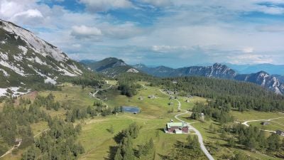
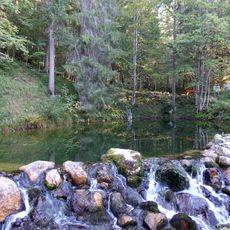
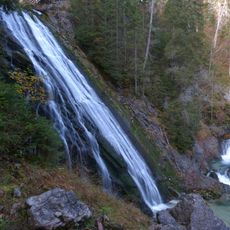
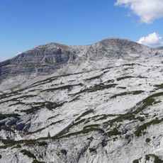
The Tauplitzalm Plateauweg is a mountain trail in the Salzkammergut that begins in Bad Mitterndorf and spans about 16 kilometers to reach a high plateau at 1600 to 2000 meters elevation. The route combines forest paths, mountain trails, and wide gravel roads that pass through alpine meadows and several mountain lakes, including the Steirersee and Schwarzensee.
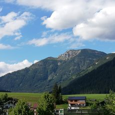
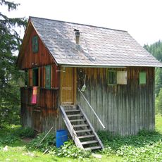
The path long served as a connection between valley settlements and mountain pastures, used by herders and farmers to reach the alpine meadows. The route has retained its rural character and reflects the historically developed infrastructure of the Alpine region.
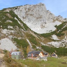
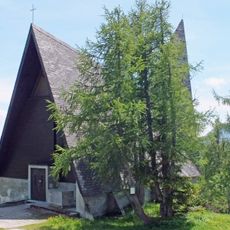
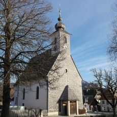
The name Tauplitzalm refers to the alpine pasture tradition that has shaped this region for generations. Visitors today encounter small wooden huts and farms that reflect how mountain communities have worked the land and adapted to life at high elevation.
The best time to hike is from June to October when weather is stable and all paths are open. Wear good walking shoes, bring layers to handle sudden weather changes, and park at the Grimminghalle parking area in Bad Mitterndorf to start your walk.
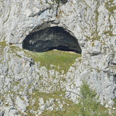
This area holds the largest lake plateau in central Europe with six mountain lakes clustered close together. The most popular route connects all six lakes and showcases the rare concentration of water bodies at such a high elevation.
Location: Bad Mitterndorf
Address: 8982 Bad Mitterndorf, Austria
Opening Hours: Monday-Thursday 09:00-16:30; Friday 08:30-20:00; Saturday-Sunday 09:00-16:30
Phone: +4336882252
Website: http://dietauplitz.com
GPS coordinates: 47.59572,13.99403
Latest update: January 22, 2026 11:34
Styria: Graz, mountain ranges, castles and vineyards. In Graz, the old center is easy to walk through. You see narrow streets, the church of Saint Aegidius and the Eggenberg Palace. The Palace is old and has gardens. On the hill called Schlossberg, the clock tower gives a view over the rooftops. The...
Dachstein Formation
654 m
Traweng
1.8 km
Lawinenstein
3 km
Kath. Filialkirche Hl. Dreifaltigkeit Tauplitz
461 m
Käferloch
1 km
Sagtümpel
3.1 kmDÖF sun-wire system of caves
3 km
Pfarrkirche zum Heiligen Kreuz, Tauplitz
4.2 km
Tauplitzer Wasserfall
3.4 km
In den Karen
3.4 km
Lopernalm
1.9 km
Aufbahrungshalle
4.1 kmScenic viewpoint
3.3 kmWayside cross
1.9 kmMühle
3.9 kmScenic viewpoint
1 kmScenic viewpoint
1.9 kmScenic viewpoint
1.1 kmWayside shrine
3.1 kmScenic viewpoint
3.4 kmWayside cross
1.9 kmJungbauerkreuz
3.5 kmWayside cross
2.7 kmDietmar Canaris
1.6 kmGrete Hierzegger
3.4 kmWayside shrine
2.7 kmWayside shrine
3.6 kmPavel Suchánek
1.9 kmVisited this place? Tap the stars to rate it and share your experience / photos with the community! Try now! You can cancel it anytime.
Discover hidden gems everywhere you go!
From secret cafés to breathtaking viewpoints, skip the crowded tourist spots and find places that match your style. Our app makes it easy with voice search, smart filtering, route optimization, and insider tips from travelers worldwide. Download now for the complete mobile experience.
A unique approach to discovering new places❞
— Le Figaro
All the places worth exploring❞
— France Info
A tailor-made excursion in just a few clicks❞
— 20 Minutes