Roys Peak Track
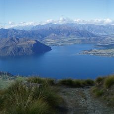
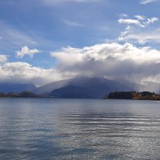
Roys Peak Track is a walking trail near Wānaka in the Otago region that covers about 16 kilometers round-trip to reach the summit. The path climbs steeply through farmland, open grasslands, and rocky terrain to an elevation of approximately 1578 meters.
The trail was developed across private farmland that has been used for sheep grazing for generations. Its growing popularity in recent years has been driven by social media fame after the viewpoint became widely photographed.
The trail crosses working farmland where sheep graze, giving visitors a sense of how the land is actively used by local farmers. You can observe the blend of pastoral countryside and mountain environment as you walk.
Plan to start early in the morning to secure parking and avoid crowds, especially during summer months. Wear sturdy hiking boots, carry waterproof layers, and bring plenty of water and snacks, as the trail is steep and has no facilities along the way.
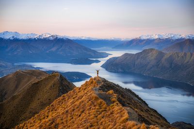
A famous photo viewpoint along the trail is not the actual summit but sits about 30 minutes below it, offering views over the lake that have made it widely photographed on social media. Many visitors stop here instead of continuing to the true peak.
The community of curious travelers
AroundUs brings together thousands of curated places, local tips, and hidden gems, enriched daily by 60,000 contributors worldwide.