Enable Location

We need your location to show you interesting places around you

Discover nearby places

Find interesting locations and hidden gems around you

Precise directions

Get accurate directions and distances to places

Your location is never shared with other users. It's only used when you tap the location button.

Naděje

Log in to your account

Start exploring — it's free

Trusted by 63,415 travelers worldwide

Continue with Google
Continue with Apple
or

We will send you a code to connect

By continuing, you accept our Terms and Conditions and our Privacy Policy

Check your inbox

We've sent a pincode in your inbox. Please enter the code below.

Discussion Reviews 1 Photos
1.3k Popularity

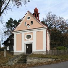
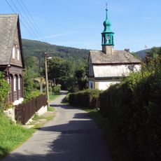
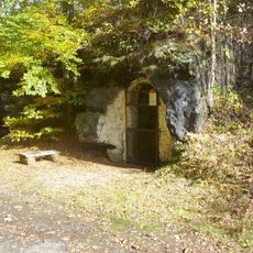
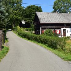
Naděje, Ice cave in Lusatian Mountains, Czech Republic

Naděje is an ice cave in the Lusatian Mountains extending about 30 meters with widths ranging from 2 to 4 meters. Its chambers contain permanent ice formations maintained year-round by the sealed structure above.

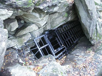
The Zwickau Mountain Club created an access path in 1870 and initially installed a wooden trunk for descent. This early access method was later replaced with a ladder to provide safer entry to the cave.

The name means 'Hope' and reflects the expectation of finding ice in this location. Visitors today can observe how local communities have long regarded this place as a natural wonder worth protecting.

The cave maintains near-freezing temperatures year-round due to its sealed roof structure, which prevents air circulation. Visitors should dress warmly and expect slippery surfaces caused by the persistent ice formations.

The ice formations reach thicknesses of up to 2 meters and include ice covers, stalactites, and ground ice of various types. These different ice structures develop from the cave's unique microclimate created by its sealed environment.

The community of curious travelers

AroundUs brings together thousands of curated places, local tips, and hidden gems, enriched daily by 60,000 contributors worldwide.

Start exploring
Location
Inception
August 4, 1966
GPS coordinates
50.82110,14.64280
Latest update
December 14, 2025 17:40
Around this place
Naděje Reservoir
Czech Republic

Naděje Reservoir

507 m
Milštejn Castle
Czech Republic

Milštejn Castle

1.3 km
Bývalá pila
Czech Republic

Bývalá pila

1.1 km
Chapel of the Nativity of Saint John the Baptist
Czech Republic

Chapel of the Nativity of Saint John the Baptist

2.3 km
Chapel of Saint Anne
Czech Republic

Chapel of Saint Anne

1.7 km
Socha svatého Jana Nepomuckého u silnice západně od Horní Světlé
Czech Republic

Socha svatého Jana Nepomuckého u silnice západně od Horní Světlé

1.7 km
Most silnice III/26844 přes Svitávku v Dolní Světlé
Czech Republic

Most silnice III/26844 přes Svitávku v Dolní Světlé

2.2 km
Kaufmannův obrázek u silnice z Nové Huti do Horní Světlé
Czech Republic

Kaufmannův obrázek u silnice z Nové Huti do Horní Světlé

2.4 km
Leinertův obrázek u rozcestí silnice do Horní Světlé
Czech Republic

Leinertův obrázek u rozcestí silnice do Horní Světlé

2.1 km
Dolní Světlá 93
Czech Republic

Dolní Světlá 93

2.2 km
Jilm v Dolní Světlé pod Luží
Czech Republic

Jilm v Dolní Světlé pod Luží

2.5 km
Trávník 64
Czech Republic

Trávník 64

2.3 km
Trávník 22
Czech Republic

Trávník 22

2.3 km
Obrázek svatého Jiří u lesní cesty severně od Rousínova
Czech Republic

Obrázek svatého Jiří u lesní cesty severně od Rousínova

2.3 km
Juliovka 15
Czech Republic

Juliovka 15

2 km
Trávník 10
Czech Republic

Trávník 10

2.1 km
Kříž u lesní cesty v západní části Mařenic
Czech Republic

Kříž u lesní cesty v západní části Mařenic

2.3 km
Skalní kaplička svatého Antonína v západní části Mařenic
Czech Republic

Skalní kaplička svatého Antonína v západní části Mařenic

2.2 km
Trávník 13
Czech Republic

Trávník 13

2 km
Horní Světlá 76
Czech Republic

Horní Světlá 76

2.4 km
Dolní Světlá 83
Czech Republic

Dolní Světlá 83

2.4 km
Dolní Světlá 46
Czech Republic

Dolní Světlá 46

2.4 km
Skalní kaplička s reliéfem Krista u silnice z Mařenic do Trávníku
Czech Republic

Skalní kaplička s reliéfem Krista u silnice z Mařenic do Trávníku

2.4 km
Horní Světlá 111
Czech Republic

Horní Světlá 111

1.6 km
Kříž u silnice z Mařenic do Cvikova
Czech Republic

Kříž u silnice z Mařenic do Cvikova

2.6 km
Dolní Světlá 171
Czech Republic

Dolní Světlá 171

2.5 km
Horní Světlá 75
Czech Republic

Horní Světlá 75

2.4 km
Naděje 64
Czech Republic

Naděje 64

969 m
Show the full map
Reviews
Share your experience

No review yet

Discussions
Start a discussion...

No discussion yet

« Naděje - Ice cave in Lusatian Mountains, Czech Republic » is provided by Around Us (aroundus.com). Images and texts are derived from Wikimedia project under a Creative Commons license. You are allowed to copy, distribute, and modify copies of this page, under the conditions set by the license, as long as this note is clearly visible.

Discover hidden gems everywhere you go!

From secret cafés to breathtaking viewpoints, skip the crowded tourist spots and find places that match your style. Our app makes it easy with voice search, smart filtering, route optimization, and insider tips from travelers worldwide. Download now for the complete mobile experience.

Around Us App Screenshot

A unique approach to discovering new places

Le Figaro

All the places worth exploring

France Info

A tailor-made excursion in just a few clicks

20 Minutes

Around Us
Travel Guide & Maps
Download

Send to your phone

QR Code
1

Open the camera app on your mobile.

2

Point at the QR code with your camera. A notification will appear.

3

Tap the notification to open the link.