Chest opened
+${chestReward.xp} XP
Explorer
NOUVEAU ×${chestReward.collectible.quantity}
tapez pour fermer

See the monuments around you in AR Open chests in the app

Around Us is built for your phone — point your camera at the streets and discover the monuments and places around you in augmented reality. Around Us is built for your phone — chests unlock when you walk, explore and capture nearby places.

•

Enable Location

We need your location to show you interesting places around you

Discover nearby places

Find interesting locations and hidden gems around you

Precise directions

Get accurate directions and distances to places

Your location is never shared with other users. It's only used when you tap the location button.

Jordán

Log in to your account

Start exploring — it's free

Trusted by 92,674 travelers worldwide

Continue with Google
Continue with Apple
or

We will send you a code to connect

By continuing, you accept our Terms and Conditions and our Privacy Policy

Check your inbox

We've sent a pincode in your inbox. Please enter the code below.

Jordán, Mountain summit in Central Bohemia, Czech Republic.

Jordán is a summit in the Central Brdy hills, about 6 km east of Strašice, whose top is covered with spruce forest. Its northern slopes hold the former Jordán military impact area, where a infantry blockhouse CE was completed in 1936 and tested with artillery fire. Since 2016 the area is open only along marked hardened paths because of unexploded ordnance.

After the Brdy firing range was founded in 1926, the Jordán area became one of two sites in Brdy where components of the Czechoslovak fortification system were tested. An infantry blockhouse, completed in 1936, was built here and subjected to shelling trials. Nazi Germany later used the range as Truppenübungsplatz Kammwald, and some structures were added after World War II.

The name Jordán also belongs to the former military impact area on the northern slopes, where the Czechoslovak fortification was tested from 1926 and infantry blockhouse CE was completed in 1936. The open plains between Jordán and Houpák were among the most visited spots in the Central Brdy before access was opened, and films including Svěrák's Obecná škola were shot here.

The hike to the summit takes around two hours and follows marked trails from nearby parking areas. It is advisable to take care in wet or poor weather conditions, as the paths can become slippery.

The plains between Jordán and Houpák hold stone polygons and frost cracks, periglacial forms otherwise found near the Arctic Circle or at much higher elevations; the site is valued by geomorphologists and botanists.

The community of curious travelers

AroundUs brings together thousands of curated places, local tips, and hidden gems, enriched daily by 92,674 contributors worldwide.

Start exploring
GPS coordinates
49.71754,13.85294
Latest update
October 21, 2026 20:20
Around this place
Brdy Protected Landscape Area
Czech Republic

Brdy Protected Landscape Area

2.9 mi
Tok
Czech Republic

Tok

1.4 mi
Tři Trubky
Czech Republic

Tři Trubky

2.9 mi
Augustinian monastery in Zaječov
Czech Republic

Augustinian monastery in Zaječov

3.3 mi
CE Jordán casemate
Czech Republic

CE Jordán casemate

1 mi
Houpák
Czech Republic

Houpák

0.9 mi
Koruna
Czech Republic

Koruna

1.7 mi
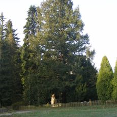
Douglaska na Třech trubkách
Czech Republic

Douglaska na Třech trubkách

2.9 mi
Peškův dub
Czech Republic

Peškův dub

3.2 mi
Svatá Dobrotivá
Czech Republic

Svatá Dobrotivá

3.3 mi
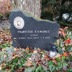
Pomník lesníka Františka Komance
Czech Republic

Pomník lesníka Františka Komance

2.9 mi
Pomník zřícení letounu L-159A Alca
Czech Republic

Pomník zřícení letounu L-159A Alca

0.8 mi
Kostel Zvěstování Panny Marie
Czech Republic

Kostel Zvěstování Panny Marie

3.3 mi
Obrázek svatého Václava u chaty Carvánka v Brdech
Czech Republic

Obrázek svatého Václava u chaty Carvánka v Brdech

1.4 mi
Památník nehody vrtulníku v Brdech
Czech Republic

Památník nehody vrtulníku v Brdech

0.4 mi
Socha sv. Jana Nepomuckého ve Sv. Dobrotivé - Zaječově
Czech Republic

Socha sv. Jana Nepomuckého ve Sv. Dobrotivé - Zaječově

3.4 mi
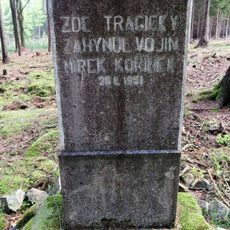
Pomník vojína M. Kořínka v Brdech
Czech Republic

Pomník vojína M. Kořínka v Brdech

2.9 mi
Klobouček
Czech Republic

Klobouček

3 mi
Památník 52. Pomocného technického praporu ve Svaté Dobrotivé
Czech Republic

Památník 52. Pomocného technického praporu ve Svaté Dobrotivé

3 mi
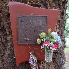
Pamětní deska V. Bryndy u zámečku Tři trubky
Czech Republic

Pamětní deska V. Bryndy u zámečku Tři trubky

2.9 mi
Obrázek madony u studánky U Panny Lídy v Brdech
Czech Republic

Obrázek madony u studánky U Panny Lídy v Brdech

2.5 mi
Bílý křížek
Czech Republic

Bílý křížek

2.5 mi
Kříž na Dobrotivské cestě v Brdech
Czech Republic

Kříž na Dobrotivské cestě v Brdech

1.9 mi
Křížek u Panny Lídy v Brdech
Czech Republic

Křížek u Panny Lídy v Brdech

2.5 mi
Kříž u kláštera sv. Dobrotivé
Czech Republic

Kříž u kláštera sv. Dobrotivé

3.4 mi
Kříž v jižní části Zaječova
Czech Republic

Kříž v jižní části Zaječova

3 mi
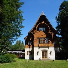
Kašna na nádvoří zámečku Tři trubky
Czech Republic

Kašna na nádvoří zámečku Tři trubky

2.9 mi
Kříž v Těních u křižovatky
Czech Republic

Kříž v Těních u křižovatky

3.3 mi
Show the full map
Reviews
Share your experience

No review yet

Discussions
Start a discussion...

No discussion yet

« Jordán - Mountain summit in Central Bohemia, Czech Republic » is provided by Around Us (aroundus.com). Images and texts are derived from Wikimedia project under a Creative Commons license. You are allowed to copy, distribute, and modify copies of this page, under the conditions set by the license, as long as this note is clearly visible.

Discover hidden gems everywhere you go!

From secret cafés to breathtaking viewpoints, skip the crowded tourist spots and find places that match your style. Our app makes it easy with voice search, smart filtering, route optimization, and insider tips from travelers worldwide. Download now for the complete mobile experience.

Around Us App Screenshot
❝

A unique approach to discovering new places❞

— Le Figaro

❝

All the places worth exploring❞

— France Info

❝

A tailor-made excursion in just a few clicks❞

— 20 Minutes

Around Us
Travel Guide & Maps
Download

Send to your phone

QR Code
1

Open the camera app on your mobile.

2

Point at the QR code with your camera. A notification will appear.

3

Tap the notification to open the link.