Chest opened
+${chestReward.xp} XP
Explorer
NOUVEAU ×${chestReward.collectible.quantity}
tapez pour fermer

See the monuments around you in AR Open chests in the app

Around Us is built for your phone — point your camera at the streets and discover the monuments and places around you in augmented reality. Around Us is built for your phone — chests unlock when you walk, explore and capture nearby places.

•

Enable Location

We need your location to show you interesting places around you

Discover nearby places

Find interesting locations and hidden gems around you

Precise directions

Get accurate directions and distances to places

Your location is never shared with other users. It's only used when you tap the location button.

Sedlecké skály

Log in to your account

Start exploring — it's free

Trusted by 94,099 travelers worldwide

Continue with Google
Continue with Apple
or

We will send you a code to connect

By continuing, you accept our Terms and Conditions and our Privacy Policy

Check your inbox

We've sent a pincode in your inbox. Please enter the code below.

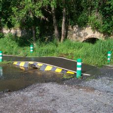
Sedlecké skály, protected area in Czech Republic

Sedlecké skály is a rock defile on the left bank of the Vltava, made of alternating greywacke and shale of the Kralupy-Zbraslav group from the late Proterozoic, inclined 40° to 90° east. The southern part is wooded with maples, oaks and black locust; the northern part has sharp rock ledges with steppe vegetation on top.

The rock wall is made of Upper Proterozoic greywackes and shales of the Kralupy-Zbraslav group, weakly contact-metamorphosed by magma. Sedlec, with its former brickworks, yielded Neanderthal finds dated to 250,000 BC, and the slopes show fireplaces from repeated settlement. The site was declared a protected natural formation in 1982 and re-declared in 2002 with unchanged boundaries.

The name comes from the village of Sedlec, whose former brickworks yielded Neanderthal remains dated to 250,000 BC. From the early 5th century BC farming cleared the original forest, and until the 1950s smallholdings with orchards and pastures surrounded the rocks; after the residents left, blackthorn and black locust spread over the former steppe. Look for the yellow Aurinia saxatilis on the rock ledges in April and May.

The monument lies on the left bank of the Vltava between the northern edge of Sedlec and the Roztocký háj – Tiché údolí reserve, bordered on the west by Suchdol. The southern part is wooded and gently sloping; the northern part has sharp rock ledges with steppe vegetation. The lower gorges are overgrown and hard to enter, and the lower slopes were affected by the railway corridor built in the 20th century.

The reserve protects a population of the Czech endemic beetle Cylindromorphus bohemicus, described in 1933 by Professor I. The steep rock outcrops were once grazed only occasionally by goats and sheep, which is why their steppe vegetation survived. A small stream springs 130 m above the site and feeds pools inhabited by fire salamanders.

The community of curious travelers

AroundUs brings together thousands of curated places, local tips, and hidden gems, enriched daily by 94,099 contributors worldwide.

Start exploring
Location
Inception
September 1, 1982
GPS coordinates
50.13797,14.39014
Latest update
October 21, 2026 21:19
Around this place
Roztocký háj - Tiché údolí
Czech Republic

Roztocký háj - Tiché údolí

0.8 mi
Brandejsův statek
Czech Republic

Brandejsův statek

0.8 mi
Zámka
Czech Republic

Zámka

0.8 mi
Bohnické údolí
Czech Republic

Bohnické údolí

0.6 mi
Sedlec Castle
Czech Republic

Sedlec Castle

0.4 mi
Zámky
Czech Republic

Zámky

0.8 mi
Přírodní rezervace Podhoří
Czech Republic

Přírodní rezervace Podhoří

0.7 mi
Ferry Sedlec - Zámky
Czech Republic

Ferry Sedlec - Zámky

0.2 mi
Spálený mlýn
Czech Republic

Spálený mlýn

0.7 mi
Kaple Nejsvětější Trojice
Czech Republic

Kaple Nejsvětější Trojice

0.4 mi
Stromořadí lip srdčitých v Suchdole
Czech Republic

Stromořadí lip srdčitých v Suchdole

0.5 mi
Red Army memorial
Czech Republic

Red Army memorial

0.7 mi
Plaque to plane crash in Prague-Suchdol
Czech Republic

Plaque to plane crash in Prague-Suchdol

0.2 mi
Pomník Mikoláše Alše v Praze-Suchdole
Czech Republic

Pomník Mikoláše Alše v Praze-Suchdole

0.5 mi
Kaple se zvoničkou
Czech Republic

Kaple se zvoničkou

0.8 mi
Pomník obětem 2. světové války v Sedlci
Czech Republic

Pomník obětem 2. světové války v Sedlci

0.4 mi
Rudolf Pernický memorial
Czech Republic

Rudolf Pernický memorial

0.7 mi
Kaňon Vltavy u Sedlce
Czech Republic

Kaňon Vltavy u Sedlce

0.6 mi
Sluneční hodiny u dětského hřiště v Suchdolské ulici v Suchdole
Czech Republic

Sluneční hodiny u dětského hřiště v Suchdolské ulici v Suchdole

0.4 mi
Most cesty v Tichém údolí přes Únětický potok
Czech Republic

Most cesty v Tichém údolí přes Únětický potok

0.8 mi
Most přes Únětický potok u Spáleného mlýna
Czech Republic

Most přes Únětický potok u Spáleného mlýna

0.7 mi
Railway bridge over V rokli street
Czech Republic

Railway bridge over V rokli street

0.2 mi
Propustek pro Čimický potok pod pobřežní cyklostezkou
Czech Republic

Propustek pro Čimický potok pod pobřežní cyklostezkou

0.6 mi
School in Sedlec
Czech Republic

School in Sedlec

0.7 mi
Pomník padlým 1938-1945 v Praze-Suchdole
Czech Republic

Pomník padlým 1938-1945 v Praze-Suchdole

0.5 mi
Busta Mikoláše Alše v Praze-Suchdole
Czech Republic

Busta Mikoláše Alše v Praze-Suchdole

0.5 mi
Železniční most v Sedlci u zámku
Czech Republic

Železniční most v Sedlci u zámku

0.4 mi
Lávka přes Drahanský potok v ústí Drahanského údolí
Czech Republic

Lávka přes Drahanský potok v ústí Drahanského údolí

0.8 mi
Show the full map
Reviews
Share your experience

No review yet

Discussions
Start a discussion...

No discussion yet

« Sedlecké skály - protected area in Czech Republic » is provided by Around Us (aroundus.com). Images and texts are derived from Wikimedia project under a Creative Commons license. You are allowed to copy, distribute, and modify copies of this page, under the conditions set by the license, as long as this note is clearly visible.

Discover hidden gems everywhere you go!

From secret cafés to breathtaking viewpoints, skip the crowded tourist spots and find places that match your style. Our app makes it easy with voice search, smart filtering, route optimization, and insider tips from travelers worldwide. Download now for the complete mobile experience.

Around Us App Screenshot
❝

A unique approach to discovering new places❞

— Le Figaro

❝

All the places worth exploring❞

— France Info

❝

A tailor-made excursion in just a few clicks❞

— 20 Minutes

Around Us
Travel Guide & Maps
Download

Send to your phone

QR Code
1

Open the camera app on your mobile.

2

Point at the QR code with your camera. A notification will appear.

3

Tap the notification to open the link.