Enable Location

We need your location to show you interesting places around you

Discover nearby places

Find interesting locations and hidden gems around you

Precise directions

Get accurate directions and distances to places

Your location is never shared with other users. It's only used when you tap the location button.

Golden Eagle-Toppmeyer Site

Log in to your account

Start exploring — it's free

Trusted by 62,170 travelers worldwide

Continue with Google
Continue with Apple
or

We will send you a code to connect

By continuing, you accept our Terms and Conditions and our Privacy Policy

Check your inbox

We've sent a pincode in your inbox. Please enter the code below.

Golden Eagle-Toppmeyer Site, Archaeological site in Calhoun County, United States.

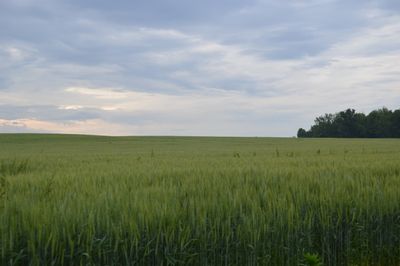
The Golden Eagle-Toppmeyer Site is an archaeological complex in Calhoun County consisting of two distinct areas: a geometric earthwork formation and an adjacent residential zone along a river. The entire area spans roughly 45 acres and combines engineered earth structures with evidence of human settlement.

The site dates from 150 BC to 450 AD and was a significant center of the Havana Hopewell culture, a society known for extensive trade networks. The geometric earthworks and residential areas show how this civilization developed and evolved over several centuries.

The site reveals how ancient communities shaped their landscape with mounds and geometric forms that served as gathering places and symbols of community identity. Visitors can observe how the layout of these elements reflected the connection between people and their territory.

The complex is located at the intersection of Quarry Road and Illinois River Road and welcomes visitors for research and observation. The open landscape requires standard outdoor footwear, and visitors should take care to stay on designated pathways to protect the archaeological features.

This is the only geometric earthwork from the Middle Woodland period found in the central Mississippi River valley. This rarity makes it an exceptional example of construction techniques developed by early societies in this region.

The community of curious travelers

AroundUs brings together thousands of curated places, local tips, and hidden gems, enriched daily by 60,000 contributors worldwide.

Start exploring
Location
GPS coordinates
38.91530,-90.52030
Latest update
December 14, 2025 15:02
Around this place
Harlen C. Hunter Stadium
United States of America

Harlen C. Hunter Stadium

14.4 km
Old St. Charles Bridge
United States of America

Old St. Charles Bridge

15.2 km
Discovery Bridge
United States of America

Discovery Bridge

13.9 km
Wabash Bridge
United States of America

Wabash Bridge

13.9 km
Principia College Historic District
United States of America

Principia College Historic District

15.4 km
African Church
United States of America

African Church

15 km
Frenchtown Historic District
United States of America

Frenchtown Historic District

14.5 km
Duncan Farm
United States of America

Duncan Farm

5.9 km
Lindenwood Hall
United States of America

Lindenwood Hall

14.4 km
Elsah Historic District
United States of America

Elsah Historic District

14.5 km
St. Charles Odd Fellows Hall
United States of America

St. Charles Odd Fellows Hall

15.4 km
Paris Mason Building
United States of America

Paris Mason Building

8.7 km
Charles Brainerd House
United States of America

Charles Brainerd House

10.1 km
Smith-Duncan House and Eastman Barn
United States of America

Smith-Duncan House and Eastman Barn

6 km
Samuel Stewart Watson House
United States of America

Samuel Stewart Watson House

13.6 km
Slaten-LaMarsh House
United States of America

Slaten-LaMarsh House

9.6 km
Brussels Historic District
United States of America

Brussels Historic District

6.9 km
Midtown Neighborhood Historic District
United States of America

Midtown Neighborhood Historic District

15 km
Grafton Historic District
United States of America

Grafton Historic District

9.7 km
Grafton Bank
United States of America

Grafton Bank

9.7 km
Old City Hall
United States of America

Old City Hall

15.3 km
John and Amelia McClintock House
United States of America

John and Amelia McClintock House

9.8 km
Marten-Becker House
United States of America

Marten-Becker House

15.1 km
Oliver L. and Catherine Link House
United States of America

Oliver L. and Catherine Link House

14.7 km
Lindenwood Neighborhood Historic District
United States of America

Lindenwood Neighborhood Historic District

14.3 km
Dr. John H. Stumberg House
United States of America

Dr. John H. Stumberg House

15.2 km
J. Scheidegger Center for the Arts
United States of America

J. Scheidegger Center for the Arts

14.4 km
Wabash Bridge (1871)
United States of America

Wabash Bridge (1871)

14.3 km
Show the full map
« Golden Eagle-Toppmeyer Site - Archaeological site in Calhoun County, United States » is provided by Around Us (aroundus.com). Images and texts are derived from Wikimedia project under a Creative Commons license. You are allowed to copy, distribute, and modify copies of this page, under the conditions set by the license, as long as this note is clearly visible.

Discover hidden gems everywhere you go!

From secret cafés to breathtaking viewpoints, skip the crowded tourist spots and find places that match your style. Our app makes it easy with voice search, smart filtering, route optimization, and insider tips from travelers worldwide. Download now for the complete mobile experience.

Around Us App Screenshot

A unique approach to discovering new places

Le Figaro

All the places worth exploring

France Info

A tailor-made excursion in just a few clicks

20 Minutes

Around Us
Travel Guide & Maps
Download

Send to your phone

QR Code
1

Open the camera app on your mobile.

2

Point at the QR code with your camera. A notification will appear.

3

Tap the notification to open the link.