Enable Location

We need your location to show you interesting places around you

Discover nearby places

Find interesting locations and hidden gems around you

Precise directions

Get accurate directions and distances to places

Your location is never shared with other users. It's only used when you tap the location button.

Pot Creek Cultural Site

Log in to your account

Start exploring — it's free

Trusted by 66,237 travelers worldwide

Continue with Google
Continue with Apple
or

We will send you a code to connect

By continuing, you accept our Terms and Conditions and our Privacy Policy

Check your inbox

We've sent a pincode in your inbox. Please enter the code below.

Pot Creek Cultural Site
Discussion Reviews 1 Photos
3k Popularity

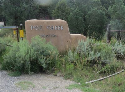
Pot Creek Cultural Site, Archaeological pueblo ruins in Taos County, United States.

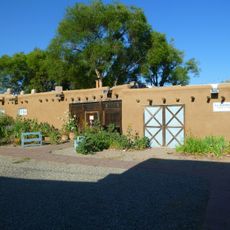
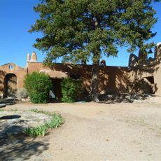
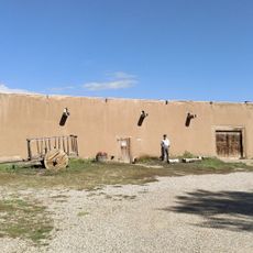
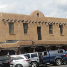
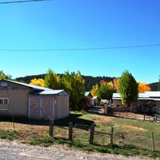
Pot Creek Cultural Site is an archaeological ruin in northern New Mexico where the remains of a multi-story pueblo settlement, including adobe structures, storage rooms, and ceremonial spaces arranged around a central plaza, can still be seen. A marked trail runs through the site and leads to a reconstructed pueblo room that shows how the spaces were once used.

The settlement grew during the 13th century into a multi-story pueblo that housed a sizable community over several generations. Between 1260 and 1320, residents left the site and moved to nearby communities such as Picuris and Taos.

The pottery found at the site includes gray cooking vessels and black-on-white decorated pieces that show how daily life and craft skills were woven together in this community. These ceramics are seen as a direct link to the Pueblo communities still living in the region today.

The site is on Carson National Forest land and is reached by a marked interpretive trail that provides information along the way. The ground is uneven and there is little shade, so sturdy footwear and water are worth bringing.

A large ceremonial structure started in 1318 was never finished, showing that the community left while building work was still underway. This unfinished construction is one of the few visible signs of what life here looked like in its final years.

The community of curious travelers

AroundUs brings together thousands of curated places, local tips, and hidden gems, enriched daily by 60,000 contributors worldwide.

Start exploring
Location
GPS coordinates
36.27920,-105.57600
Latest update
March 3, 2026 13:54
Around this place
Rio Grande Gorge Bridge
United States of America

Rio Grande Gorge Bridge

26 km
Mabel Dodge Luhan House
United States of America

Mabel Dodge Luhan House

14.4 km
Taos Downtown Historic District
United States of America

Taos Downtown Historic District

14.2 km
Kit Carson House
United States of America

Kit Carson House

14.2 km
Martinez Hacienda
United States of America

Martinez Hacienda

13.8 km
Harwood Museum of Art
United States of America

Harwood Museum of Art

14.1 km
John Dunn Bridge
United States of America

John Dunn Bridge

30.9 km
San José de Gracia Church
United States of America

San José de Gracia Church

23.2 km
Taos Inn
United States of America

Taos Inn

14.4 km
Nicolai Fechin House
United States of America

Nicolai Fechin House

14.6 km
Ranchos de Taos Plaza
United States of America

Ranchos de Taos Plaza

9.3 km
La Morada de Nuestra Senora de Guadalupe
United States of America

La Morada de Nuestra Senora de Guadalupe

14.2 km
Taos Art Museum
United States of America

Taos Art Museum

14.6 km
Governor Charles Bent House
United States of America

Governor Charles Bent House

14.4 km
Ernest L. Blumenschein House
United States of America

Ernest L. Blumenschein House

14.1 km
Eanger Irving Couse House and Studio—Joseph Henry Sharp Studios
United States of America

Eanger Irving Couse House and Studio—Joseph Henry Sharp Studios

14.1 km
Taos Pueblo
United States of America

Taos Pueblo

17.9 km
La Loma Plaza Historic District
United States of America

La Loma Plaza Historic District

14.2 km
Leon Gaspard House
United States of America

Leon Gaspard House

13 km
E. Martin Hennings House and Studio Historic District
United States of America

E. Martin Hennings House and Studio Historic District

13.4 km
Carson School
United States of America

Carson School

19.5 km
Bernard J. Beimer House
United States of America

Bernard J. Beimer House

15.3 km
Hernández-Manby House
United States of America

Hernández-Manby House

14.4 km
Hacienda de Los Martinez Museum
United States of America

Hacienda de Los Martinez Museum

13.9 km
Barrancos Blancos
United States of America

Barrancos Blancos

30.9 km
Veterans Memorial
United States of America

Veterans Memorial

14.2 km
Old Taos County Courthouse
United States of America

Old Taos County Courthouse

14.3 km
Las Trampas Historic District
United States of America

Las Trampas Historic District

23.3 km
Show the full map
Reviews
Share your experience

No review yet

Discussions
Start a discussion...

No discussion yet

« Pot Creek Cultural Site - Archaeological pueblo ruins in Taos County, United States » is provided by Around Us (aroundus.com). Images and texts are derived from Wikimedia project under a Creative Commons license. You are allowed to copy, distribute, and modify copies of this page, under the conditions set by the license, as long as this note is clearly visible.

Discover hidden gems everywhere you go!

From secret cafés to breathtaking viewpoints, skip the crowded tourist spots and find places that match your style. Our app makes it easy with voice search, smart filtering, route optimization, and insider tips from travelers worldwide. Download now for the complete mobile experience.

Around Us App Screenshot

A unique approach to discovering new places

Le Figaro

All the places worth exploring

France Info

A tailor-made excursion in just a few clicks

20 Minutes

Around Us
Travel Guide & Maps
Download

Send to your phone

QR Code
1

Open the camera app on your mobile.

2

Point at the QR code with your camera. A notification will appear.

3

Tap the notification to open the link.