Enable Location

We need your location to show you interesting places around you

Discover nearby places

Find interesting locations and hidden gems around you

Precise directions

Get accurate directions and distances to places

Your location is never shared with other users. It's only used when you tap the location button.

Ranchos de Taos Plaza

Log in to your account

Start exploring — it's free

Trusted by 62,526 travelers worldwide

Continue with Google
Continue with Apple
or

We will send you a code to connect

By continuing, you accept our Terms and Conditions and our Privacy Policy

Check your inbox

We've sent a pincode in your inbox. Please enter the code below.

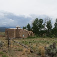
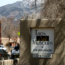
Ranchos de Taos Plaza, Historic district in Ranchos de Taos, New Mexico.

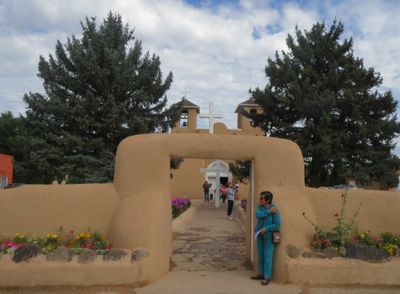
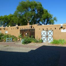
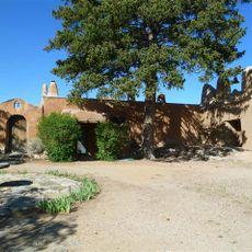
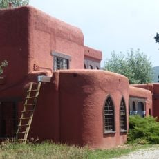
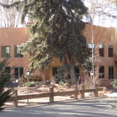
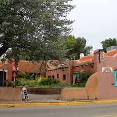
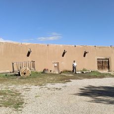
Ranchos de Taos Plaza is a historic district in New Mexico organized around the San Francisco de Asis Mission Church, which stands as its central landmark. The surrounding adobe buildings form a compact settlement that preserves Spanish colonial settlement patterns.

Spanish settlers established this settlement in the 1770s as a fortified plaza with defensive structures to protect against raids from nomadic tribes. The mission church was added later and eventually became the spiritual and social heart of the community.

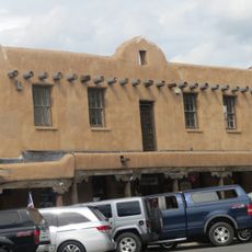
The adobe structures around the plaza serve as galleries and shops where local residents and visitors interact throughout the day. These spaces reflect how the community has maintained traditional uses while adapting to contemporary needs.

The plaza is accessible via U.S. Route 64 and lies a short drive south of Taos with parking available near the main area. Walking slowly through the grounds allows you to notice the varied textures and features of the adobe architecture.

A cafe operates within one of the original trading structures, maintaining the commercial continuity that has existed for centuries. This ongoing use demonstrates how everyday commerce has remained central to the place throughout its history.

The community of curious travelers

AroundUs brings together thousands of curated places, local tips, and hidden gems, enriched daily by 60,000 contributors worldwide.

Start exploring
Location
GPS coordinates
36.35833,-105.60778
Latest update
December 12, 2025 16:43
Around this place
Wheeler Peak
United States of America

Wheeler Peak

27.9 km
Rio Grande Gorge Bridge
United States of America

Rio Grande Gorge Bridge

17.2 km
D. H. Lawrence Ranch
United States of America

D. H. Lawrence Ranch

24.9 km
Mabel Dodge Luhan House
United States of America

Mabel Dodge Luhan House

6.8 km
Taos Downtown Historic District
United States of America

Taos Downtown Historic District

6.3 km
Kit Carson House
United States of America

Kit Carson House

6.3 km
Martinez Hacienda
United States of America

Martinez Hacienda

4.7 km
Harwood Museum of Art
United States of America

Harwood Museum of Art

5.9 km
John Dunn Bridge
United States of America

John Dunn Bridge

21.7 km
Pot Creek Cultural Site
United States of America

Pot Creek Cultural Site

9.3 km
Taos Inn
United States of America

Taos Inn

6.4 km
Nicolai Fechin House
United States of America

Nicolai Fechin House

6.7 km
La Morada de Nuestra Senora de Guadalupe
United States of America

La Morada de Nuestra Senora de Guadalupe

6.7 km
Taos Art Museum
United States of America

Taos Art Museum

6.7 km
Governor Charles Bent House
United States of America

Governor Charles Bent House

6.4 km
Ernest L. Blumenschein House
United States of America

Ernest L. Blumenschein House

6 km
Eanger Irving Couse House and Studio—Joseph Henry Sharp Studios
United States of America

Eanger Irving Couse House and Studio—Joseph Henry Sharp Studios

6.2 km
Mount Walter
United States of America

Mount Walter

28.4 km
Taos Pueblo
United States of America

Taos Pueblo

10.4 km
La Loma Plaza Historic District
United States of America

La Loma Plaza Historic District

5.9 km
Leon Gaspard House
United States of America

Leon Gaspard House

5.7 km
E. Martin Hennings House and Studio Historic District
United States of America

E. Martin Hennings House and Studio Historic District

5.8 km
Carson School
United States of America

Carson School

14.1 km
Bernard J. Beimer House
United States of America

Bernard J. Beimer House

7.3 km
Hernández-Manby House
United States of America

Hernández-Manby House

6.4 km
Hacienda de Los Martinez Museum
United States of America

Hacienda de Los Martinez Museum

4.8 km
Veterans Memorial
United States of America

Veterans Memorial

6.2 km
Old Taos County Courthouse
United States of America

Old Taos County Courthouse

6.2 km
Show the full map
« Ranchos de Taos Plaza - Historic district in Ranchos de Taos, New Mexico » is provided by Around Us (aroundus.com). Images and texts are derived from Wikimedia project under a Creative Commons license. You are allowed to copy, distribute, and modify copies of this page, under the conditions set by the license, as long as this note is clearly visible.

Discover hidden gems everywhere you go!

From secret cafés to breathtaking viewpoints, skip the crowded tourist spots and find places that match your style. Our app makes it easy with voice search, smart filtering, route optimization, and insider tips from travelers worldwide. Download now for the complete mobile experience.

Around Us App Screenshot

A unique approach to discovering new places

Le Figaro

All the places worth exploring

France Info

A tailor-made excursion in just a few clicks

20 Minutes

Around Us
Travel Guide & Maps
Download

Send to your phone

QR Code
1

Open the camera app on your mobile.

2

Point at the QR code with your camera. A notification will appear.

3

Tap the notification to open the link.