Enable Location

We need your location to show you interesting places around you

Discover nearby places

Find interesting locations and hidden gems around you

Precise directions

Get accurate directions and distances to places

Your location is never shared with other users. It's only used when you tap the location button.

Nation Ford Road

Log in to your account

Start exploring — it's free

Trusted by 62,486 travelers worldwide

Continue with Google
Continue with Apple
or

We will send you a code to connect

By continuing, you accept our Terms and Conditions and our Privacy Policy

Check your inbox

We've sent a pincode in your inbox. Please enter the code below.

Nation Ford Road

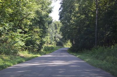
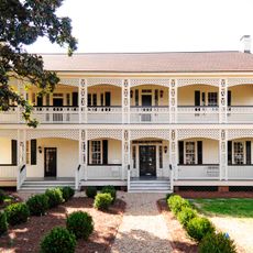
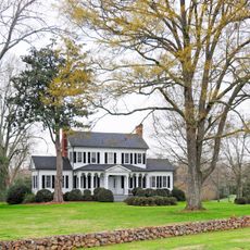
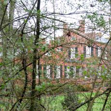
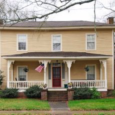
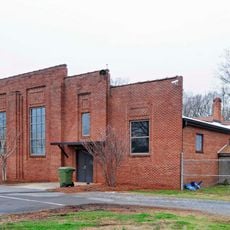
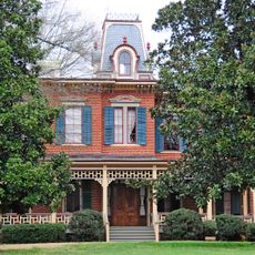
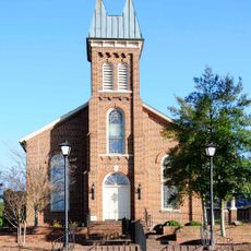
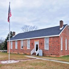
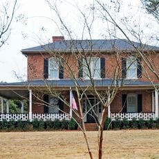
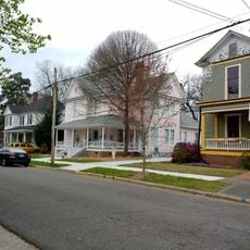
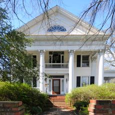
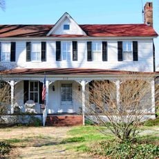
Nation Ford Road is a historic route in York County, South Carolina, listed on the National Register of Historic Places since 2007. The road crossed the Catawba River at a reliable ford and extended from Virginia through the Piedmont region, with surviving segments visible near historic homes such as the William Elliott White House and Springfield Plantation House.

The route was used by Catawba Indians and other tribes long before European settlement, later becoming known as the Occaneechi Path and Indian Road. European traders began using it for commerce around 1650, and its course influenced where settlements grew in Rock Hill and Fort Mill, eventually guiding the development of railroads and modern highways like Interstate 77.

The name Nation Ford Road comes from the river crossing where Catawba Indians and early European traders could safely traverse the Catawba River. Segments of the route remain visible in the landscape today, marking where communities chose to settle and grow.

Many sections of the original road are no longer clearly visible today, though some segments can be explored near historic homes and in local parks or greenways. Keep in mind that much of the historic site lies on private property and is not always open to visitors.

Though mostly invisible today, railroad lines in the early 20th century followed the course of this ancient road, and Interstate 77 was later built over portions of its original route. This reveals how a path used for centuries by travelers shaped the region's infrastructure for generations to come.

The community of curious travelers

AroundUs brings together thousands of curated places, local tips, and hidden gems, enriched daily by 60,000 contributors worldwide.

Start exploring
Location
GPS coordinates
34.99528,-80.95167
Latest update
February 9, 2026 08:21
Around this place
White House
United States of America

White House

10 km
Tillman Hall
United States of America

Tillman Hall

9.5 km
Springfield Plantation House
United States of America

Springfield Plantation House

6.3 km
William Elliott White House
United States of America

William Elliott White House

2.3 km
Anderson House
United States of America

Anderson House

9.8 km
Rock Hill Downtown Historic District
United States of America

Rock Hill Downtown Historic District

10.3 km
Fort Mill Downtown Historic District
United States of America

Fort Mill Downtown Historic District

1.6 km
Wilson House
United States of America

Wilson House

1.6 km
Temple Kol Ami
United States of America

Temple Kol Ami

1.9 km
National Guard Armory
United States of America

National Guard Armory

1.9 km
Mills House
United States of America

Mills House

1.5 km
John M. White House
United States of America

John M. White House

1.7 km
Unity Presbyterian Church Complex
United States of America

Unity Presbyterian Church Complex

2 km
People's National Bank Building
United States of America

People's National Bank Building

10.4 km
Banks-Mack House
United States of America

Banks-Mack House

1.5 km
U.S. Post Office and Courthouse
United States of America

U.S. Post Office and Courthouse

10.3 km
Ebenezer Academy
United States of America

Ebenezer Academy

9.7 km
Mack-Belk House
United States of America

Mack-Belk House

2 km
Thornwell-Elliott House
United States of America

Thornwell-Elliott House

1.5 km
Bleachery Water Treatment Plant
United States of America

Bleachery Water Treatment Plant

9.9 km
Marion Street Area Historic District
United States of America

Marion Street Area Historic District

10.9 km
Winthrop College Historic District
United States of America

Winthrop College Historic District

9.5 km
Reid Street-North Confederate Avenue Area Historic District
United States of America

Reid Street-North Confederate Avenue Area Historic District

10.2 km
Stokes-Mayfield House
United States of America

Stokes-Mayfield House

9.7 km
McCorkle-Fewell-Long House
United States of America

McCorkle-Fewell-Long House

9.1 km
Highland Park Manufacturing Plant and Cotton Oil Complex
United States of America

Highland Park Manufacturing Plant and Cotton Oil Complex

9.9 km
Charlotte Avenue-Aiken Avenue Historic District
United States of America

Charlotte Avenue-Aiken Avenue Historic District

9.4 km
Main Street Children's Museum
United States of America

Main Street Children's Museum

10.3 km
Show the full map
« Nation Ford Road » is provided by Around Us (aroundus.com). Images and texts are derived from Wikimedia project under a Creative Commons license. You are allowed to copy, distribute, and modify copies of this page, under the conditions set by the license, as long as this note is clearly visible.

Discover hidden gems everywhere you go!

From secret cafés to breathtaking viewpoints, skip the crowded tourist spots and find places that match your style. Our app makes it easy with voice search, smart filtering, route optimization, and insider tips from travelers worldwide. Download now for the complete mobile experience.

Around Us App Screenshot

A unique approach to discovering new places

Le Figaro

All the places worth exploring

France Info

A tailor-made excursion in just a few clicks

20 Minutes

Around Us
Travel Guide & Maps
Download

Send to your phone

QR Code
1

Open the camera app on your mobile.

2

Point at the QR code with your camera. A notification will appear.

3

Tap the notification to open the link.