Chest opened
+${chestReward.xp} XP
Explorer
NOUVEAU ×${chestReward.collectible.quantity}
tapez pour fermer

See the monuments around you in AR Open chests in the app

Around Us is built for your phone — point your camera at the streets and discover the monuments and places around you in augmented reality. Around Us is built for your phone — chests unlock when you walk, explore and capture nearby places.

Enable Location

We need your location to show you interesting places around you

Discover nearby places

Find interesting locations and hidden gems around you

Precise directions

Get accurate directions and distances to places

Your location is never shared with other users. It's only used when you tap the location button.

Log in to your account

Start exploring — it's free

Trusted by 86,319 travelers worldwide

Continue with Google
Continue with Apple
or

We will send you a code to connect

By continuing, you accept our Terms and Conditions and our Privacy Policy

Check your inbox

We've sent a pincode in your inbox. Please enter the code below.

Lake Calero
Discussion Reviews Photo
1.3k Popularity

Lake Calero, body of water

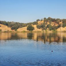
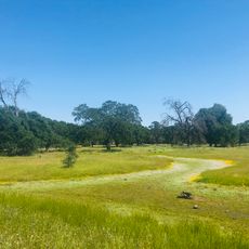
Lake Calero is a reservoir in Santa Clara County that stores water for regional use and helps supply local homes and businesses. The lake is surrounded by green hills and trees, offering calm water for fishing, boating, and waterside activities.

Lake Calero was created in 1935 when an earthen dam was built to store water for drought periods and manage seasonal flooding. The project fundamentally changed water flow in the region and allowed mountain streams from the Santa Cruz range to be captured for local use.

Lake Calero is a gathering place for locals seeking quiet time away from the city and a connection with nature. The shoreline and trails draw people for walks, picnics, and bird watching throughout the year.

The lake is easily accessible with parking near the shoreline and features picnic areas, restrooms, and walking trails for visitors of all abilities. Fishing is allowed under catch-and-release rules, but swimming is prohibited to protect water quality for drinking supplies.

Fish in the lake contain elevated mercury levels from historical pollution, so eating them is not recommended despite their abundance in the water. A visit here reveals how human activity can leave a mark even on quiet natural spaces.

The community of curious travelers

AroundUs brings together thousands of curated places, local tips, and hidden gems, enriched daily by 60,000 contributors worldwide.
Start exploring
Location
GPS coordinates
38.52054,-121.08152
Latest update
September 14, 2026 01:31
Around this place
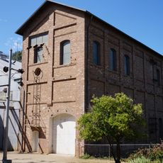
Folsom Powerhouse State Historic Park
United States of America

Folsom Powerhouse State Historic Park

12.2 mi
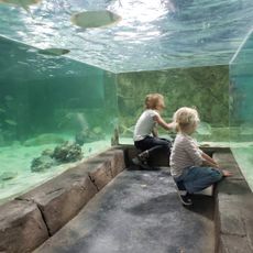
SeaQuest Folsom
United States of America

SeaQuest Folsom

9.3 mi
Folsom City Zoo Sanctuary
United States of America

Folsom City Zoo Sanctuary

12.2 mi
United States of America

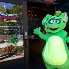
Sacramento Children's Museum

11.9 mi
Nimbus Dam Recreation Area
United States of America

Nimbus Dam Recreation Area

10.8 mi
American River Grange Hall No. 172
United States of America

American River Grange Hall No. 172

11.8 mi
Chung Wah Cemetery
United States of America

Chung Wah Cemetery

12 mi
Cohn House
United States of America

Cohn House

12 mi
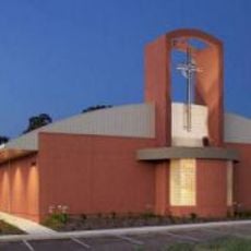
Faith Episcopal Church
United States of America

Faith Episcopal Church

10.1 mi
Sacramento Children's Museum
United States of America

Sacramento Children's Museum

11.9 mi
Chaparral Gardens
United States of America

Chaparral Gardens

5.9 mi
Lake Natoma Waterfront Park
United States of America

Lake Natoma Waterfront Park

12.2 mi
Prairie City State Vehicular Recreation Area
United States of America

Prairie City State Vehicular Recreation Area

6.7 mi
Historic Opera House
United States of America

Historic Opera House

12 mi
CountryHouse Residence
United States of America

CountryHouse Residence

9.2 mi
United States of America

Moot Rock Beach

11.3 mi

Laurel Beach

11.5 mi
United States of America

Statue

12 mi
United States of America

Scenic viewpoint

11.3 mi
United States of America

Lake Natoma Access Point

10.8 mi
United States of America

Norfolk Birdwatching Point

12 mi
United States of America

Ishiyama Bird View Point

11.6 mi
United States of America

Farrier View Point

11.2 mi
United States of America

Scenic viewpoint

8.4 mi
United States of America

Scenic viewpoint

10.8 mi
United States of America

Scenic viewpoint

10.9 mi
United States of America

Cameron Park CSD Pool

10.5 mi
Phoenix Vernal Pools
United States of America

Phoenix Vernal Pools

11.7 mi
Show the full map
Reviews
Share your experience

No review yet

Discussions
Start a discussion...

No discussion yet

« Lake Calero - body of water » is provided by Around Us (aroundus.com). Images and texts are derived from Wikimedia project under a Creative Commons license. You are allowed to copy, distribute, and modify copies of this page, under the conditions set by the license, as long as this note is clearly visible.

Discover hidden gems everywhere you go!

From secret cafés to breathtaking viewpoints, skip the crowded tourist spots and find places that match your style. Our app makes it easy with voice search, smart filtering, route optimization, and insider tips from travelers worldwide. Download now for the complete mobile experience.

Around Us App Screenshot

A unique approach to discovering new places

Le Figaro

All the places worth exploring

France Info

A tailor-made excursion in just a few clicks

20 Minutes

Around Us
Travel Guide & Maps
Download

Send to your phone

QR Code
1

Open the camera app on your mobile.

2

Point at the QR code with your camera. A notification will appear.

3

Tap the notification to open the link.