·

Enable Location

We need your location to show you interesting places around you

Discover nearby places

Find interesting locations and hidden gems around you

Precise directions

Get accurate directions and distances to places

Your location is never shared with other users. It's only used when you tap the location button.

Creek Street

Log in to your account

Start exploring — it's free

Trusted by 62,647 travelers worldwide

Continue with Google
Continue with Apple
or

We will send you a code to connect

By continuing, you accept our Terms and Conditions and our Privacy Policy

Check your inbox

We've sent a pincode in your inbox. Please enter the code below.

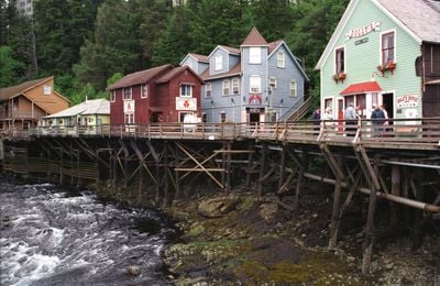
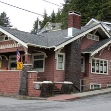
Creek Street, historic area of Ketchikan, Alaska

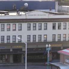
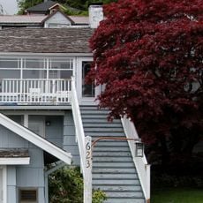
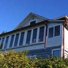
Creek Street is a narrow wooden boardwalk in Ketchikan that runs above a stream, lined with colorful buildings that extend over the water. The road contains shops, small museums, and historic structures with foundations anchored directly in the creek.

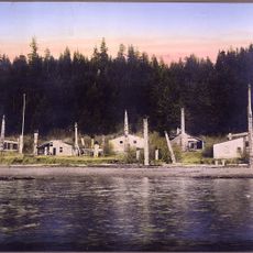
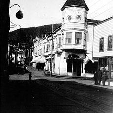
In the early 1900s, the street became a residential area for women offering services after the city relocated such activity from downtown. During the 1920s Prohibition era, illegal alcohol sales and clandestine businesses operated here, using trap doors and hidden entrances to avoid authorities.

The street takes its name from the creek that flows beneath it, which shaped how the town developed around water. Visitors today gather here to photograph the colorful wooden buildings and watch salmon navigate upstream during their seasonal runs.

The street is best explored on foot with easy walking paths along the wooden boardwalk, though surfaces become slippery in rain. Sturdy footwear is important, and nearby you can find starting points for salmon viewing and fishing gear rental.

The street became notorious for trap doors and hidden entrances in building floors that allowed people to discreetly move goods between boats and structures during Prohibition. A footpath called Married Man's Trail crosses above the creek and reveals how people historically navigated the area in secrecy.

The community of curious travelers

AroundUs brings together thousands of curated places, local tips, and hidden gems, enriched daily by 60,000 contributors worldwide.

Start exploring
Location
GPS coordinates
55.34220,-131.64200
Latest update
February 7, 2026 11:00
Around this place
Saxman Totem Park
United States of America

Saxman Totem Park

3.9 km
Totem Heritage Center
United States of America

Totem Heritage Center

508 m
Deer Mountain
United States of America

Deer Mountain

2.7 km
Ketchikan Federal Building
United States of America

Ketchikan Federal Building

84 m
Tree Point Light
United States of America

Tree Point Light

75.1 km
Guard Island Light
United States of America

Guard Island Light

19 km
Mary Island Light
United States of America

Mary Island Light

39.9 km
Triple Island Lightstation
Canada

Triple Island Lightstation

126.4 km
Lincoln Rock Light
United States of America

Lincoln Rock Light

103.5 km
Burkhart-Dibrell House
United States of America

Burkhart-Dibrell House

316 m
Father William Duncan House
United States of America

Father William Duncan House

24.3 km
Gilmore Building
United States of America

Gilmore Building

366 m
Chief Son-I-Hat's Whale House and Totems Historic District
United States of America

Chief Son-I-Hat's Whale House and Totems Historic District

53.8 km
Stedman-Thomas Historic District
United States of America

Stedman-Thomas Historic District

213 m
Chief Kashakes House
United States of America

Chief Kashakes House

3.9 km
Walker-Broderick House
United States of America

Walker-Broderick House

400 m
Etolin Canoe
United States of America

Etolin Canoe

105.7 km
Ziegler House
United States of America

Ziegler House

337 m
Storehouse No. 3
United States of America

Storehouse No. 3

98.4 km
Ketchikan Ranger House
United States of America

Ketchikan Ranger House

1 km
Downtown Ketchikan Historic District
United States of America

Downtown Ketchikan Historic District

643 m
Totem Heritage Center
United States of America

Totem Heritage Center

503 m
Green Island lighthouse
Canada

Green Island lighthouse

104.8 km
Fishing. Ketchikan adventure tours
United States of America

Fishing. Ketchikan adventure tours

97 m
United States of America

McHenry Ledge

63.9 km
United States of America

Balandra Shoal

101.5 km
Tlevak Strait-Suemez Is.
United States of America

Tlevak Strait-Suemez Is.

105.6 km
Chickamin Glacier
United States of America

Chickamin Glacier

116.3 km
Show the full map
« Creek Street - historic area of Ketchikan, Alaska » is provided by Around Us (aroundus.com). Images and texts are derived from Wikimedia project under a Creative Commons license. You are allowed to copy, distribute, and modify copies of this page, under the conditions set by the license, as long as this note is clearly visible.

Discover hidden gems everywhere you go!

From secret cafés to breathtaking viewpoints, skip the crowded tourist spots and find places that match your style. Our app makes it easy with voice search, smart filtering, route optimization, and insider tips from travelers worldwide. Download now for the complete mobile experience.

Around Us App Screenshot

A unique approach to discovering new places

Le Figaro

All the places worth exploring

France Info

A tailor-made excursion in just a few clicks

20 Minutes

Around Us
Travel Guide & Maps
Download

Send to your phone

QR Code
1

Open the camera app on your mobile.

2

Point at the QR code with your camera. A notification will appear.

3

Tap the notification to open the link.