Enable Location

We need your location to show you interesting places around you

Discover nearby places

Find interesting locations and hidden gems around you

Precise directions

Get accurate directions and distances to places

Your location is never shared with other users. It's only used when you tap the location button.

Allison Woods

Log in to your account

Start exploring — it's free

Trusted by 63,045 travelers worldwide

Continue with Google
Continue with Apple
or

We will send you a code to connect

By continuing, you accept our Terms and Conditions and our Privacy Policy

Check your inbox

We've sent a pincode in your inbox. Please enter the code below.

Discussion Reviews 1 Photos
2.6k Popularity

Allison Woods, Historic district in Iredell County, United States.

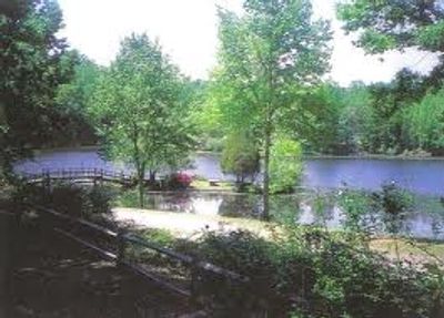
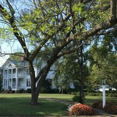
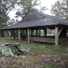
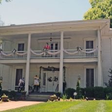
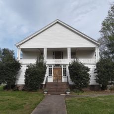
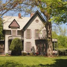
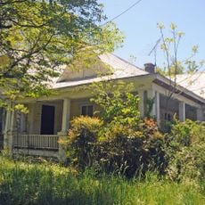
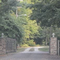
Allison Woods is a historic district comprising 13 buildings, sites, and structures located on a 298-acre gentleman's farm near Statesville, North Carolina. The property includes natural woodlands, water features, and several impoundments, with the Lower Lake serving as a focal point for the landscape.

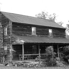
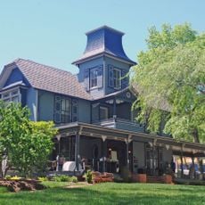
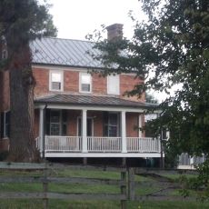
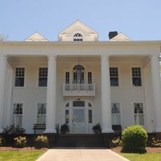
William Locke Allison developed this rural estate between 1926 and 1939, building several structures across the property for both residence and farm operations. The construction methods employed brick and stone, reflecting building practices of that era.

The district displays residential architecture from the early 20th century, with buildings in Bungalow and American Craftsman styles that reflect the owner's vision for rural living. These structures show how a gentleman's estate was designed to combine practical farm functions with refined residential design.

The site is best explored on foot along trails that wind through woodlands and around water features. Wear comfortable shoes and be prepared for muddy or wet conditions, especially on forest paths after rain.

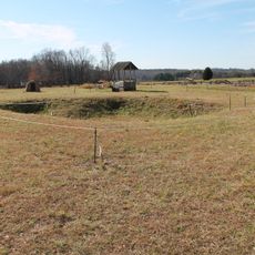
The district preserves a working windmill dating to 1928, which remains one of the few fully intact structures from the property's original systems. This mechanical relic demonstrates the water management and power generation methods that supported the estate's operations during the 20th century.

The community of curious travelers

AroundUs brings together thousands of curated places, local tips, and hidden gems, enriched daily by 60,000 contributors worldwide.

Start exploring
Location
GPS coordinates
35.89530,-80.82030
Latest update
December 12, 2025 16:41
Around this place
Fort Dobbs
United States of America

Fort Dobbs

10.6 km
Perciphull Campbell House
United States of America

Perciphull Campbell House

16.4 km
Iredell County Courthouse
United States of America

Iredell County Courthouse

13.9 km
Ebenezer Academy, Bethany Presbyterian Church and Cemetery
United States of America

Ebenezer Academy, Bethany Presbyterian Church and Cemetery

4.3 km
Congregation Emanuel
United States of America

Congregation Emanuel

13.8 km
Hinton Rowan Helper House
United States of America

Hinton Rowan Helper House

19.5 km
St. Philip's Roman Catholic Church
United States of America

St. Philip's Roman Catholic Church

14.4 km
Daltonia
United States of America

Daltonia

13.4 km
Academy Hill Historic District
United States of America

Academy Hill Historic District

14.6 km
Morrison-Mott House
United States of America

Morrison-Mott House

13.4 km
Wood Grove
United States of America

Wood Grove

27.3 km
Center Street A.M.E. Zion Church
United States of America

Center Street A.M.E. Zion Church

14.2 km
Damascus Baptist Church Arbor
United States of America

Damascus Baptist Church Arbor

14.9 km
United States Post Office and County Courthouse
United States of America

United States Post Office and County Courthouse

13.9 km
Davie County Jail
United States of America

Davie County Jail

23.4 km
Col. Silas Alexander Sharpe House
United States of America

Col. Silas Alexander Sharpe House

14 km
Downtown Mocksville Historic District
United States of America

Downtown Mocksville Historic District

23.3 km
Davie County Courthouse
United States of America

Davie County Courthouse

23.3 km
Snow Creek Methodist Church and Burying Ground
United States of America

Snow Creek Methodist Church and Burying Ground

9.1 km
Christ Episcopal Church
United States of America

Christ Episcopal Church

22.8 km
Bethesda Presbyterian Church
United States of America

Bethesda Presbyterian Church

19.5 km
Main Building, Mitchell College
United States of America

Main Building, Mitchell College

14.2 km
East Broad Street-Davie Avenue Historic District
United States of America

East Broad Street-Davie Avenue Historic District

13.2 km
South Race Street Historic District
United States of America

South Race Street Historic District

14.5 km
Jesse Clement House
United States of America

Jesse Clement House

23.6 km
Statesville Commercial Historic District
United States of America

Statesville Commercial Historic District

14.5 km
McElwee Houses
United States of America

McElwee Houses

13.6 km
Fort Dobbs State Historic Site
United States of America

Fort Dobbs State Historic Site

10.8 km
Show the full map
Reviews
Share your experience

No review yet

Discussions
Start a discussion...

No discussion yet

« Allison Woods - Historic district in Iredell County, United States » is provided by Around Us (aroundus.com). Images and texts are derived from Wikimedia project under a Creative Commons license. You are allowed to copy, distribute, and modify copies of this page, under the conditions set by the license, as long as this note is clearly visible.

Discover hidden gems everywhere you go!

From secret cafés to breathtaking viewpoints, skip the crowded tourist spots and find places that match your style. Our app makes it easy with voice search, smart filtering, route optimization, and insider tips from travelers worldwide. Download now for the complete mobile experience.

Around Us App Screenshot

A unique approach to discovering new places

Le Figaro

All the places worth exploring

France Info

A tailor-made excursion in just a few clicks

20 Minutes

Around Us
Travel Guide & Maps
Download

Send to your phone

QR Code
1

Open the camera app on your mobile.

2

Point at the QR code with your camera. A notification will appear.

3

Tap the notification to open the link.