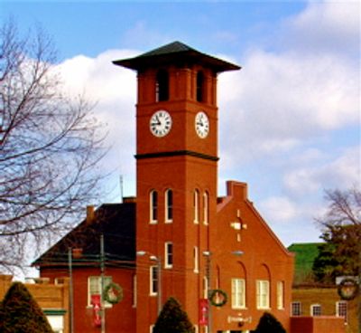
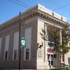
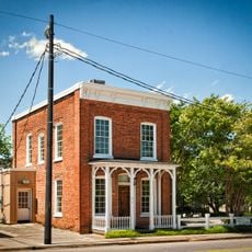
Henderson Fire Station and Municipal Building
The Henderson Fire Station and Municipal Building is a brick structure from 1908 on Garnett Street featuring a distinctive tower. The original section was expanded in 1928 with an L-shaped addition that provided space for city offices and community functions.
The building was constructed in 1908 by builder Robert Bunn as a fire station with a tower for drying hoses and staff quarters. The city recognized its historical importance in 1978 by listing it on the National Register of Historic Places.
The building serves as a community anchor in Henderson, representing local safety and civic pride. Firefighters work here daily while residents visit for municipal services, making it a center of local life and identity.
The building sits on Garnett Street in downtown Henderson and is easily accessible on foot from surrounding areas. The exterior can be viewed anytime from the street since it remains in active use by the fire department.
The distinctive tower was originally built to dry fire hoses after emergencies, not merely for the clock. The structure demonstrates how early fire stations combined practical design with multiple purposes in a single building.
The community of curious travelers
AroundUs brings together thousands of curated places, local tips, and hidden gems, enriched daily by 60,000 contributors worldwide.