Maple Grove Road Rural Historic District

Log in to your account

AroundUs is a community-driven map of interesting places, built by curious explorers like you. It grows with every review, story, and photo you share.
Connect to save your favorite spots, contribute locations, and create personalized routes.
Continue with Google
Continue with Apple
Continue with X
Continue with Facebook
Continue with email
By continuing, you accept our Terms and Conditions and our Privacy Policy
Create an account
Add to collection
Map
Suggest a change
Share

Maple Grove Road Rural Historic District, Rural historic district northwest of Bloomington, United States.

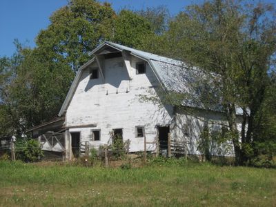
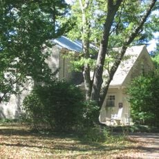
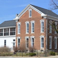
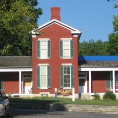
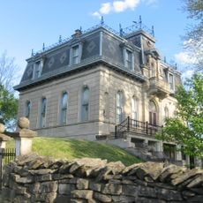
Maple Grove Road Rural Historic District is a countryside area containing farmsteads with buildings dating mainly to the 1800s, spread across two townships in Monroe County. The district covers more than 600 acres with 69 preserved structures including homes with Gothic Revival details and extensive old stone walls throughout the landscape.

The district began forming around 1828 when early settlers established farms, with the Daniel Stout House from that year being one of the oldest surviving buildings. Development continued through the 1800s and into the 1900s, reflecting how rural Indiana changed over more than a century.

The farmsteads show how families lived and worked the land across generations in this area. The old stone walls and cemetery visible today reflect the settlement patterns and rural traditions that shaped daily life here.

The district spreads across open farmland between a creek and a state road, with various homesteads accessible from public roads nearby. Visitors should respect private property boundaries and consider exploring by car to see the full extent of the preserved structures.

This was Indiana's first designated rural historic district, setting a precedent for protecting farmland heritage in the state. It was also home to Rachel Peden's farm, where she wrote about and documented everyday rural experiences.

Location: Indiana

GPS coordinates: 39.22194,-86.56278

Latest update: December 14, 2025 18:12

Photos
Around this place
Memorial Stadium
United States of America

Memorial Stadium

5.6 km
Griffy Lake
United States of America

Griffy Lake

4.4 km
Indiana Memorial Union
United States of America

Indiana Memorial Union

6.9 km
John Mellencamp Pavilion
United States of America

John Mellencamp Pavilion

5.4 km
Monroe County Courthouse
United States of America

Monroe County Courthouse

6.6 km
Kirkwood Observatory
United States of America

Kirkwood Observatory

7 km
Morgan House
United States of America

Morgan House

6.2 km
Wicks Building
United States of America

Wicks Building

6.6 km
Johnson's Creamery
United States of America

Johnson's Creamery

6.3 km
Courthouse Square Historic District
United States of America

Courthouse Square Historic District

6.6 km
Mathers Museum of World Cultures
United States of America

Mathers Museum of World Cultures

6.6 km
Elias Abel House
United States of America

Elias Abel House

6.2 km
Cantol Wax Company Building
United States of America

Cantol Wax Company Building

6.6 km
Monroe Carnegie Library
United States of America

Monroe Carnegie Library

6.6 km
Second Baptist Church
United States of America

Second Baptist Church

6.2 km
Cochran–Helton–Lindley House
United States of America

Cochran–Helton–Lindley House

6.2 km
John L. Nichols House
United States of America

John L. Nichols House

5.8 km
North Washington Street Historic District
United States of America

North Washington Street Historic District

6.3 km
University Courts Historic District
United States of America

University Courts Historic District

6.7 km
Steele Dunning Historic District
United States of America

Steele Dunning Historic District

6.6 km
Prospect Hill Historic District
United States of America

Prospect Hill Historic District

6.8 km
Daniel Stout House
United States of America

Daniel Stout House

2.1 km
Millen-Chase-McCalla House
United States of America

Millen-Chase-McCalla House

6.3 km
Blair-Dunning House
United States of America

Blair-Dunning House

6.7 km
Matthews Stone Company Historic District
United States of America

Matthews Stone Company Historic District

5.5 km
Ellettsville Downtown Historic District
United States of America

Ellettsville Downtown Historic District

5.6 km
Von Lee Cinema
United States of America

Von Lee Cinema

6.9 km
Buskirk-Chumley Theatre
United States of America

Buskirk-Chumley Theatre

6.7 km
Show the full map
Reviews

Visited this place? Tap the stars to rate it and share your experience / photos with the community! Try now! You can cancel it anytime.

« Maple Grove Road Rural Historic District - Rural historic district northwest of Bloomington, United States » is provided by Around Us (aroundus.com). Images and texts are derived from Wikimedia project under a Creative Commons license. You are allowed to copy, distribute, and modify copies of this page, under the conditions set by the license, as long as this note is clearly visible.

Discover hidden gems everywhere you go!

From secret cafés to breathtaking viewpoints, skip the crowded tourist spots and find places that match your style. Our app makes it easy with voice search, smart filtering, route optimization, and insider tips from travelers worldwide. Download now for the complete mobile experience.

Around Us App Screenshot

A unique approach to discovering new places

Le Figaro

All the places worth exploring

France Info

A tailor-made excursion in just a few clicks

20 Minutes