Chest opened
+${chestReward.xp} XP
Explorer
NOUVEAU ×${chestReward.collectible.quantity}
tapez pour fermer
Chest locked

Open chests in the app

Around Us is built for your phone — chests unlock when you walk, explore and capture nearby places.

Enable Location

We need your location to show you interesting places around you

Discover nearby places

Find interesting locations and hidden gems around you

Precise directions

Get accurate directions and distances to places

Your location is never shared with other users. It's only used when you tap the location button.

Log in to your account

Start exploring — it's free

Trusted by 72,990 travelers worldwide

Continue with Google
Continue with Apple
or

We will send you a code to connect

By continuing, you accept our Terms and Conditions and our Privacy Policy

Check your inbox

We've sent a pincode in your inbox. Please enter the code below.

Kimberling Creek Wilderness
Discussion Reviews Photo
1.1k Popularity

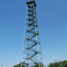
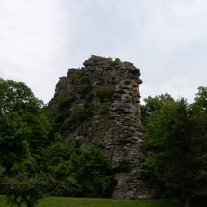
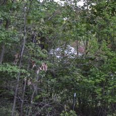
Kimberling Creek Wilderness, area protected by the Eastern Wilderness Act

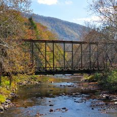
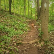
Kimberling Creek Wilderness is a large protected natural area in Virginia, USA, characterized by dense forests, gentle hills, and flowing streams. The terrain features valleys crossed by clear water, with grass and wildflowers covering the ground throughout the landscape.

The area was set aside under protection many years ago to preserve the land from development and maintain its natural state. This conservation effort has allowed the wilderness to remain largely unchanged and provides visitors with a genuine natural experience.

The name Kimberling Creek refers to the stream that flows through this area and shapes the landscape. Visitors can observe how this waterway runs through the valley and supports the surrounding ecosystem with its clear water.

Visitors should bring comfortable shoes, plenty of water, and snacks, as the trails can be challenging. Staying on marked paths is important for both personal safety and to protect the natural environment.

The area is home to abundant wildlife that remains active during daylight hours, including squirrels, birds, and occasionally deer. Observing these animals becomes a highlight of visiting, as they move freely through their natural habitat.

The community of curious travelers

AroundUs brings together thousands of curated places, local tips, and hidden gems, enriched daily by 60,000 contributors worldwide.

Start exploring
GPS coordinates
37.18683,-81.07319
Latest update
February 9, 2026 07:40
Around this place
Big Walker Lookout
United States of America

Big Walker Lookout

20.9 km
United States of America

Dismal Creek

18.5 km
Pinnacle Rock State Park
United States of America

Pinnacle Rock State Park

24.4 km
United States of America

Walker Mountain Cluster

21.3 km
Wytheville Historic District
United States of America

Wytheville Historic District

26.8 km
Walter McDonald Sanders House
United States of America

Walter McDonald Sanders House

17.5 km
Hancock House
United States of America

Hancock House

16.4 km
Loretto
United States of America

Loretto

25.6 km
Wolf Creek Bridge
United States of America

Wolf Creek Bridge

6.3 km
Crockett's Cove Presbyterian Church
United States of America

Crockett's Cove Presbyterian Church

18.2 km
Wythe County Poorhouse Farm
United States of America

Wythe County Poorhouse Farm

23.2 km
Mercer Street Historic District
United States of America

Mercer Street Historic District

20.5 km
Bramwell Historic District
United States of America

Bramwell Historic District

25.9 km
Alexander St. Clair House
United States of America

Alexander St. Clair House

22 km
Walker's Creek Presbyterian Church
United States of America

Walker's Creek Presbyterian Church

20.8 km
Reed Creek Mill
United States of America

Reed Creek Mill

27.9 km
Dr. Robert B. McNutt House
United States of America

Dr. Robert B. McNutt House

20.2 km
Mercer County Courthouse
United States of America

Mercer County Courthouse

20.1 km
Haller-Gibboney Rock House
United States of America

Haller-Gibboney Rock House

26.3 km
Dr. James W. Hale House
United States of America

Dr. James W. Hale House

20.4 km
Narrows Commercial Historic District
United States of America

Narrows Commercial Historic District

28.2 km
South Bluefield Historic District
United States of America

South Bluefield Historic District

14.9 km
Bramwell Additions Historic District
United States of America

Bramwell Additions Historic District

25.9 km
Pocahontas Historic District
United States of America

Pocahontas Historic District

27.4 km
Easley House
United States of America

Easley House

16.1 km
Junius Marcellus Updyke Farm
United States of America

Junius Marcellus Updyke Farm

8.1 km
Mountaineer Bowling Lanes
United States of America

Mountaineer Bowling Lanes

13.5 km
Angels Rest Cluster
United States of America

Angels Rest Cluster

21.1 km
Show the full map
Reviews
Share your experience

No review yet

Discussions
Start a discussion...

No discussion yet

« Kimberling Creek Wilderness - area protected by the Eastern Wilderness Act » is provided by Around Us (aroundus.com). Images and texts are derived from Wikimedia project under a Creative Commons license. You are allowed to copy, distribute, and modify copies of this page, under the conditions set by the license, as long as this note is clearly visible.

Discover hidden gems everywhere you go!

From secret cafés to breathtaking viewpoints, skip the crowded tourist spots and find places that match your style. Our app makes it easy with voice search, smart filtering, route optimization, and insider tips from travelers worldwide. Download now for the complete mobile experience.

Around Us App Screenshot

A unique approach to discovering new places

Le Figaro

All the places worth exploring

France Info

A tailor-made excursion in just a few clicks

20 Minutes

Around Us
Travel Guide & Maps
Download

Send to your phone

QR Code
1

Open the camera app on your mobile.

2

Point at the QR code with your camera. A notification will appear.

3

Tap the notification to open the link.