Clays Ferry Bridge, Road bridge at Fayette-Madison county line, United States
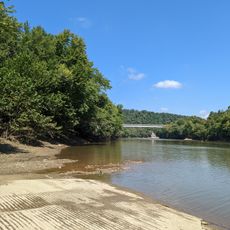
Clays Ferry Bridge is a road bridge that spans the Kentucky River, connecting the area between Madison and Fayette counties. It links Interstate 75 with US Routes 25 and 421, carrying daily traffic between these important roadways.
The first bridge here opened in 1869, replacing a ferry service that operated since 1792. The current structure was completed in 1998, replacing the earlier version that had served traffic for many decades.
The name comes from Green Clay, who started the original ferry service across the Kentucky River here in the late 1700s. Visitors passing through today are connected by the same crossing point that served settlers centuries ago.
The bridge is designed for vehicle traffic and provides safe passages between the connected roads. Travelers should expect heavy traffic during peak hours and drive during quieter times if they prefer a less congested crossing.
When completed in 1946, this bridge was the tallest east of the Mississippi River, rising about 280 feet (85 meters) above the water below. This height represented a significant engineering achievement for the time and region.
Location: Lexington
GPS coordinates: 37.88380,-84.33930
Latest update: December 11, 2025 18:01
Kroger Field
21.3 km
Fort Boonesborough State Park
6.5 km
Ashland
20.3 km
Roy Kidd Stadium
17 km
White Hall
5.8 km
Stoll Field/McLean Stadium
22.4 km
University of Kentucky Arboretum
20.5 km
Singletary Center for the Arts
22.3 km
First African Baptist Church
20.6 km
Pope Villa
22.1 km
Cathedral of Christ the King
20.1 km
Lyric Theatre
22.4 km
Fort Boonesborough State Park
6.6 km
Kentucky Association
21.9 km
Bluegrass Heritage Museum
18.4 km
Old Providence Church
10.2 km
Confederate Memorial in Nicholasville
20.6 km
Providence Church
19.3 km
Second Presbyterian Church
21.9 km
Cadentown School
16.2 km
Clark Mansion
17.7 km
Clark County Court House
18.6 km
Nannine Clay Wallis Arboretum
21.8 km
William Hickman House
18.4 km
Madison County Courthouse
16 km
J.S. Bronaugh House
20.7 km
Bybee House
14 km
Downtown Richmond Historic District
15.6 kmVisited this place? Tap the stars to rate it and share your experience / photos with the community! Try now! You can cancel it anytime.
Discover hidden gems everywhere you go!
From secret cafés to breathtaking viewpoints, skip the crowded tourist spots and find places that match your style. Our app makes it easy with voice search, smart filtering, route optimization, and insider tips from travelers worldwide. Download now for the complete mobile experience.
A unique approach to discovering new places❞
— Le Figaro
All the places worth exploring❞
— France Info
A tailor-made excursion in just a few clicks❞
— 20 Minutes