Andahuaylas Province
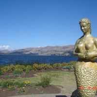
Andahuaylas Province, Administrative province in Apurimac Department, Peru.
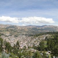
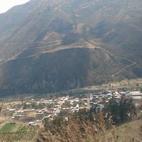
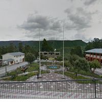
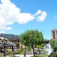
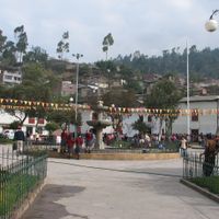
Andahuaylas Province is an administrative region in Apurímac that spans twenty districts across mountainous land. The elevation varies between 2,000 and 4,000 meters, shaping both the landscape and how people live there.
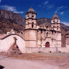
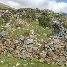
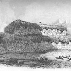
The region was once home to pre-Inca cultures, especially the Chanka, whose stone structures and farm terraces still remain visible today. These archaeological traces show a long history of people living in these mountains.
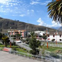
Local people keep Quechua traditions alive through farming, traditional healing, and community gatherings that follow the seasons. These customs shape how people live and work together throughout the year.
Visitors can reach the region by flying to Coronel FAP Alfredo Mendivil Duarte Airport or by taking buses from major Peruvian cities. Travel by road requires time due to mountainous routes that connect to other parts of the country.
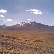
The territory contains several ecological zones ranging from high-altitude grasslands to temperate valleys. This diversity allows different farming methods and shows how nature changes dramatically across short distances.
Location: Apurimac Department
Capital city: Andahuaylas
Shares border with: Abancay Province, Aymaraes Province, Chincheros Province, Lucanas Province, Parinacochas Province, Sucre Province, La Mar Province, La Convención Province, Vilcas Huamán Province
GPS coordinates: -13.65333,-73.38833
Latest update: December 20, 2025 13:58
Suntur
13.9 km
Puente Pachachaca
48.8 km
Sanctuary of Our Lady of Cocharcas
38.4 kmMuyu Muyu
30.9 km
Yanaca
68.3 kmAwkimarka
50.9 km
Ccarhuarazo
85.7 kmLlamachayuq
1.6 kmCasa Hacienda Illanya
52.7 km
Virgin of the Rosary Cathedral, Abancay
55.2 km
Huaca Curamba
27.8 kmQ'illu Urqu (Ayacucho)
97.2 kmSilla Q'asa
86.9 kmPuente Chumbao
640 mMuseo Arqueológico y Antropológico de Apurímac
52.7 kmTunay Kassa
69.5 kmMuseo Municipal de Andahuaylas
327 mPE-VCH-24/CS-2011
54.5 kmКаменный лес
42.3 kmSmurf House
67.7 kmPanqulla
70.7 kmIglesia Chayo
64.9 kmBosque de piedra
70.3 kmMirador de Huayhuaca
825 mMirador de Killka
69.7 kmScenic viewpoint
70.4 kmScenic viewpoint
40.9 kmScenic viewpoint
85.6 kmVisited this place? Tap the stars to rate it and share your experience / photos with the community! Try now! You can cancel it anytime.
Andahuaylas District
Andarapa District
Chiara District
Huancarama District
Huancaray District
Huayana District
José María Arguedas District
Kaquiabamba District
Kishuara District
Pacobamba District
Pacucha District
Pampachiri
Pomacocha District
San Antonio de Cachi District
San Jerónimo District
San Miguel de Chaccrapampa District
Santa María de Chicmo District
Talavera District
Tumay Huaraca District
Turpopolis
Discover hidden gems everywhere you go!
From secret cafés to breathtaking viewpoints, skip the crowded tourist spots and find places that match your style. Our app makes it easy with voice search, smart filtering, route optimization, and insider tips from travelers worldwide. Download now for the complete mobile experience.
A unique approach to discovering new places❞
— Le Figaro
All the places worth exploring❞
— France Info
A tailor-made excursion in just a few clicks❞
— 20 Minutes