Enable Location

We need your location to show you interesting places around you

Discover nearby places

Find interesting locations and hidden gems around you

Precise directions

Get accurate directions and distances to places

Your location is never shared with other users. It's only used when you tap the location button.

Boggy Peak

Log in to your account

Start exploring — it's free

Trusted by 65,171 travelers worldwide

Continue with Google
Continue with Apple
or

We will send you a code to connect

By continuing, you accept our Terms and Conditions and our Privacy Policy

Check your inbox

We've sent a pincode in your inbox. Please enter the code below.

Boggy Peak
Discussion Reviews 1 Photos
9.8k Popularity

Boggy Peak, Mountain summit in southwestern Antigua and Barbuda.

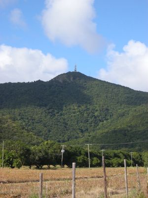
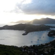
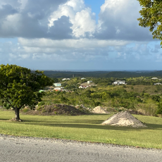
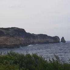
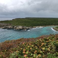
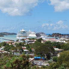
Boggy Peak is the highest point in Antigua and Barbuda, located in the southwestern part of the island as part of the Shekerley Mountains, between Christian Valley and Falmouth Harbour. The summit is forested and the ridge it sits on is visible from much of the southern coastline.

The mountain area was used as a refuge by people escaping the sugarcane plantations that once covered much of Antigua during the period of slavery. After emancipation in the 19th century, the area gradually lost that role but remained tied to the island's memory of that period.

The peak was known as Mount Obama from 2009 to 2016, named in honor of the then US president, before the original name was restored. Visitors who ask locals about it will often hear both names used interchangeably, depending on the generation.

Two main trails lead to the summit, one starting from Old Road Village and a shorter one from Christian Valley, with the latter taking less time to complete. Sturdy footwear and enough water are essential for both, as the paths can be steep and uneven in places.

A telecommunications tower sits at the very top and supports much of the island's communication network, which means the area right at the summit is sometimes fenced off. The views from the upper trail sections just below the top are still open and on a clear day reach as far as neighboring islands.

The community of curious travelers

AroundUs brings together thousands of curated places, local tips, and hidden gems, enriched daily by 60,000 contributors worldwide.

Start exploring
GPS coordinates
17.04443,-61.86134
Latest update
March 3, 2026 10:12
Reviews
Share your experience

No review yet

Discussions
Start a discussion...

No discussion yet

« Boggy Peak - Mountain summit in southwestern Antigua and Barbuda » is provided by Around Us (aroundus.com). Images and texts are derived from Wikimedia project under a Creative Commons license. You are allowed to copy, distribute, and modify copies of this page, under the conditions set by the license, as long as this note is clearly visible.

Discover hidden gems everywhere you go!

From secret cafés to breathtaking viewpoints, skip the crowded tourist spots and find places that match your style. Our app makes it easy with voice search, smart filtering, route optimization, and insider tips from travelers worldwide. Download now for the complete mobile experience.

Around Us App Screenshot

A unique approach to discovering new places

Le Figaro

All the places worth exploring

France Info

A tailor-made excursion in just a few clicks

20 Minutes

Around Us
Travel Guide & Maps
Download

Send to your phone

QR Code
1

Open the camera app on your mobile.

2

Point at the QR code with your camera. A notification will appear.

3

Tap the notification to open the link.