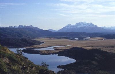
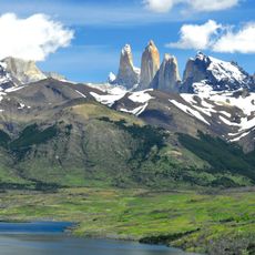
Torres del Paine, Administrative commune in Última Esperanza Province, Chile
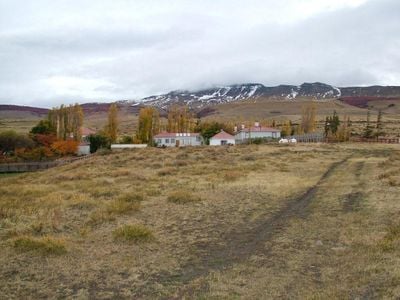
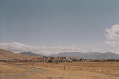
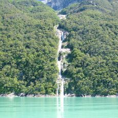
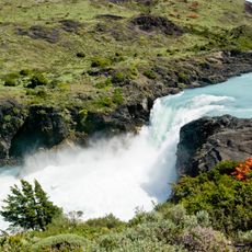
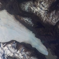
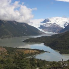
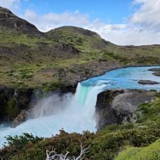
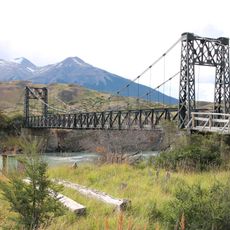
Torres del Paine is an administrative commune in Última Esperanza Province that covers a large area of Patagonia with mountains, glaciers, lakes, and grasslands. The administrative center at Cerro Castillo serves as the hub for services and facilities in the region.
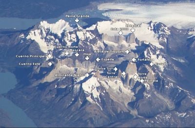
The region gained international attention when Lady Florence Dixie explored it in 1880 and documented the granite formations. This early exploration helped bring global awareness to this remote Patagonian area.
The name Paine comes from the Tehuelche language and means blue, reflecting the indigenous roots of this Patagonian region. Local people maintain a deep connection to the landscape that shapes daily life here.
The best time to explore is during the warmer months when trails are more accessible and weather is more stable. Visitors should come prepared for rapidly changing weather conditions with appropriate gear.
The area maintains an extremely low population density, which preserves its wilderness character and makes it one of South America's most remote inhabited places. This isolation is part of what draws many visitors seeking genuine natural solitude.
Location: Última Esperanza Province
Capital city: Cerro Castillo
Elevation above the sea: 113 m
Address: Torres de Paine, Magallanes y la Antártica Chilena, Chile
Website: http://torresdelpayne.cl
GPS coordinates: -51.26667,-72.35000
Latest update: December 12, 2025 09:02
The Earth offers a wide range of geological shapes shaped over millions of years by weather and the movements of the land. In Northern Ireland, thousands of basalt columns stand along the coast, leftover from an ancient eruption. In Arizona, the Colorado River carved out a canyon more than 400 miles...
Torres del Paine National Park
53.4 km
Grey Glacier
72.1 km
Water resources management in Chile
72.1 km
Última Esperanza Sound
57.2 km
Salto Grande
50.9 km
Tyndall Glacier
65 kmMount Stokes
77.5 km
Dickson Glacier
77.7 km
Cerro Benítez
36.5 kmCerro Daudet
76 km
Salto grande Peohe
50.9 kmCerro Ohnet
75.2 kmMuseo de Villa Cerro Castillo
1.4 kmCerro Pináculo
56.8 kmCerro La Mesa
77.9 kmCerro Verlika
72.2 kmCerro Cancha Carrera
4.5 kmCerro Cazador
13.8 kmSalto Paine
50.6 kmCerro Voga Mala
9.4 kmCerro Zapata
74.4 kmCerro Divisadero
71.2 kmCerro Monte Chico
8 kmCerro Adriana
86.6 kmCerro Negro
71.2 kmCerro Agudo
70.9 kmMuseo Escuela Villa Cerro Castillo
1.3 kmOlvidado Glacier
84 kmVisited this place? Tap the stars to rate it and share your experience / photos with the community! Try now! You can cancel it anytime.
Discover hidden gems everywhere you go!
From secret cafés to breathtaking viewpoints, skip the crowded tourist spots and find places that match your style. Our app makes it easy with voice search, smart filtering, route optimization, and insider tips from travelers worldwide. Download now for the complete mobile experience.
A unique approach to discovering new places❞
— Le Figaro
All the places worth exploring❞
— France Info
A tailor-made excursion in just a few clicks❞
— 20 Minutes