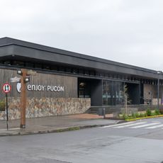
Villarrica, Municipal center in Cautín Province, Chile
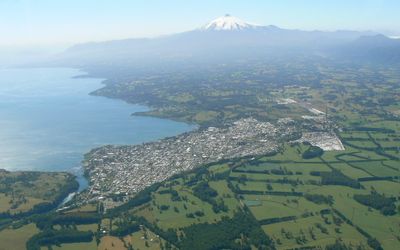
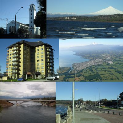
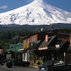
Villarrica sits at the western shore of a lake whose waters stretch to the horizon, while the snow-covered volcano rises in the background to 9383 ft (2860 m). The streets run parallel to the shoreline, with low buildings made of wood and stone, a few squares lined with trees, and shops selling local goods.
Spanish settlers founded the town in 1552, but conflicts with the Mapuche led to several abandonments and rebuildings over the following centuries. Only in 1882 did permanent occupation take hold after the end of armed confrontations.
This town takes its name from the nearby lake and mountain, whose designation comes from the Mapuche language and describes earth rich in gold. Along the streets you often see vendors offering handwoven textiles and carved wooden items, while some neighborhoods still preserve traditional ruka structures.
The town serves as a starting point for excursions into the surrounding nature parks, with trails accessible on foot or by vehicle. During summer, activities center on the water, while winter brings skiing opportunities on the mountain slopes.
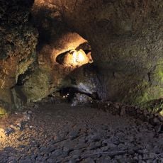
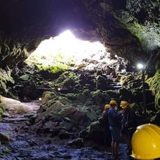
The settlement sits at the meeting point of three geological features: an active volcano, a glacial lake, and the Mocha-Villarrica fault zone. This position makes it a monitoring site for researchers studying tectonic activity and earthquake risks.
Location: Cautín Province
Inception: 1552
Elevation above the sea: 227 m
Address: Villarrica, Panguipulli, Los Ríos, Chile
Website: https://munivillarrica.cl
GPS coordinates: -39.27807,-72.22740
Latest update: December 11, 2025 23:07
Chile stretches over 2,670 miles (4,300 kilometers) from north to south, crossing some of South America's most varied landscapes. The north features the Atacama Desert with its salt flats, geysers at El Tatio, and astronomical observatories such as Paranal. The coastal city of Valparaíso displays...
Villarrica Volcano
29.4 km
Casino de Pucón
21.7 km
Sitio de Villarrica
233 m
Estadio Municipal de Villarrica
1.3 km
Cathedral of the Sacred Heart, Villarrica
302 m
Volcanic Caves Park
26.8 km
Cerros de Punguichay
22.3 km
Cerros de Voipire
8.1 km
Museo Histórico y Arqueológico Municipal de Villarrica
843 m
Casa Museo Padre Pancho
21.5 km
Paseo de la Memoria Herida de Villarrica
562 m
Parque Cuevas Volcanicas
26.8 km
Museo Leandro Penchulef
188 m
Complejo ceremonial indígena de la Comunidad Mapuche Pedro Ancalef, en Putue
6.4 km
Cuevas volcánicas Villarrica
26.8 km
Embarcadero El Lanchón
348 m
Feria Artesanal Pucón
21.8 km
Península de Pucón
20.7 km
Cancha de Golf Privada
25.2 km
Cancha de Golf Nevados del Villarrica
19.3 km
Mini Golf Alü Antü
25.2 km
Cancha de Golf Privada
16.4 km
Cancha de Golf Los Guindos
5.8 km
Cancha Golf Privada
20.2 km
Casino Enjoy Pucón
21.7 km
Mercado Fritz
939 m
Anfiteatro
562 m
Playa Foresta
24.4 kmVisited this place? Tap the stars to rate it and share your experience / photos with the community! Try now! You can cancel it anytime.
Discover hidden gems everywhere you go!
From secret cafés to breathtaking viewpoints, skip the crowded tourist spots and find places that match your style. Our app makes it easy with voice search, smart filtering, route optimization, and insider tips from travelers worldwide. Download now for the complete mobile experience.
A unique approach to discovering new places❞
— Le Figaro
All the places worth exploring❞
— France Info
A tailor-made excursion in just a few clicks❞
— 20 Minutes