Cerro Alcázar, Natural monument in Calingasta Department, Argentina
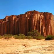
Cerro Alcázar is a mountain formation in San Juan Province featuring red and brown sedimentary rocks that create vertical walls and sharp peaks across the Andean landscape. The structure displays distinct layers formed by geological processes over millions of years.
The mountain formed during the early Mesozoic era and contains sedimentary materials from the same geological period as the Valle de la Luna formation. This shared history shows how the region experienced major earth movements and transformations.
The name comes from Arabic through Spanish, meaning fortified palaces, which reflects how the rocky walls resemble medieval castle structures. When you walk around the formation, you can see why people chose this name for the place.
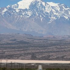
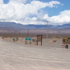
The site can be reached via Provincial Route 412, located roughly 22 kilometers from Barreal and about 155 kilometers from San Juan. The best time to visit is during warmer months when the exposed terrain is more comfortable for walking and exploring.
The area received protected status through a decree that safeguarded approximately 1000 hectares around the formation. This legal protection ensures the landscape remains intact for visitors and future generations to appreciate.
The community of curious travelers
AroundUs brings together thousands of curated places, local tips, and hidden gems, enriched daily by 60,000 contributors worldwide.